Safety Score: 3,0 of 5.0 based on data from 9 authorites. Meaning we advice caution when travelling to United Kingdom.
Travel warnings are updated daily. Source: Travel Warning United Kingdom. Last Update: 2024-08-13 08:21:03
Discover Datchet
Datchet in Windsor and Maidenhead (England) with it's 4,913 citizens is a city in United Kingdom about 20 mi (or 31 km) west of London, the country's capital city.
Local time in Datchet is now 09:57 AM (Saturday). The local timezone is named Europe / London with an UTC offset of zero hours. We know of 10 airports in the vicinity of Datchet, of which 5 are larger airports. The closest airport in United Kingdom is London Heathrow Airport in a distance of 5 mi (or 8 km), East. Besides the airports, there are other travel options available (check left side).
There are several Unesco world heritage sites nearby. The closest heritage site in United Kingdom is Blenheim Palace in a distance of 25 mi (or 40 km), North. Also, if you like golfing, there are a few options in driving distance. We discovered 3 points of interest in the vicinity of this place. Looking for a place to stay? we compiled a list of available hotels close to the map centre further down the page.
When in this area, you might want to pay a visit to some of the following locations: Old Windsor, Slough, Horton, Sunningdale and Bray. To further explore this place, just scroll down and browse the available info.
Local weather forecast
Todays Local Weather Conditions & Forecast: 9°C / 49 °F
| Morning Temperature | 3°C / 38 °F |
| Evening Temperature | 13°C / 56 °F |
| Night Temperature | 14°C / 57 °F |
| Chance of rainfall | 11% |
| Air Humidity | 89% |
| Air Pressure | 1004 hPa |
| Wind Speed | Strong breeze with 19 km/h (12 mph) from North-East |
| Cloud Conditions | Overcast clouds, covering 100% of sky |
| General Conditions | Moderate rain |
Sunday, 24th of November 2024
15°C (60 °F)
11°C (53 °F)
Moderate rain, strong breeze, overcast clouds.
Monday, 25th of November 2024
10°C (50 °F)
8°C (46 °F)
Broken clouds, fresh breeze.
Tuesday, 26th of November 2024
10°C (50 °F)
10°C (50 °F)
Light rain, moderate breeze, broken clouds.
Hotels and Places to Stay
The Ostrich Inn
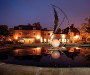
De Vere Beaumont Estate PH Hotels
Parallel House Serviced Apartments Slough Windsor
Pinewood
Macdonald Windsor
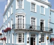
Royal Adelaide
Castle Hotel Windsor - MGallery by Sofitel
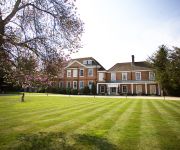
Stoke Place
Sir Christopher Wren Hotel and Spa
Copthorne Hotel Slough Windsor
Videos from this area
These are videos related to the place based on their proximity to this place.
Driving Lessons Slough - Taking 3rd Exit Right on a Roundabout
How to take the 3rd Exit Right - Driving from A4 Slough Centre and heading to A412 South, Datchet & Windsor onto Yew Tree Road.
Driving Lessons Slough - Taking 2nd Exit Ahead on a Roundabout
How to take the 2nd Exit Ahead - Driving from A4 London Road heading to A4 Slough Centre & Maidenhead.
Driving Lessons Slough - Taking 3rd Exit Right on a Roundabout (Correct Option)
How to take the 3rd Exit Right - Driving from A412 Uxbridge Road and heading to A4 West, Slough Center and Maidenhead. (Correct Option)
Driving Lessons Slough - Taking 1st Exit Left on a Roundabout
How to take the 1st Exit Left - Driving from A4 London Road heading to A412 South, Datchet & Windsor onto Yew Tree Road.
Driving Lessons Slough - Taking 2nd Exit Ahead on a Roundabout
How to take the 2nd Exit Ahead - Driving from A4 London Road heading to A4 Slough Centre & Maidenhead (Take 1)
Driving Lessons Slough - Taking 2nd Exit Ahead on a Roundabout
How to take the 2nd Exit Ahead - Driving from A4 Slough Centre heading to A4 London & Langley onto London Road A4.
Driving Lessons Slough - Taking 3rd Exit Right on a Roundabout (Option 2)
How to take the 3rd Exit Right - Driving from the A412 Uxbridge Road and heading A4 West, Slough Centre and Maidenhead. (Option 2)
Driving Lessons Slough - taking 2nd Exit Ahead on a Roundabout
How to take the 2nd Exit Ahead - Driving from A4 London Road heading to A4 Slough Center and Maidenhead (Take 2)
Driving Lessons Slough - Taking 2nd Exit Ahead on a Roundabout
How to take the 2nd Exit Ahead - Driving from the A412 Uxbridge Road heading to A412 South, Datchet & Windsor onto Yew Tree Road.
Windsor Home Park Flood 2014
Aerial footage of the Home Park floods in Windsor in Feb 2014. Footage shot by HeliScan UK.
Videos provided by Youtube are under the copyright of their owners.
Attractions and noteworthy things
Distances are based on the centre of the city/town and sightseeing location. This list contains brief abstracts about monuments, holiday activities, national parcs, museums, organisations and more from the area as well as interesting facts about the region itself. Where available, you'll find the corresponding homepage. Otherwise the related wikipedia article.
Jubilee River
The Jubilee River is a hydraulic channel in southern England. It is 11.6 km long and is on average 45 metres wide. It was constructed in the late 1990s and early 2000s to take overflow from the River Thames and so alleviate flooding to areas in and around the towns of Maidenhead, Windsor, and Eton in the counties of Berkshire and Buckinghamshire.
Ditton Park
Ditton Park was part of the Manor of Ditton which was in what was formerly the south east corner of the English county of Buckinghamshire, before the county boundary reorganisations of 1974 & 1998 which moved it to the Slough Unitary Authority, which is in the ceremonial county of Berkshire. Ditton Park belonged to the crown in the reign of Queen Elizabeth I. It then belonged to Sir Ralph Winwood and passed to Ralph Montagu, 1st Duke of Montagu, through marriage.
Frogmore House
Frogmore House is a 17th-century country house standing at the centre of the Frogmore Estate, amongst beautiful gardens, about a half a mile south of Windsor Castle in the Home Park at Windsor in the English county of Berkshire. It is a Grade I listed building.
Datchet railway station
Datchet railway station is a railway station serving the village of Datchet in Berkshire, England. The station is located on the line between Windsor and Eton Riverside and London Waterloo, which lies 24 miles to the east. The station has two side platforms linked by a pedestrian footbridge, and the principal station buildings are to be found on the London bound platform.
Home Park, Windsor
The Home Park, previously known as the Little Park (and originally Lydecroft Park), is a private 655 acres Royal park, administered by the Crown Estate. It lies on the eastern side of Windsor Castle in the town and former civil parish of Windsor in the English county of Berkshire.
Ham Island
Ham Island is an island in the River Thames in England. It was created when the course of the river was diverted, via a cut, to avoid a weir and provide a navigable route through to Old Windsor Lock. Today land use is divided between 37 privately owned dwellings. The original houses on the island, now almost entirely rebuilt in a more luxurious style, were quite modest- many holiday homes. The island is also the site of a water treatment plant.
Albert Bridge, Datchet
Albert Bridge is a road bridge in England running North/South and carrying the B3012 between Datchet and Old Windsor. It crosses the River Thames on the reach between Old Windsor Lock and Romney Lock. It was rebuilt in brick in 1927 to replace a cast-iron bridge built in 1850-51. The Albert and Victoria Bridges in Datchet were built to replace the old Datchet Bridge as part of the rerouting of the Datchet to Windsor roads following the expansion of the grounds of Windsor Castle.
Victoria Bridge, Datchet
Victoria Bridge is a road bridge running North/South between Datchet and Windsor, Berkshire, England. It crosses the River Thames on the reach between Old Windsor Lock and Romney Lock. It was rebuilt in 1967 to replace a damaged bridge. The Victoria and Albert Bridges in Datchet were built to replace the old Datchet Bridge as part of the rerouting of the Datchet to Windsor roads following the expansion of the grounds of Windsor Castle.
Sumptermead Ait
Sumptermead Ait is an island in the River Thames in England on the reach above Old Windsor Lock, near Datchet Berkshire. The island is a thin wooded strip separated by a narrow channel on the Datchet side. In 1995 a Thames side path was created here for the diverted Thames Path. The island has a long history, being recorded as "Sondremede" in 1263, when given to the prioress of St Helens in London, and "Saunder-meade" in 1586, when leased to the queens laundress.
Lion Island (Old Windsor)
Lion Island is a small uninhabited island in the River Thames in England on the reach above Old Windsor Lock, near Old Windsor, Berkshire. The island is a thin wooded strip separated by a narrow channel on the north bank. It is just above Old Windsor Weir and the head of New Cut which leads to Old Windsor Lock. The island is the relict of three long parallel islands which existed at this point before the creation of the Old Windsor Lock cut.
Datchet Common
Datchet Common near Datchet in the English county of Berkshire was used as a cricket venue for 2 first-class matches between 1769 and 1785 as well as for a number of minor matches.
Datchet Bridge
Datchet Bridge, also known as The Divided Bridge, was a road bridge which crossed the River Thames at Datchet from 1706 until it was demolished in 1848. It was situated on the reach between Old Windsor Lock and Romney Lock and linked Windsor on the Berkshire bank to Datchet on the Buckinghamshire side. The bridge replaced a ferry service which had operated at the site since at least the middle of the 13th century.


