Safety Score: 3,0 of 5.0 based on data from 9 authorites. Meaning we advice caution when travelling to United Kingdom.
Travel warnings are updated daily. Source: Travel Warning United Kingdom. Last Update: 2024-08-13 08:21:03
Discover West Ashton
West Ashton in Wiltshire (England) with it's 467 citizens is a city in United Kingdom about 89 mi (or 144 km) west of London, the country's capital city.
Local time in West Ashton is now 11:44 PM (Thursday). The local timezone is named Europe / London with an UTC offset of zero hours. We know of 9 airports in the vicinity of West Ashton, of which 5 are larger airports. The closest airport in United Kingdom is RAF Lyneham in a distance of 16 mi (or 26 km), North-East. Besides the airports, there are other travel options available (check left side).
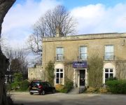
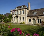
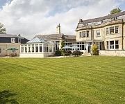
There are several Unesco world heritage sites nearby. The closest heritage site in United Kingdom is City of Bath in a distance of 24 mi (or 38 km), East. Also, if you like golfing, there are a few options in driving distance. Looking for a place to stay? we compiled a list of available hotels close to the map centre further down the page.
When in this area, you might want to pay a visit to some of the following locations: North Bradley, Trowbridge, Westbury, Bratton and Southwick. To further explore this place, just scroll down and browse the available info.
Local weather forecast
Todays Local Weather Conditions & Forecast: 3°C / 38 °F
| Morning Temperature | 1°C / 33 °F |
| Evening Temperature | 3°C / 37 °F |
| Night Temperature | 3°C / 37 °F |
| Chance of rainfall | 0% |
| Air Humidity | 73% |
| Air Pressure | 999 hPa |
| Wind Speed | Moderate breeze with 9 km/h (6 mph) from South-West |
| Cloud Conditions | Overcast clouds, covering 100% of sky |
| General Conditions | Overcast clouds |
Friday, 22nd of November 2024
6°C (42 °F)
2°C (35 °F)
Sky is clear, fresh breeze, clear sky.
Saturday, 23rd of November 2024
10°C (50 °F)
14°C (58 °F)
Moderate rain, strong breeze, overcast clouds.
Sunday, 24th of November 2024
15°C (59 °F)
11°C (51 °F)
Moderate rain, high wind, near gale, overcast clouds.
Hotels and Places to Stay
Apsley House Hotel
An Auberge Resort Malliouhana
Hilbury Court Hotel
The Moonraker Hotel
The Kings Arms Hotel - Inn
BEST WESTERN LEIGH PARK HOTEL
The Conigre Hotel
TRAVELODGE WARMINSTER
Trowbridge
Videos from this area
These are videos related to the place based on their proximity to this place.
Wayne Hussey, When The Trap Clicks Shut, Trowbridge Lamb Inn, 20th September 2014
One of my favourite songs.
A trip from Westbury to Pets at Home, Trowbridge
A trip from Westbury to Pets at Home, Trowbridge on Sunday 30th August 2009.
Trowbridge Day One
Post Army Aviation Museum. Trowbridge, pubs, ale and Premier Inn. 4 pubs and one Premier Inn. Good times.
A trip from Morrisons Westbury via Bratton and West Ashton to Tesco Trowbridge X 4
Presented at four times normal speed, an autumnal trip from Westbury to Trowbridge via Bratton, Dunge and West Ashton.
Armed Forces Weekend In Trowbridge
A Collection Of Photos Taken At The Armed Forces Day In Trowbridge Park On 26th June 2010.
Scrub Clearance at Biss Meadows Country Park - day 2 - taking out some trees
Day 2 of the scrub clearance. This video shows some trees being turned to matchsticks. Note: at about 2/3rds way through the camera is moved to a more stable platform.
Scrub Clearance at Biss Meadows Country Park - day 1
Undertaken by Conservation Contractors from 22nd October 2014. They are clearing scrub from the Cheviot Close / Tesco car park entrances up to Broadcloth Lan...
Black 5 44781 on the bath and Bristol Christmas markets between Trowbridge and west bury
via youtube Capture.
On Top Of It
Day 02, moving the car and waffling, from a multi storey carpark. via youtube Capture #mb05.
Videos provided by Youtube are under the copyright of their owners.
Attractions and noteworthy things
Distances are based on the centre of the city/town and sightseeing location. This list contains brief abstracts about monuments, holiday activities, national parcs, museums, organisations and more from the area as well as interesting facts about the region itself. Where available, you'll find the corresponding homepage. Otherwise the related wikipedia article.
Westbury (UK Parliament constituency)
Westbury was a parliamentary constituency in Wiltshire from 1449 to 2010. It was represented in the House of Commons of England until 1707, and then in the House of Commons of Great Britain from 1707 to 1800, and finally in the House of Commons of the Parliament of the United Kingdom from 1801 until 2010. Until 1885, it was a parliamentary borough, returning two Members of Parliament (MPs) until 1832 and only one from 1832 to 1885.
Yarnbrook
Yarnbrook is a hamlet in Wiltshire, England, between the towns of Westbury and Trowbridge. Most of it lies in the civil parish of North Bradley, the rest in West Ashton. Most of the settlement's houses stand on the A350 road, which runs between the M4 motorway near Chippenham and the south coast of England at Poole, Dorset. Yarnbrook has never been a parish in its own right, but the name dates from at least the 16th century.
Trowbridge Town F.C
Trowbridge Town F.C. are a football club based in Trowbridge, Wiltshire, England, and they play at Woodmarsh on the southern edge of the town. They are currently members of the Wiltshire League Premier Division.
Westbury United F.C
Westbury United F.C. are a football club based in Westbury, Wiltshire, England. They play in the Western Football League Division One.
North Bradley
North Bradley is a village in Wiltshire, England, and lies between Trowbridge and Westbury, now separated from Trowbridge by only small fields. Most of the hamlet of Yarnbrook is part of North Bradley. The parish originally also included the present civil parish of Southwick, but the two separated in 1866. In 2001, the population was 1,848.
Rood Ashton House
Rood Ashton House was a country house in the village of West Ashton in the English county of Wiltshire. It was once the home of the 1st Viscount Long, and during his residence it was visited by various members of the British Royal Family, including the Prince of Wales, later Edward VIII.
Wiltshire Library and Information Service
Wiltshire Library and Information Service is a county-wide network of public libraries based in Trowbridge, Wiltshire, England. It is part of Wiltshire Council. Its strapline is: "Love Reading, Love Libraries". Wiltshire Library and Information Service 200pxMotto Love Reading, Love LibrariesType Public librariesLegal status Local governmentHeadquarters Library HQ, Bythesea Road, Trowbridge, Wilts BA14 8BSRegion served WiltshireMembership c.
Whorwellsdown Hundred
Whorwellsdown was a hundred of the English county of Wiltshire, lying in the west of the county to the south of the towns of Bradford on Avon and Melksham and to the north and east of Westbury. An arm of the hundred reached several miles southwards into Salisbury Plain, with a detached portion, a tithing of Tilshead, lying high on the Plain about five miles east of the southern arm of the rest of the hundred. At its western end, it reached as far as the Somerset county boundary.


