Safety Score: 3,0 of 5.0 based on data from 9 authorites. Meaning we advice caution when travelling to United Kingdom.
Travel warnings are updated daily. Source: Travel Warning United Kingdom. Last Update: 2024-08-13 08:21:03
Discover Sherrington
Sherrington in Wiltshire (England) is a place in United Kingdom about 87 mi (or 140 km) west of London, the country's capital city.
Current time in Sherrington is now 11:48 PM (Thursday). The local timezone is named Europe / London with an UTC offset of zero hours. We know of 9 airports near Sherrington, of which 5 are larger airports. The closest airport in United Kingdom is RAF Lyneham in a distance of 25 mi (or 40 km), North. Besides the airports, there are other travel options available (check left side).
There are several Unesco world heritage sites nearby. The closest heritage site in United Kingdom is City of Bath in a distance of 24 mi (or 39 km), North-East. Also, if you like playing golf, there are a few options in driving distance. If you need a hotel, we compiled a list of available hotels close to the map centre further down the page.
While being here, you might want to pay a visit to some of the following locations: Codford, Boyton, Stockton, Chicklade and Hindon. To further explore this place, just scroll down and browse the available info.
Local weather forecast
Todays Local Weather Conditions & Forecast: 3°C / 37 °F
| Morning Temperature | 0°C / 32 °F |
| Evening Temperature | 2°C / 36 °F |
| Night Temperature | 1°C / 34 °F |
| Chance of rainfall | 0% |
| Air Humidity | 73% |
| Air Pressure | 999 hPa |
| Wind Speed | Moderate breeze with 10 km/h (6 mph) from South-West |
| Cloud Conditions | Overcast clouds, covering 98% of sky |
| General Conditions | Overcast clouds |
Friday, 22nd of November 2024
5°C (42 °F)
1°C (34 °F)
Sky is clear, moderate breeze, clear sky.
Saturday, 23rd of November 2024
10°C (49 °F)
14°C (57 °F)
Moderate rain, strong breeze, overcast clouds.
Sunday, 24th of November 2024
14°C (58 °F)
10°C (51 °F)
Moderate rain, high wind, near gale, overcast clouds.
Hotels and Places to Stay
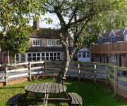
The Dove Inn
Videos from this area
These are videos related to the place based on their proximity to this place.
Hindon - The Dene (Blocked Byway, E-W)
NGR Start: ST910325 NGR Finish: ST905325 Byway Number: HIND15 Date: 14.10.12 Condition: Paved road, grassy track, tip. Notes: The landowner has permanently obstructed this byway...
A Short Ride Through Hindon in Wiltshire
A short ride through the pretty Wiltshire village. 29.06.13.
Glastonbury to Stonehenge 25-07-2010
On the day after Life in a Day day, we packed up our tents & headed home. The coach back would have left at 7am, but thankfully some friends offered me a lift to SW London. Here is my time...
The Monarch's Way (Ox Drove) - Teffont Magna (Byway, E-W)
NGR Start: SU005349 NGR Finish: ST984347 Byway Number: TEFF12 Date: 14.10.11 Condition: Concrete road with grassy track to side. Notes: This last 100m or so of this video is actually...
Bishopstrow - Middle Hill (Byway, S-N)
Subscribe for the love of motorcycles and the great outdoors: http://www.youtube.com/subscription_center?add_user=wiltshirebyways Please click 'S H O W M O R E' for route info: ↓↓↓↓↓↓...
Biker vs Residents
Not one but two residents take issue with our use of a byway open to all traffic near Bishopstrow in Wiltshire. The lady was unwilling to consider my position and instead argued from a position...
Clayden Cloud Studies - Google Edit
1905-1925 (1925 second edition) We MUST preserve all PHYSICAL HARD COPY's of this book!! Why trust Google and MSM to post this important information? Fined it! . Read it! . Remember it! ...
BRITAIN: MAN DROWNS IN POOL
48 hour film comp for college. Mockumentary of one of these "extraordinary people" documentaries that are always popping up on tv! filmed in the Great British City of Winchester. Cheers very...
RAF Charmy Down Control Tower
The control tower at Charmy Down former RAF nightfighter station during WWII now sadly derelict.
Videos provided by Youtube are under the copyright of their owners.
Attractions and noteworthy things
Distances are based on the centre of the city/town and sightseeing location. This list contains brief abstracts about monuments, holiday activities, national parcs, museums, organisations and more from the area as well as interesting facts about the region itself. Where available, you'll find the corresponding homepage. Otherwise the related wikipedia article.
Codford
Codford is a village and civil parish south of Salisbury Plain in the Wylye Valley in Wiltshire, England at grid reference ST970397.
Stockton Wood and Down
Stockton Wood and Down is a 61.5 hectare biological Site of Special Scientific Interest in Wiltshire, notified in 1951.
Starveall and Stony Down
Stockton Wood and Down is a 22.5 hectare biological Site of Special Scientific Interest in the parishes of Codford and Wylye, Wiltshire, notified in 1971.
Ashton Gifford House
Ashton Gifford House is a Grade II listed building in the hamlet of Ashton Gifford, part of the civil parish of Codford in the English county of Wiltshire. The house was built during the early 19th century, following the precepts of Georgian architecture, and its estate eventually included all of the hamlet or tithing of Ashton Gifford. The house sits in the Wylye valley, an Area of Outstanding Natural Beauty.
Stockton, Wiltshire
Stockton is a small village in the Wylye Valley in Wiltshire, England (grid reference ST985385).
Knook, Wiltshire
Knook is a small village and former civil parish in the County of Wiltshire, in the south west of England. For civil purposes, it now forms part of the united parish of 'Heytesbury, Imber and Knook'.


