Safety Score: 3,0 of 5.0 based on data from 9 authorites. Meaning we advice caution when travelling to United Kingdom.
Travel warnings are updated daily. Source: Travel Warning United Kingdom. Last Update: 2024-08-13 08:21:03
Discover Seend
Seend in Wiltshire (England) with it's 267 citizens is a city in United Kingdom about 85 mi (or 137 km) west of London, the country's capital city.
Local time in Seend is now 11:36 PM (Sunday). The local timezone is named Europe / London with an UTC offset of zero hours. We know of 9 airports in the vicinity of Seend, of which 5 are larger airports. The closest airport in United Kingdom is RAF Lyneham in a distance of 12 mi (or 19 km), North. Besides the airports, there are other travel options available (check left side).
There are several Unesco world heritage sites nearby. The closest heritage site in United Kingdom is City of Bath in a distance of 19 mi (or 31 km), East. Also, if you like golfing, there are a few options in driving distance. Looking for a place to stay? we compiled a list of available hotels close to the map centre further down the page.
When in this area, you might want to pay a visit to some of the following locations: Bulkington, Marston, Worton, Erlestoke and Edington. To further explore this place, just scroll down and browse the available info.
Local weather forecast
Todays Local Weather Conditions & Forecast: 9°C / 49 °F
| Morning Temperature | 6°C / 44 °F |
| Evening Temperature | 10°C / 50 °F |
| Night Temperature | 8°C / 46 °F |
| Chance of rainfall | 0% |
| Air Humidity | 80% |
| Air Pressure | 1017 hPa |
| Wind Speed | Moderate breeze with 11 km/h (7 mph) from East |
| Cloud Conditions | Overcast clouds, covering 97% of sky |
| General Conditions | Light rain |
Monday, 18th of November 2024
8°C (47 °F)
10°C (50 °F)
Light rain, fresh breeze, overcast clouds.
Tuesday, 19th of November 2024
3°C (38 °F)
1°C (34 °F)
Moderate rain, fresh breeze, overcast clouds.
Wednesday, 20th of November 2024
5°C (40 °F)
2°C (36 °F)
Light rain, gentle breeze, clear sky.
Hotels and Places to Stay
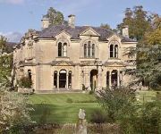
Beechfield House
Avalon Lodge B&B
Bowood Spa & Golf Resort
Bowood Hotel
The Kings Arms Hotel - Inn
The Conigre Hotel
Videos from this area
These are videos related to the place based on their proximity to this place.
Conference Planner
What is a DMC (Destination Management Company)? DMC is a conference planning or incentive travel company that specialises in the organisation and logistics o...
The Strokes - Reptilia cover No vocals
NOTE: This was out first band practice and we didn't have our bassist or keyboardist. LEAD GUITAR-Gabe RHYTHM GUITAR-Geno DRUMS-Ellie.
True Utility Multi Tool TU17 Pen Knife
True Utility Multi Tool TU17 Pen Knife - Prices ranges from £9 - £19.99 Blog Link - http://weaponcollector.blogspot.com/ LINKS - http://www.trueutility.com/ http://www.youtube.com/user...
Biker vs Herd of Cows
A farmer drives his dairy herd to the parlour for their second milking of the day. Forest Road, Melksham, 20.10.12.
Morph Meets TrapDoor
Hi Guys, I Have tried to re-create the morph & trap door characters and thought I would do a cross over! I know my work is nothing like Aardman studios But hey, its my first time animation!...
main line steam 2008.mpg
mixed collection of my main steam locomotive video shots over 2008 and one shot at hereford many years ago , I just wish all my viewers a happy christmas and hope fully a good 2009 , Im now...
Episode 42 - Carp fishing at Newton Park - Nuffinbutfishing
From sunrise to sunset I fished Newton park with a few lovely fish. **SPONSOR** Katch Karp - http://www.ebay.co.uk/sch/carpman1325/m.html?_nkw=&_armrs=1&_from=&am.
Videos provided by Youtube are under the copyright of their owners.
Attractions and noteworthy things
Distances are based on the centre of the city/town and sightseeing location. This list contains brief abstracts about monuments, holiday activities, national parcs, museums, organisations and more from the area as well as interesting facts about the region itself. Where available, you'll find the corresponding homepage. Otherwise the related wikipedia article.
Seend Cleeve Quarry
Seend Cleeve Quarry is a 7.5 acres Geological Site of Special Scientific Interest at Seend Cleeve, Wiltshire, England, notified in 1987. The site was an iron ore quarry and a steel mill, with the coal being delivered via the Kennet and Avon Canal. It also had its own on-site railway. None of these facilities had been preserved; the site is now pasture.
Seend Ironstone Quarry and Road Cutting
Seend Ironstone Quarry And Road Cutting is a 3 acres Geological Site of Special Scientific Interest at Seend in Wiltshire, notified in 1965. Iron ore was quarried and smelted in Seend from the 1850s with three blast furnaces fifty feet high, and employed 300 men. The antiquarian John Aubrey wrote that he discovered iron ore as early as 1666 when it rained so much that it washed away the sand from the ore and the later bright sun reflected on it.
Sandridge Park
Sandridge Park, near Stoke Gabriel, Devon, is an English country house in the Italianate style, designed by John Nash around 1805 for the Dowager Lady Ashburton, née Elizabeth Baring. Sandridge, on high ground at the head of the River Dart estuary, was held by the Sandridges under the Bishop of Exeter in Henry II's reign. The Nash house took the place of the former house, which had belonged to the descendants of Sir Thomas Pomeroy until the eighteenth century. "Gilbert, Esq.
Bradford Lock
Bradford Lock is situated at Bradford on Avon on the Kennet and Avon Canal, England. It was in Bradford on Avon that the first sod was cut for the Kennet and Avon Canal in 1794 and had wharves above and below the lock. The lock has a rise/fall of 12 ft 6 inches (3.81 m). There are moorings above and below Bradford Lock. Next to the canal, a little way west of the lock, is a huge 14th century tithe barn.
Seend Locks
Seend Locks are at Seend Cleeve, Wiltshire on the Kennet and Avon Canal, England. The five locks were built between 1718 and 1723 under the supervision of the engineer John Hore of Newbury. They have a rise/fall of 38 ft 4ins (11.68m). During the 19th century there were several wharves at Seend primarily serving the Seend Iron Works but these have been disused for many years. The five locks at Seend Cleeve are numbered 17 to 21.
RAF Keevil
Royal Air Force Station Keevil or more simply RAF Keevil is a former Royal Air Force station located 4 miles east of Trowbridge, Wiltshire, England. The airfield was built on a site previously ear-marked for the purpose in the mid-1930s. Consisting of 3 long concrete runways the airfield was used by the Royal Air Force and the United States Army Air Forces Eighth and Ninth Air Forces.
Bromham and Rowde Halt railway station
Bromham and Rowde Halt was the railway station serving Bromham and Rowde in Wiltshire, England. The station was a stop on the Devizes Branch Line, between Seend and Devizes After the completion of the Devizes line, the junction at Holt allowed the fastest route from London to the West Country. However the Devizes line lost to competition and returned to a branch line in 1900.
Melksham Oak Community School
Melksham Oak Community School is a state secondary comprehensive school in Melksham, Wiltshire, England. It was created under the Building Schools for the Future programme, opening on 12 July 2010 to replace The George Ward Technology College.


