Safety Score: 3,0 of 5.0 based on data from 9 authorites. Meaning we advice caution when travelling to United Kingdom.
Travel warnings are updated daily. Source: Travel Warning United Kingdom. Last Update: 2024-08-13 08:21:03
Discover Ogbourne Saint Andrew
Ogbourne Saint Andrew in Wiltshire (England) is a place in United Kingdom about 69 mi (or 111 km) west of London, the country's capital city.
Current time in Ogbourne Saint Andrew is now 12:19 AM (Sunday). The local timezone is named Europe / London with an UTC offset of zero hours. We know of 9 airports near Ogbourne Saint Andrew, of which 5 are larger airports. The closest airport in United Kingdom is RAF Lyneham in a distance of 12 mi (or 19 km), West. Besides the airports, there are other travel options available (check left side).
There are several Unesco world heritage sites nearby. The closest heritage site in United Kingdom is City of Bath in a distance of 6 mi (or 10 km), South-East. Also, if you like playing golf, there are a few options in driving distance. If you need a hotel, we compiled a list of available hotels close to the map centre further down the page.
While being here, you might want to pay a visit to some of the following locations: Marlborough, Mildenhall, Fyfield, Chiseldon and Wanborough. To further explore this place, just scroll down and browse the available info.
Local weather forecast
Todays Local Weather Conditions & Forecast: 14°C / 58 °F
| Morning Temperature | 14°C / 58 °F |
| Evening Temperature | 11°C / 52 °F |
| Night Temperature | 9°C / 48 °F |
| Chance of rainfall | 19% |
| Air Humidity | 87% |
| Air Pressure | 994 hPa |
| Wind Speed | High wind, near gale with 26 km/h (16 mph) from North |
| Cloud Conditions | Overcast clouds, covering 100% of sky |
| General Conditions | Moderate rain |
Monday, 25th of November 2024
9°C (48 °F)
5°C (42 °F)
Moderate rain, fresh breeze, overcast clouds.
Tuesday, 26th of November 2024
7°C (44 °F)
5°C (42 °F)
Sky is clear, moderate breeze, clear sky.
Wednesday, 27th of November 2024
6°C (42 °F)
3°C (38 °F)
Moderate rain, gentle breeze, broken clouds.
Hotels and Places to Stay
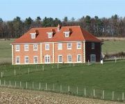
Poulton Grange - B&B
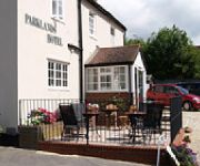
Parklands Hotel & Bentley's Chop House
Alexandra House
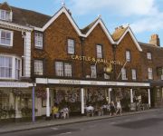
Castle and Ball
PARKLANDS HOTEL
CHISELDON HOUSE HOTEL
Videos from this area
These are videos related to the place based on their proximity to this place.
Mildenhall - Woodlands Farm Short Track (Byway, N-S)
NGR Start: SU214713 NGR Finish: SU214712 Byway Number: MILD5 Date: 09.08.12 Condition: Hard track.
Mildenhall - Woodlands Farm (Byway, E-W)
NGR Start: SU218716 NGR Finish: SU209717 Byway Number: MILD5 Date: 09.09.12 Condition: Hard track with ruts and muddy part.
THG Camping Rig (Tent & Van)
THG Camping Trip - Postern Hill Campsite , Savernack Forest UK - July 2012. A short clip from Kevs cam giving you a tour of the THG Camping Rig (Tent & Van).
The Hedgewitch Cooks - TV Show
he HedgeWitch Cooks is a new kind of television lifestyle and food show. It aims to be a feel-good series in which daily chores become magical rituals with the potential to transform your life....
Part 1 - IkarusC42 experience flight GS Aviation Clench Common Wilts
Part 1 of my 1st lesson / experience flight, flown in a Ikarus C42 microlight, take off and landing at Clench Common airfield Wiltshire. Flight duration on part 1 and 2 approx 50 mins in air,...
London to Bath by Mk2 Jaguar, July 1963
A drive from London to Bath in a mk2 Jaguar by George Eyles IAM (later head of the IAM) in July 1963. The route follows the A4 road which has changed somewhat since the recording (Calne being...
Show of Hands - Blue Cockade
Miranda Sykes on Double Bass and vocals. Steve Knightly vocals and guitar Phil Beer vocals and guitar.
Part 2 - Ikarus C42 experience flight GS Aviation Clench Common Wilts
Part 2 of my 1st lesson / experience flight, flown in a Ikarus C42 microlight, take off and landing at Clench Common airfield Wiltshire. Flight duration on part 1 and 2 approx 50 mins in air,...
A Drive Through Marlborough, Wiltshire
An autumnal drive through the historic and pretty Wiltshire town. 22.10.12.
Homecoming Parade for 4 Military Intelligence Battalion, Marlborough
The Chief of the Defence staff and the Marlborough Mayor presented soldiers from 45 Company, 4 Military Intelligence Battalion (4MI Bn), based in Bulford, Wiltshire with their Operational Service...
Videos provided by Youtube are under the copyright of their owners.
Attractions and noteworthy things
Distances are based on the centre of the city/town and sightseeing location. This list contains brief abstracts about monuments, holiday activities, national parcs, museums, organisations and more from the area as well as interesting facts about the region itself. Where available, you'll find the corresponding homepage. Otherwise the related wikipedia article.
Marlborough College
Marlborough College is a co-educational independent school for day and boarding pupils, located in Marlborough, Wiltshire. Founded in 1843 for the education of the sons of Church of England clergy, the school now accepts both boys and girls of all beliefs. Currently there are just over 800 pupils, approximately one third of whom are female. New pupils are admitted at the ages of 13+ ("Shell entry") and 16 (Lower Sixth).
Marlborough and Ramsbury Rural District
Marlborough and Ramsbury was a rural district in Wiltshire, England from 1935 to 1974. It was formed by a County Review Order in 1935 as a merger of the Marlborough Rural District and the Ramsbury Rural District. It entirely surrounded the municipal borough of Marlborough. In 1974, it was abolished under the Local Government Act 1972, becoming part of the new Kennet district.
Manton, Wiltshire
Manton is a small village in Wiltshire on the outskirts of Marlborough just off the A4 Bath Road. Manton village is part of the Parish of Preshute, and as such includes St Georges Church, and Preshute Primary The Outside Chance is the only pub in the village. The village primary school is Preshute Primary School, which feeds into St Johns Community College in Marlborough. It is home to the historic Manton House Stables, currently operated by Thoroughbred horse trainer Brian Meehan.
Cunetio
The Roman town of Cunetio, located across the River Kennet from the modern town of Mildenhall, Wiltshire, was occupied from the 2nd century AD until the end of the Roman period, early 5th century, when it was apparently abandoned. Its location was identified from aerial photos of crop marks taken in 1940, and the site has been sporadically excavated since the 1950s. In the 1960s, a small coin hoard was found, followed in 1978 by the much larger Cunetio Hoard of over 55,000 coins.
Ogbourne St Andrew
Ogbourne St Andrew is a small village in Wiltshire. It is near the village of Ogbourne St George and the hamlets of Ogbourne Maizey and Rockley. The village is lacking in local facilities because it changed from a farming-based community into a commuter-based one and therefore lost its local shop and post office due to lack of demand although the post box is still operating.
Marlborough Castle
Marlborough Castle, locally known and recorded in historical documents as The Mount, was an 11th-century royal castle located in the civil parish of Marlborough, a market town in the English county of Wiltshire, on the Old Bath Road, the old main road from London to Bath. The barrow on which the fortification was built, perhaps the "barrow of Maerla" seems to be a prehistoric earthwork which formed the motte of the Norman Marlborough Castle.
Marlborough railway stations
|} Marlborough, Wiltshire in England was served by two separate railway stations whose histories were intertwined. The two stations were built by different railway companies which started as competitors but ended up under the same ownership. This led to some complex rationalisation in the operation of the railway lines that served the town.
Ogbourne Maizey
Ogbourne Maizey is a hamlet in Wiltshire. It is at the Marlborough end of the village of Ogbourne St. Andrew. The hamlet on the banks of the River Og is dominated by commuter housing and race horse stables on the narrow road that leads over the downs to Rockley. Local primary-level children usually go to the school in Ogbourne St. George or to Marlborough. A map of 1773 shows an almost continuous ribbon of buildings along it between Ogbourne Maizey and Ogbourne St. Andrew.


