Safety Score: 3,0 of 5.0 based on data from 9 authorites. Meaning we advice caution when travelling to United Kingdom.
Travel warnings are updated daily. Source: Travel Warning United Kingdom. Last Update: 2024-08-13 08:21:03
Explore Monkton_Farleigh
Monkton_Farleigh in Wiltshire (England) is a city in United Kingdom about 93 mi (or 150 km) west of London, the country's capital.
Local time in Monkton_Farleigh is now 11:49 PM (Sunday). The local timezone is named Europe / London with an UTC offset of zero hours. We know of 9 airports in the vicinity of Monkton_Farleigh, of which 5 are larger airports. The closest airport in United Kingdom is RAF Lyneham in a distance of 15 mi (or 24 km), North-East. Besides the airports, there are other travel options available (check left side).
There are several Unesco world heritage sites nearby. The closest heritage site in United Kingdom is City of Bath in a distance of 28 mi (or 44 km), East. Also, if you like golfing, there are multiple options in driving distance. We found 1 points of interest in the vicinity of this place. If you need a place to sleep, we compiled a list of available hotels close to the map centre further down the page.
Depending on your travel schedule, you might want to pay a visit to some of the following locations: Bathford, Box, Westwood, Freshford and Wingfield. To further explore this place, just scroll down and browse the available info.
Local weather forecast
Todays Local Weather Conditions & Forecast: 9°C / 48 °F
| Morning Temperature | 6°C / 43 °F |
| Evening Temperature | 10°C / 49 °F |
| Night Temperature | 8°C / 46 °F |
| Chance of rainfall | 0% |
| Air Humidity | 80% |
| Air Pressure | 1017 hPa |
| Wind Speed | Moderate breeze with 11 km/h (7 mph) from East |
| Cloud Conditions | Overcast clouds, covering 97% of sky |
| General Conditions | Light rain |
Monday, 18th of November 2024
8°C (46 °F)
10°C (49 °F)
Light rain, fresh breeze, overcast clouds.
Tuesday, 19th of November 2024
3°C (37 °F)
1°C (34 °F)
Rain and snow, fresh breeze, overcast clouds.
Wednesday, 20th of November 2024
4°C (40 °F)
2°C (35 °F)
Light rain, gentle breeze, clear sky.
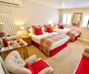
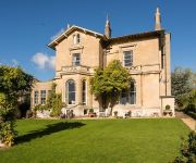
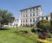
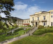
Hotels and Places to Stay
The Northey Arms
The Windsor
Chestnuts House
Apsley House Hotel
The Ayrlington
Macdonald Bath Spa
Spinneycross
The Kennard
The County Hotel Bath
Brindleys Boutique Bed & Breakfast
Videos from this area
These are videos related to the place based on their proximity to this place.
Bath Skyline Walk - A Guided Tour
A video tour of the National Trust's brilliant 'Skyline' walk in Bath. The walk is six miles long with some hilly parts. It offers spectacular views of the Roman city of Bath and the surrounding...
Box Tunnel In Box | 3x FGW HST | Western Entrance | 1/8/2011
So i read somewhere a while back Network Rail cleared this area that allows a clear view of the tunnel, and with the electrification of the line in a few years away.. this maybe one of my only...
Box - Hazelbury Hill (UCR, S-N & N-S)
Subscribe for the love of motorcycles and the great outdoors: http://www.youtube.com/subscription_center?add_user=wiltshirebyways Please click 'S H O W M O R E' for route info: ↓↓↓↓↓↓...
Gavin Mikhail Real World Video Blog - Day 2 (Part 2 of 2)
http://www.gavinmikhail.com/freesongs - Gavin talks about his first day of recording at Peter Gabriel's Real World Studios. As the landslide winner of the Tunecore/SSL/Eventful-sponsored...
Chinese CNC plasma or flame cutter setup
Yahong2100 CNC.they speak English and can give you a price to your nearest port/airport.remember that you will have to pay import duty also.for only 200 USD or so they also sell a remote control.
A Ride Around Colerne in Wiltshire (KMX125, 15.01.15)
Subscribe for the love of motorcycles and the great outdoors: http://www.youtube.com/subscription_center?add_user=wiltshirebyways Please click 'S H O W M O R E' for route info: ↓↓↓↓↓↓...
Command Pillbox & Underground Telephone Exchange In Monkton Farleigh.
This unusual command pillbox has been dug out to show the connecting trench, telephone exhange & stairway. It was part of the defence system at CAD East,Monkton Farleigh.
WW2 Underground Bomb Store Photos
A collection of stills taken at the underground bomb store september 2008.
Kurland Skincare Herbal Pedicure
Relax tired and aching feet with a soothing rose petal soak followed by a poppy seed and rose scrub to leave your feet fully revitalised. A totally superb experience! Visit www.kurlandskincare.co.u...
A Ride Around Colerne in Wiltshire (TTR250, 14.11.14)
Subscribe for the love of motorcycles and the great outdoors: http://www.youtube.com/subscription_center?add_user=wiltshirebyways Please click 'S H O W M O R E' for route info: ↓↓↓↓↓↓...
Videos provided by Youtube are under the copyright of their owners.
Attractions and noteworthy things
Distances are based on the centre of the city/town and sightseeing location. This list contains brief abstracts about monuments, holiday activities, national parcs, museums, organisations and more from the area as well as interesting facts about the region itself. Where available, you'll find the corresponding homepage. Otherwise the related wikipedia article.
Kennet and Avon Canal
The Kennet and Avon Canal is a waterway in southern England with an overall length of 87 miles, made up of two lengths of navigable river linked by a canal. The name is commonly used to refer to the entire length of the navigation rather than solely to the central canal section. From Bristol to Bath the waterway follows the natural course of the River Avon before the canal links it to the River Kennet at Newbury, and from there to Reading on the River Thames.
Hawthorn, Wiltshire
Hawthorn is the location of a number of defence related underground facilities in the vicinity of Corsham, Wiltshire. Specifically the Hawthorn site was the location of an above-ground bunker used for the planning of satellite communications support to the United Kingdom's armed forces worldwide. These facilities had been built in quarries cleared through the excavation of Bath stone.
Monkton Farleigh
Monkton Farleigh is a small village in west Wiltshire, England, 3 miles (6 km) from Bradford-on-Avon, and 5 miles from the city of Bath, Somerset. It is known for its underground mines of Bath Stone, which were converted into one of the largest Ministry of Defence underground ammunition stores in the UK. The civil parish has 34 listed buildings, including: Monkton Farleigh Manor (Grade I) the Refectory at Monkton Farleigh Manor (Grade I ruin) Church of St. Peter (Grade II*)
Inwood, Warleigh
Inwood, Warleigh is a 56.9 hectare biological Site of Special Scientific Interest in Wiltshire, notified in 1988.
The Old Ride School
The Old Ride School (previously called The Old Ride Preparatory School) was an independent school, at Little Horwood, Buckinghamshire, later at Bradford on Avon, Wiltshire.
Great Pulteney Street
Great Pulteney Street is a grand thoroughfare that connects Bathwick on the east of the River Avon with the City of Bath, England via the Robert Adam designed Pulteney Bridge. Viewed from the city side of the bridge the road leads directly to the Holburne Museum of Art that was originally the Sydney Hotel where tea rooms, card rooms a concert room and a ballroom were installed for the amusement of Bath's many visitors.
Monkton Farleigh Manor
Monkton Farleigh Manor is a Grade I listed country house built on the site of a Cluniac priory founded in 1125 in Wiltshire, situated 3 miles (6 km) from Bradford-on-Avon, and 5 miles (8 km) from the city of Bath.
Kingsdown, Box
Kingsdown is a hamlet in the civil parish of Box, Wiltshire.


