Safety Score: 3,0 of 5.0 based on data from 9 authorites. Meaning we advice caution when travelling to United Kingdom.
Travel warnings are updated daily. Source: Travel Warning United Kingdom. Last Update: 2024-08-13 08:21:03
Touring Durnford
Durnford in Wiltshire (England) is a town located in United Kingdom about 77 mi (or 125 km) west of London, the country's capital place.
Time in Durnford is now 03:16 PM (Thursday). The local timezone is named Europe / London with an UTC offset of zero hours. We know of 9 airports nearby Durnford, of which 5 are larger airports. The closest airport in United Kingdom is Bournemouth Airport in a distance of 24 mi (or 39 km), South. Besides the airports, there are other travel options available (check left side).
There are several Unesco world heritage sites nearby. The closest heritage site in United Kingdom is City of Bath in a distance of 19 mi (or 30 km), North-East. Also, if you like the game of golf, there are several options within driving distance. Need some hints on where to stay? We compiled a list of available hotels close to the map centre further down the page.
Being here already, you might want to pay a visit to some of the following locations: Woodford, Amesbury, Salisbury, Wilton and Durrington. To further explore this place, just scroll down and browse the available info.
Local weather forecast
Todays Local Weather Conditions & Forecast: 1°C / 34 °F
| Morning Temperature | 0°C / 33 °F |
| Evening Temperature | 0°C / 33 °F |
| Night Temperature | 1°C / 33 °F |
| Chance of rainfall | 0% |
| Air Humidity | 68% |
| Air Pressure | 998 hPa |
| Wind Speed | Gentle Breeze with 9 km/h (5 mph) from South-West |
| Cloud Conditions | Overcast clouds, covering 100% of sky |
| General Conditions | Overcast clouds |
Friday, 22nd of November 2024
5°C (41 °F)
2°C (35 °F)
Sky is clear, fresh breeze, clear sky.
Saturday, 23rd of November 2024
8°C (47 °F)
14°C (56 °F)
Moderate rain, strong breeze, overcast clouds.
Sunday, 24th of November 2024
14°C (58 °F)
15°C (58 °F)
Light rain, strong breeze, overcast clouds.
Hotels and Places to Stay
Fairlawn House
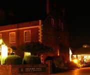
Milford Hall A Classic British Hotel
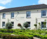
Peartree Serviced Apartments
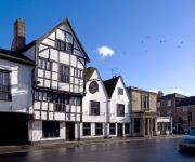
Mercure Salisbury White Hart Hotel
The Chapter House
Holiday Inn SALISBURY - STONEHENGE
Antrobus Arms
The George Relaxinnz
Victoria Lodge Guest House
City Lodge Salisbury
Videos from this area
These are videos related to the place based on their proximity to this place.
Old Sarum, world heritage at Salisbury Plain
Salisbury Plain: after the building of Stonehenge and Avebury, the Romans built a fortification named Old Sarum in the first century. Later, the Normans built a fort there. In 1075 a cathedral...
Flying around Old Sarum castle on a windy day.
After asking permission to fly the zone by the manager, I allowed some of the staff to don the video goggles as I flew the circuit, so to speak...Strong cold crosswinds and drab lighting seem...
GoSkyDive UK Intro Video
We were approached to put this introductory promo video together for GoSkyDive, a popular sky diving company based in Wiltshire. The promo would serve as an intro to the personalised DVD that...
Autism Hampshire Skydive
On Saturday 29th June 2013, nine brave volunteers headed to the Old Sarum airfield near Salisbury to take part in a 10000ft parachute jump to raise money for local charity Hampshire Autistic Society.
Emergency landing in Suffolk. The Kid Story.
The story so far of G-IMMI the KID. Watch out for my first hairy landing on a very blustery day. The "fuel management problem" that preceded the forced landing near RAF Wattisham in Suffolk,...
Stonehenge - Amesbury, Wiltshire, England, United Kingdom
http://tripwow.tripadvisor.com/tripwow/ta-00a0-60ce-a5ab?ytv2=1 - Created at TripWow by TravelPod Attractions (a TripAdvisor™ company) Stonehenge Amesbury One of the most important survivals...
The Evil Within Walkthrough, Gameplay with Commentary Part 4, (1080p HD): Doctor & Spider Bitch
If you liked the video please leave a Like & PLENTY of Comments, I appreciate all feedback! :) The Evil Within Walkthrough Gameplay Part 4 -- Watch live at http://www.twitch.tv/pagan_prince...
Main Square in Bridport where entertainment happens but not in the RAIN
Every time I film Buckydoo Square in Bridport there is some kind of entertainment. Bands, Dancers, Jugglers, Singers, Actors, tap dancers, Mimers, Mummers, Father Christmas, but this time there...
Videos provided by Youtube are under the copyright of their owners.
Attractions and noteworthy things
Distances are based on the centre of the city/town and sightseeing location. This list contains brief abstracts about monuments, holiday activities, national parcs, museums, organisations and more from the area as well as interesting facts about the region itself. Where available, you'll find the corresponding homepage. Otherwise the related wikipedia article.
Salisbury Plain
Salisbury Plain is a chalk plateau in central southern England covering 300 square miles . It is part of a system of chalk downlands throughout eastern and southern England formed by the rocks of the Chalk Group and largely lies within the county of Wiltshire, with a little in Hampshire. The plain is famous for its rich archaeology, including Stonehenge, one of England's best known landmarks.
North Wessex Downs
The North Wessex Downs Area of Outstanding Natural Beauty (AONB) is located in the English counties of Berkshire, Hampshire, Oxfordshire and Wiltshire. The name North Wessex Downs is not a traditional one, the area covered being better known by various overlapping local names, including the Berkshire Downs, the White Horse Hills, the Lambourn Downs, the Marlborough Downs, the Vale of Pewsey and Savernake Forest.
Camp Down
Camp Down is a 7.3 hectare biological Site of Special Scientific Interest in Wiltshire, designated as such in 1965.
Lower Woodford Water Meadows
Lower Woodford Water Meadows is a 23.9 hectare biological Site of Special Scientific Interest in Wiltshire, notified in 1971.
Lake House
Lake House is an Elizabethan country house dating from 1578, in Wilsford-cum-Lake in Wiltshire, England, about 7 miles north of Salisbury. It is a Grade I listed building. The gardens are Grade II listed in the English Heritage Register of Parks and Gardens of Special Historic Interest.
Bush Barrow
After Johnson 2008]] {{#invoke:Coordinates|coord}}{{#coordinates:51.172|-1.825||||||| |primary |name= }} Bush Barrow is a site of the early British Bronze Age, at the western end of the Normanton Down Barrows cemetery. It is among the most important sites of the Stonehenge complex. It was excavated in 1808 by Sir Richard Colt Hoare and William Cunnington. The finds are displayed at Wiltshire Heritage Museum in Devizes.
Normanton Down Barrows
Normanton Down is a Neolithic and Bronze Age barrow cemetery located south of Stonehenge in the county of Wiltshire, England. It dates from between 2600 and 1600 BC and consists of a Neolithic long barrow and Bronze Age round barrows.
Wilsford cum Lake
Wilsford cum Lake is a civil parish near Salisbury in Wiltshire. It contains the small settlements of Wilsford, Normanton and Lake. The 2001 Census recorded a population of 109.


