Safety Score: 3,0 of 5.0 based on data from 9 authorites. Meaning we advice caution when travelling to United Kingdom.
Travel warnings are updated daily. Source: Travel Warning United Kingdom. Last Update: 2024-08-13 08:21:03
Discover Calne
Calne in Wiltshire (England) with it's 17,274 citizens is a place in United Kingdom about 81 mi (or 130 km) west of London, the country's capital city.
Current time in Calne is now 09:42 PM (Thursday). The local timezone is named Europe / London with an UTC offset of zero hours. We know of 9 airports near Calne, of which 5 are larger airports. The closest airport in United Kingdom is RAF Lyneham in a distance of 5 mi (or 7 km), North. Besides the airports, there are other travel options available (check left side).
There are several Unesco world heritage sites nearby. The closest heritage site in United Kingdom is City of Bath in a distance of 16 mi (or 26 km), East. Also, if you like playing golf, there are a few options in driving distance. If you need a hotel, we compiled a list of available hotels close to the map centre further down the page.
While being here, you might want to pay a visit to some of the following locations: Bremhill, Lacock, Seend, Chippenham and Worton. To further explore this place, just scroll down and browse the available info.
Local weather forecast
Todays Local Weather Conditions & Forecast: 2°C / 36 °F
| Morning Temperature | 1°C / 34 °F |
| Evening Temperature | 0°C / 32 °F |
| Night Temperature | 2°C / 36 °F |
| Chance of rainfall | 0% |
| Air Humidity | 79% |
| Air Pressure | 999 hPa |
| Wind Speed | Moderate breeze with 9 km/h (6 mph) from East |
| Cloud Conditions | Overcast clouds, covering 100% of sky |
| General Conditions | Overcast clouds |
Friday, 22nd of November 2024
5°C (41 °F)
1°C (34 °F)
Few clouds, moderate breeze.
Saturday, 23rd of November 2024
9°C (49 °F)
14°C (57 °F)
Moderate rain, strong breeze, overcast clouds.
Sunday, 24th of November 2024
15°C (59 °F)
10°C (50 °F)
Moderate rain, high wind, near gale, overcast clouds.
Hotels and Places to Stay
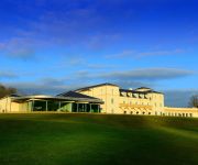
Bowood Hotel
Bowood Spa & Golf Resort
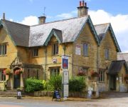
The Foxham Inn
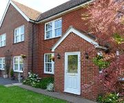
Avalon Lodge B&B
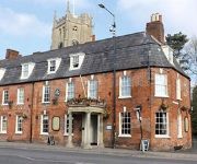
The Duke Hotel
The Castle Hotel
TRAVELODGE DEVIZES
Videos from this area
These are videos related to the place based on their proximity to this place.
The Chaos Brothers Clash City Rockers
The Chaos Brothers Clash City Rockers Friday 19th December 2014 The Wheatsheaf Calne.
Driving Lessons Calne Devizes
Driving lessons for Calne, Devizes, Chippenham and surrounding areas. First in a series of short to the point driving lesson videos promoting better driving.
The Chaos Brothers Pretty Vacant
The Chaos Brothers Pretty Vacant Friday 19th December 2014 The Wheatsheaf Calne.
Calne Motorcycle Meet 2010 - Part 2
The Rotary Club of Calne's (calne) Motorcycle Meet 10th anniversary Saturday - 24th July 2010 Web: http://www.calnemotorcyclemeet.co.uk Part 2 of 2 Full High Def Recorded on Panasonic...
paintballing with friends practice makes perfect
attacking the enemy team as they hide in the base, almost got clipped by a ball but it broke on the tree behind me ...... thank god!
Is this a burglary or not???
Apparently this isnt stealing and she hasnt just been caught on camera robbing from my sons spongebob money box in calne, wiltshire.
Videos provided by Youtube are under the copyright of their owners.
Attractions and noteworthy things
Distances are based on the centre of the city/town and sightseeing location. This list contains brief abstracts about monuments, holiday activities, national parcs, museums, organisations and more from the area as well as interesting facts about the region itself. Where available, you'll find the corresponding homepage. Otherwise the related wikipedia article.
Quemerford
Quemerford is a suburb of the town of Calne in the county of Wiltshire, South West England, UK.
Black Dog Halt railway station
Black Dog Halt was opened 1863-11-03 by the Great Western Railway for Lord Lansdowne of Bowood House. Lord Lansdowne had a special compartment in one of the Calne line's autocoaches. Eventually, Lord Lansdowne was persuaded to allow the halt to be used by the public. After the British Rail take over the halt was turned into a request stop. In 1965 the halt was closed and, soon afterwards, the buildings were demolished.
Calne railway station
Calne railway station was opened on 3 November 1863 by the Great Western Railway as a terminus for the branch line from the Great Western mainline (with a junction at Chippenham). It was situated a short distance from Calne town centre and was equipped with only one platform. The station, when first opened, had its own engine shed. In the early years of the station's history, the seven sidings were usually full due to the amount of traffic coming in from the nearby Chippenham railway station.
RAF Compton Bassett
RAF Compton Basset was an RAF base situated near Calne in Wiltshire, England. First opened as an RAF base in World War I, like RAF Yatesbury it continued operations in the interwar years before again taking on a major role in World War II. During the Second World War, RAF Yatesbury and RAF Compton Bassett were major Radio and Radar Training Schools, RAF Townsend a satellite landing ground and RAF Cherhill was 27 Group Headquarters Technical Training Command.
Mile Elm
Mile Elm is a hamlet in central Wiltshire, UK with a population of around 40 residents. It is situated on the A3102 road some 2 km southwest of Calne (the nearest town) and 11 km northeast of Melksham. The hamlet backs onto part of the Marquess of Lansdowne's Bowood Estate. Larger nearby villages include Heddington, Bromham and Sandy Lane. {{#invoke:Coordinates|coord}}{{#coordinates:51|25|24|N|2|00|30|W| |primary |name= }}
Ratford
Ratford is a hamlet in the county of Wiltshire, United Kingdom, with a population of approximately 50. It is located around 1 km north of the A4 national route, some 2.5 km northwest of Calne (the nearest town) and 1 km southwest of Bremhill, the closest village. Other nearby settlements include the villages of Derry Hill and Studley, plus the hamlet of Stanley. The village pub is the 'Dumb Post Inn', situated on the north side of Ratford on the lane to Bremhill.
Fishers Brook
Fishers Brook is a small hamlet in Wiltshire, England, with a population of approximately 25 residents. It is essentially a small collection of houses situated just to the south of Fishers Brook bridge. The brook itself flows into the River Marden approximately 1 km to the west of the settlement. Fishers Brook is signposted from the A3102 Calne bypass route and lies some 2.5 km to the northwest of central Calne (the closest town).
The John Bentley School
The John Bentley School is an age 11–18 mixed secondary school with academy status located in the town of Calne, Wiltshire in England. As of January 2012 the school has 1,200 students.


