Safety Score: 3,0 of 5.0 based on data from 9 authorites. Meaning we advice caution when travelling to United Kingdom.
Travel warnings are updated daily. Source: Travel Warning United Kingdom. Last Update: 2024-08-13 08:21:03
Discover Bishopstrow
Bishopstrow in Wiltshire (England) is a city in United Kingdom about 90 mi (or 145 km) west of London, the country's capital city.
Local time in Bishopstrow is now 11:24 PM (Sunday). The local timezone is named Europe / London with an UTC offset of zero hours. We know of 9 airports in the vicinity of Bishopstrow, of which 5 are larger airports. The closest airport in United Kingdom is RAF Lyneham in a distance of 23 mi (or 36 km), North. Besides the airports, there are other travel options available (check left side).
There are several Unesco world heritage sites nearby. The closest heritage site in United Kingdom is City of Bath in a distance of 26 mi (or 41 km), North-East. Also, if you like golfing, there are a few options in driving distance. Looking for a place to stay? we compiled a list of available hotels close to the map centre further down the page.
When in this area, you might want to pay a visit to some of the following locations: Upton Scudamore, Westbury, Bratton, Chicklade and Boyton. To further explore this place, just scroll down and browse the available info.
Local weather forecast
Todays Local Weather Conditions & Forecast: 9°C / 48 °F
| Morning Temperature | 6°C / 43 °F |
| Evening Temperature | 9°C / 48 °F |
| Night Temperature | 8°C / 46 °F |
| Chance of rainfall | 0% |
| Air Humidity | 81% |
| Air Pressure | 1018 hPa |
| Wind Speed | Moderate breeze with 10 km/h (6 mph) from East |
| Cloud Conditions | Overcast clouds, covering 99% of sky |
| General Conditions | Light rain |
Monday, 18th of November 2024
8°C (46 °F)
10°C (50 °F)
Light rain, fresh breeze, overcast clouds.
Tuesday, 19th of November 2024
3°C (37 °F)
0°C (33 °F)
Rain and snow, fresh breeze, overcast clouds.
Wednesday, 20th of November 2024
4°C (39 °F)
2°C (35 °F)
Sky is clear, gentle breeze, clear sky.
Hotels and Places to Stay
Home Farm
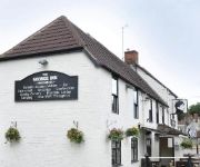
George Inn
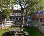
The Dove Inn
An Auberge Resort Malliouhana
TRAVELODGE WARMINSTER
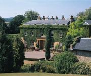
THE BISHOPSTROW HOTEL AND SPA
Videos from this area
These are videos related to the place based on their proximity to this place.
Upton Scudamore - Imber Range Perimeter Path (Permissive Byway, S-N)
Subscribe for the love of motorcycles and the great outdoors: http://www.youtube.com/subscription_center?add_user=wiltshirebyways Please click 'S H O W M O R E' for route info: ↓↓↓↓↓↓...
Bishopstrow - Middle Hill (Byway, S-N)
Subscribe for the love of motorcycles and the great outdoors: http://www.youtube.com/subscription_center?add_user=wiltshirebyways Please click 'S H O W M O R E' for route info: ↓↓↓↓↓↓...
Biker vs Residents
Not one but two residents take issue with our use of a byway open to all traffic near Bishopstrow in Wiltshire. The lady was unwilling to consider my position and instead argued from a position...
Warminster Wobble 2014: Colin French with Andrei Burton mtb trials stunt rider
Colin French takes part in the Savage Skills MTB trials riding display.
Bridport RFC v Warminster RFC (Part 2 of 4) [12/10/13]
The 6th game of Bridport RFC's 13/14 season where they came up against a stronger side in Warminster. Bridport lost 29-10. However Bridport took solace from a fantastic team try well finished...
Videos provided by Youtube are under the copyright of their owners.
Attractions and noteworthy things
Distances are based on the centre of the city/town and sightseeing location. This list contains brief abstracts about monuments, holiday activities, national parcs, museums, organisations and more from the area as well as interesting facts about the region itself. Where available, you'll find the corresponding homepage. Otherwise the related wikipedia article.
Warminster Town F.C
Warminster Town F.C. are a football club based in Warminster, Wiltshire, England. They play in the Western Football League Division One.
Upton Scudamore
Upton Scudamore is a village in Wiltshire, England, located about a mile north of the town of Warminster. In earlier centuries, it was often spelt Upton Skidmore. It appears on John Sexton's map of Wiltshire (1610) as simply Upton. The River Biss has its source as the Biss Brook in Upton Scudamore. Upton Cow Down rises above the village to the north-east, on the western edge of Salisbury Plain.
Scratchbury and Cotley Hills SSSI
Scratchbury & Cotley Hills SSSI is a 53.5 hectare biological Site of Special Scientific Interest at Norton Bavant in Wiltshire, notified in 1951. The Iron Age hillfort of Scratchbury Camp occupies the summit of the hill.
Warminster Athenaeum
Warminster Athenaeum is a Victorian theatre in Warminster, UK, and a Grade II listed building. Built in 1858 based on the designs of W. J. Stent, it has been closed three times in its history, most recently in 1997. There were dangers of the building's being demolished or redeveloped; however, the district council handed over trusteeship to the newly formed Athenaeum Trust. The trust have since launched a restoration appeal and have already spent over £100,000 on the building.
Norton Bavant
Norton Bavant is a village and civil parish in Wiltshire, England.
Sutton Veny
Sutton Veny is a small village situated in the Wylye Valley, about 2 miles south east of the town of Warminster in Wiltshire, England. 'Sutton' means south farmstead in relation to Norton Bavant, one mile to the north. 'Veny' may be a French family name or else may describe the village's fenny situation. The village is represented in parliament by Andrew Murrison and in Wiltshire Council by Fleur de Rhé-Philipe, both Conservatives.


!['Bridport RFC v Warminster RFC (Part 2 of 4) [12/10/13]' preview picture of video 'Bridport RFC v Warminster RFC (Part 2 of 4) [12/10/13]'](https://img.youtube.com/vi/LkHV3yoOV-Q/mqdefault.jpg)


