Safety Score: 3,0 of 5.0 based on data from 9 authorites. Meaning we advice caution when travelling to United Kingdom.
Travel warnings are updated daily. Source: Travel Warning United Kingdom. Last Update: 2024-08-13 08:21:03
Delve into Atherton
Atherton in Wigan (England) with it's 20,149 habitants is a city located in United Kingdom about 171 mi (or 275 km) north-west of London, the country's capital town.
Current time in Atherton is now 06:10 PM (Tuesday). The local timezone is named Europe / London with an UTC offset of zero hours. We know of 9 airports closer to Atherton, of which 5 are larger airports. The closest airport in United Kingdom is Manchester Airport in a distance of 15 mi (or 24 km), South-East. Besides the airports, there are other travel options available (check left side).
There are several Unesco world heritage sites nearby. The closest heritage site in United Kingdom is Pontcysyllte Aqueduct and Canal in a distance of 42 mi (or 68 km), South-West. Also, if you like playing golf, there are some options within driving distance. In need of a room? We compiled a list of available hotels close to the map centre further down the page.
Since you are here already, you might want to pay a visit to some of the following locations: Bolton, Croft, Haigh, Partington and Winwick. To further explore this place, just scroll down and browse the available info.
Local weather forecast
Todays Local Weather Conditions & Forecast: 5°C / 41 °F
| Morning Temperature | 4°C / 39 °F |
| Evening Temperature | 4°C / 39 °F |
| Night Temperature | 5°C / 41 °F |
| Chance of rainfall | 0% |
| Air Humidity | 89% |
| Air Pressure | 1023 hPa |
| Wind Speed | Light breeze with 4 km/h (3 mph) from North |
| Cloud Conditions | Scattered clouds, covering 39% of sky |
| General Conditions | Scattered clouds |
Wednesday, 4th of December 2024
6°C (44 °F)
10°C (49 °F)
Light rain, moderate breeze, overcast clouds.
Thursday, 5th of December 2024
11°C (52 °F)
9°C (48 °F)
Heavy intensity rain, fresh breeze, overcast clouds.
Friday, 6th of December 2024
8°C (46 °F)
11°C (51 °F)
Moderate rain, moderate breeze, overcast clouds.
Hotels and Places to Stay
Bolton Whites
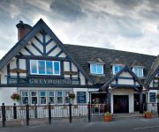
Greyhound Restaurant & Hotel
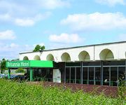
Britannia Bolton
Holiday Inn Express LEIGH - SPORTS VILLAGE
Bolton (Stadium/Arena)
Mercure Bolton Georgian House Hotel
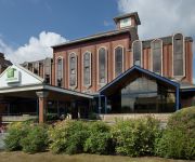
Holiday Inn BOLTON CENTRE
TRAVELODGE BOLTON CENTRAL RIVER STREET
TRAVELODGE WARRINGTON LOWTON
Bolton West
Videos from this area
These are videos related to the place based on their proximity to this place.
MOTAN Central Feed System - Journey of plastic through a factory
Watch the journey of a plastic granule from the silo, to the dryer, into a gravimetric blender, and then into the processing machine. This type of system is used to supply the raw material...
Let's Build Sims 3 Arren's Country Cabin
This was my first let's build video, I enjoy making these videos and I think I will make more of them. The house specifications was a 1 door 1 car garage, 2 bedrooms (I know I put three in...
Seat Leon 1.9TDi SE 110 - Engine Recording
I was taking this recording so I could get a better idea of the sounds of the car and so I can show to others what sounds I am hearing, that way it is easier to be diagnosed! =) I've been...
Towels Unbalanced Interm Spin/Loads Of Washing From Holiday
Towels on cottons interm. spin (unbalanced again, you can hear it more at the end) and the load of washing after coming home from a weeks holiday.
whiteys salvia trip
this is whitey, he toots salvia and trips out under skag bridge. what a legend!!!!!!!!
Selling a car - get the best price
a useful video on how to get the best price when selling your car. MicksGarage sells a full range of Haynes car DIY manuals. MicksGarage is Europe's leading online retailer of car parts and...
Far Cry 2 Gameplay and map editor
Gameplay video and map editor, from gamespot OVERVIEW: Far Cry 2 is an upcoming first person shooter published by Ubisoft and is the sequel to Far Cry. Crytek, developers of the original...
Mr Gill dancing (Westhoughton High School)
I wish this was a longer clip, but I recorded what I could. This is Westhoughton High school's own Mr Gill raving to his favourite anthem 'Nelly the elephant'. Year 10 G.C.S.E citizenship class.
Ramiel Hi Jinks
A mad 5 minutes, from todays fun at Westhoughton Leisure Centre. Recorded by Andy James. No epp was harmed in the making of this video. All stunts were performed by trained Flying Dogs !!
Gentle Lady soaring off Pendle Hill, Lancashire, England.
Gentle Lady glider flying off Pendle Hill, Lancashire, England, in a light breeze, 4MPH. This is my second flight with a glider I built last winter after watching build vids on youtube. Spent...
Videos provided by Youtube are under the copyright of their owners.
Attractions and noteworthy things
Distances are based on the centre of the city/town and sightseeing location. This list contains brief abstracts about monuments, holiday activities, national parcs, museums, organisations and more from the area as well as interesting facts about the region itself. Where available, you'll find the corresponding homepage. Otherwise the related wikipedia article.
Atherton, Greater Manchester
Atherton (pop. 20,300) is a town within the Metropolitan Borough of Wigan, in Greater Manchester, England and historically a part of Lancashire. It is 5 miles east of Wigan, 2 miles north-northeast of Leigh, and 10.7 miles northwest of Manchester. For about 300 years from the 17th century Atherton was referred to as Chowbent, which was frequently shortened to Bent, the town's old nickname.
Pretoria Pit Disaster
The Pretoria Pit disaster was a mining accident that occurred on 21 December 1910, when there was an underground explosion at the Hulton Bank Colliery No. 3 Pit, known as the Pretoria Pit, in Over Hulton, Westhoughton, then in the historic county of Lancashire, in North West England. A total of 344 men lost their lives.
Atherton Collieries A.F.C
Atherton Collieries A.F.C. is an English football club based in Atherton in Greater Manchester. The club currently plays in the North West Counties League First Division, the tenth tier of English football, and is a full member of the Lancashire County Football Association. Between 1919 and 1965 Atherton Collieries were winners of the Bolton Combination ten times. By 1964–65 they had won the Lancashire FA Amateur Shield six times, a record which is still unsurpassed.
Hag Fold railway station
Hag Fold railway station is one of the local stations that lie on the Atherton line, between Wigan and Manchester, England. The station is located 13 miles (20 km) west of Manchester Victoria with regular Northern Rail services to these towns as well as Salford, Swinton, Walkden and Hindley. The station was built to serve the Hag Fold estate in Atherton, and is only manned during the morning and lunchtime period.
Chowbent Chapel
Chowbent Chapel is an active Unitarian place of worship in Atherton, Greater Manchester, England. It was built in 1721 and is the oldest place of worship in the town. It is a member of the General Assembly of Unitarian and Free Christian Churches, the umbrella organisation for British Unitarians. The chapel was granted Grade II* Listed status in 1966.
Atherton Bag Lane railway station
Atherton Bag Lane railway station served an area of Atherton, Greater Manchester in what was then Lancashire, England. It was located on the Bolton and Leigh Railway line which ran from Bolton, Great Moor Street Station to Leigh Station and the Leeds and Liverpool Canal and later to Kenyon Junction.
Atherton Urban District
Atherton was, from 1863 to 1974, a local government district in Lancashire, England.
St John the Baptist's Church, Atherton
St John the Baptist's Church, Atherton, is located in Market Place, Atherton, Greater Manchester, England. It is an active Anglican parish church in the Leigh deanery in the archdeaconry of Salford, and diocese of Manchester. Together with St George's and St Philip's Churches in Atherton and St Michael and All Angels at Howe Bridge, the church is part of the United Benefice of Atherton and Hindsford with Howe Bridge. It is designated a Grade II listed building.
Atherton Hall, Leigh
Atherton Hall was a country house and estate in Atherton historically a part of Lancashire, England. It was built between 1723 and 1742 and demolished in 1824. In 1894 this part of Atherton was incorporated into Leigh, Greater Manchester. Christopher Saxton's map shows there was a medieval deer park here in the time of Elizabeth I.
Gibfield Colliery
Gibfield Colliery was a coal mine which was part of the Fletcher, Burrows and Company's collieries in Atherton, Greater Manchester, then in the historic county of Lancashire, England. A shaft was sunk to the Trencherbone mine in 1829 by John Fletcher next to the Bolton and Leigh Railway line which opened in 1830. The colliery was served by sidings near Bag Lane Station. In 1872 the colliery was expanded when a second shaft was sunk to access the Arley mine at 1233 feet.
St Michael and All Angels' Church, Howe Bridge
St Michael and All Angels' Church, Howe Bridge, is located in Leigh Road, Howe Bridge, a suburb of Atherton, Greater Manchester, England. It is an active Anglican parish church in the deanery of Leigh, the archdeaconry of Salford and the diocese of Manchester. Its benefice is united with those of three local churches, St John the Baptist, St George and St Philip, forming a team ministry entitled the United Benefice of Atherton and Hindsford with Howe Bridge.
St Anne's Church, Hindsford
St Anne's Church, Hindsford, is a redundant Anglican parish church located in Tyldesley Road, Hindsford, Atherton, Greater Manchester, England. It is designated by English Heritage as a Grade II listed building.


