Safety Score: 3,0 of 5.0 based on data from 9 authorites. Meaning we advice caution when travelling to United Kingdom.
Travel warnings are updated daily. Source: Travel Warning United Kingdom. Last Update: 2024-08-13 08:21:03
Delve into Lower Beeding
Lower Beeding in West Sussex (England) is a town located in United Kingdom about 33 mi (or 54 km) south of London, the country's capital town.
Time in Lower Beeding is now 12:39 AM (Saturday). The local timezone is named Europe / London with an UTC offset of zero hours. We know of 9 airports closer to Lower Beeding, of which 5 are larger airports. The closest airport in United Kingdom is London Gatwick Airport in a distance of 9 mi (or 14 km), North. Besides the airports, there are other travel options available (check left side).
There are several Unesco world heritage sites nearby. The closest heritage site in United Kingdom is Stonehenge, Avebury and Associated Sites in a distance of 11 mi (or 17 km), North. Also, if you like the game of golf, there are some options within driving distance. We saw 3 points of interest near this location. In need of a room? We compiled a list of available hotels close to the map centre further down the page.
Since you are here already, you might want to pay a visit to some of the following locations: Henfield, Newdigate, Fulking, Ockley and Brighton. To further explore this place, just scroll down and browse the available info.
Local weather forecast
Todays Local Weather Conditions & Forecast: 9°C / 49 °F
| Morning Temperature | 4°C / 40 °F |
| Evening Temperature | 9°C / 48 °F |
| Night Temperature | 9°C / 48 °F |
| Chance of rainfall | 0% |
| Air Humidity | 74% |
| Air Pressure | 1020 hPa |
| Wind Speed | Light breeze with 5 km/h (3 mph) from East |
| Cloud Conditions | Broken clouds, covering 84% of sky |
| General Conditions | Broken clouds |
Sunday, 17th of November 2024
7°C (45 °F)
2°C (36 °F)
Light rain, gentle breeze, overcast clouds.
Monday, 18th of November 2024
11°C (51 °F)
12°C (53 °F)
Moderate rain, fresh breeze, overcast clouds.
Tuesday, 19th of November 2024
4°C (39 °F)
1°C (34 °F)
Light rain, moderate breeze, overcast clouds.
Hotels and Places to Stay
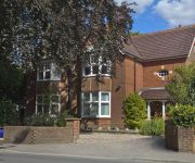
Copper Beech House
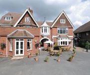
Barrington Lodge
Hickstead
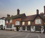
The Grange Hotel
RAMADA CRAWLEY GATWICK
Arora Hotel Gatwick / Crawley
TRAVELODGE CRAWLEY
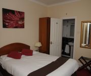
Wimblehurst Hotel
TRAVELODGE HORSHAM CENTRAL
TRAVELODGE HICKSTEAD
Videos from this area
These are videos related to the place based on their proximity to this place.
This is Horsham Rugby Club 2011
Horsham Rugby Club in West Sussex is one of the largest clubs in Sussex with over 600 members, running teams from Under 7 to Vets. This video is about the activities of the club, what it brings...
Horsham v Faversham Town Dec 2014
Horsham v Faversham Town, Ryman League - Division One South, Tuesday, 23 December 2014, Score: Horsham 1 Faversham Town 2 Attendance: 219.
The cycle paths of Horsham
A simple journey from Horsham station, across the town centre and out the other side using the designated cycle routes. The ups, the downs, the ons and the offs. Watch it to the end and...
Horsham v Faversham Town - Feb 2014
Horsham v Faversham Town, Ryman League - Division One South, Wednesday, 19 February 2014, Score: Horsham 1 Faversham Town 1 Attendance: 94.
Arbworx garden makeover in Horsham. The final day and we have finished!
A great build to do and with a fair budget to complete all the features that the client requested. We used Balau smooth decking with a hidden fixing system and Marshalls natural slate paving...
Covered: Living for the city
Covered at the Queens Head, Horsham, Jan 22nd 2011 http://www.coveredmusic.com http://queensheadhorsham.co.uk.
Holmbush Paintball Walkon 04/05/2008 Vid No.3
The third and final video I have of Holmbush Paintball's 4th May Walkon.
Videos provided by Youtube are under the copyright of their owners.
Attractions and noteworthy things
Distances are based on the centre of the city/town and sightseeing location. This list contains brief abstracts about monuments, holiday activities, national parcs, museums, organisations and more from the area as well as interesting facts about the region itself. Where available, you'll find the corresponding homepage. Otherwise the related wikipedia article.
Colwood, West Sussex
Colwood is a village near Warninglid in West Sussex, England. It is the site of Colwood Manor. {{#invoke:Coordinates|coord}}{{#coordinates:51|00|18|N|0|13|36|W| |primary |name= }}
Leonardslee
Leonardslee is one of the largest and most spectacular landscaped woodland gardens in England. They are particularly noted for their spring displays of rhododendrons, azaleas, camellias, magnolias and bluebells, with the flowering season reaching its peak in May. Leonardslee is situated at Lower Beeding, near Horsham, West Sussex. Following the sale of the estate in July 2010, the gardens are no longer open to the public.
St Leonard's Forest
St. Leonard's Forest is at the western end of the Wealden Forest Ridge which runs from Horsham to Tonbridge, and is part of the High Weald Area of Outstanding Natural Beauty. It lies on the ridge to the south of the A264 between Horsham and Crawley with the villages of Colgate and Lower Beeding within it. The A24 lies to west and A23 to the East and A272 through Cowfold to the south. Much has been cleared, but a large area is still wooded. The Forestry Commission has 289 ha.
Southwater & Nuthurst (electoral division)
Southwater & Nuthurst is an electoral division of West Sussex in the United Kingdom and returns one member to sit on West Sussex County Council. The current County Councillor, Brad Watson, is also Cabinet Member for Communications.
Newells Preparatory School
Newells Preparatory School came to Lower Beeding, Sussex in 1947. It has been at Handcross Park House, Handcross since 1968 and merged with Brighton College in 2011.


