Safety Score: 3,0 of 5.0 based on data from 9 authorites. Meaning we advice caution when travelling to United Kingdom.
Travel warnings are updated daily. Source: Travel Warning United Kingdom. Last Update: 2024-08-13 08:21:03
Explore Farnborough
Farnborough in West Berkshire (England) with it's 102 inhabitants is located in United Kingdom about 53 mi (or 86 km) west of London, the country's capital.
Local time in Farnborough is now 07:41 PM (Sunday). The local timezone is named Europe / London with an UTC offset of zero hours. We know of 9 airports in the wider vicinity of Farnborough, of which 5 are larger airports. The closest airport in United Kingdom is RAF Benson in a distance of 13 mi (or 21 km), North-East. Besides the airports, there are other travel options available (check left side).
There are several Unesco world heritage sites nearby. The closest heritage site in United Kingdom is City of Bath in a distance of 16 mi (or 25 km), South-West. Also, if you like golfing, there are multiple options in driving distance. If you need a place to sleep, we compiled a list of available hotels close to the map centre further down the page.
Depending on your travel schedule, you might want to pay a visit to some of the following locations: Welford, Winterbourne, Frilford, Newbury and Greenham. To further explore this place, just scroll down and browse the available info.
Local weather forecast
Todays Local Weather Conditions & Forecast: 9°C / 48 °F
| Morning Temperature | 6°C / 43 °F |
| Evening Temperature | 9°C / 49 °F |
| Night Temperature | 8°C / 47 °F |
| Chance of rainfall | 0% |
| Air Humidity | 77% |
| Air Pressure | 1017 hPa |
| Wind Speed | Moderate breeze with 11 km/h (7 mph) from East |
| Cloud Conditions | Overcast clouds, covering 95% of sky |
| General Conditions | Light rain |
Monday, 18th of November 2024
8°C (46 °F)
10°C (50 °F)
Light rain, fresh breeze, overcast clouds.
Tuesday, 19th of November 2024
3°C (38 °F)
0°C (32 °F)
Rain and snow, fresh breeze, overcast clouds.
Wednesday, 20th of November 2024
4°C (38 °F)
2°C (35 °F)
Light snow, gentle breeze, clear sky.
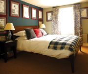
Hotels and Places to Stay
DoubleTree by Hilton Newbury North
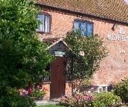
Ye Olde Red Lion
Kingswell
TRAVELODGE NEWBURY CHIEVELEY M4
QUEENS ARMS
Videos from this area
These are videos related to the place based on their proximity to this place.
Charlotte Oct 4, 2014 Spin City Showcase
Charlotte's Beautiful Silks performance. First ever solo Aerial performance. Charlotte only discovered aerials 6 months ago..... amazing talent xx.
Wantage Silver B Band | Variations on Maccabeus
Wantage Silver B Band practice Variations on Maccabeus by Kevin Norbury, the 2015 London and Southern Counties Area test piece. http://www.wantageband.org.
Monster Hunter 3rd Village Quest One Star 5/5 + Aoashira kill with starting gear(optional)
Last village quest before urgent and fight with optional boss aoashira with starting equipment.
Wantage - East Lockinge to Park Hill (Byway, W-E)
NGR Start: SU433875 NGR Finish: SU454877 Byway Number: ? Date: 02.06.12 Condition: Chalk/dirt track with narrow bridge crossing the Ginge Brook. Notes: Popular with walkers and unsuitabl...
Sierril Vinagger Sierra @ London city 2009
Que deleite internacional y cosmopolita el de nuestro compadre Sierra. Esta vez embriagado a lo más vinagger vinagger... es lo que tierne arrimarse a Felicia...
Ampthill
A workshop teaching dances from the "Ampthill tradition" devised by Redbornstoke Morris. Taught by Brian Manders at Wantage in 2002. Filmed from the gallery of the Youth Hostel on the Friday...
Monk's Farm, Grove, Oxfordshire
One of the prime building sites in our village - under water on 16 February 2014. The rushes in the middle distance set the context nicely for this pond, but of course grew in hot summer of...
A Bit of a Do in Hurst
The village hall was rocking in Hurst on Saturday 4th October 2008. Fab time had by all!
Videos provided by Youtube are under the copyright of their owners.
Attractions and noteworthy things
Distances are based on the centre of the city/town and sightseeing location. This list contains brief abstracts about monuments, holiday activities, national parcs, museums, organisations and more from the area as well as interesting facts about the region itself. Where available, you'll find the corresponding homepage. Otherwise the related wikipedia article.
The Ridgeway
The Ridgeway is a ridgeway or ancient trackway described as Britain's oldest road. The section clearly identified as an ancient trackway extends from Wiltshire along the chalk ridge of the Berkshire Downs to the River Thames at the Goring Gap, part of the Icknield Way which ran, not always on the ridge, from Salisbury Plain to East Anglia. The route was adapted and extended as a National Trail, created in 1972.
DIDO (nuclear reactor)
DIDO was a nuclear reactor at the Atomic Energy Research Establishment at Harwell, Oxfordshire in the United Kingdom. It used enriched uranium metal fuel, and heavy water as both neutron moderator and primary coolant. There was also a graphite neutron reflector surrounding the core. In the design phase, DIDO was known as AE334 after its engineering design number.
PLUTO reactor
PLUTO was a nuclear reactor at the Atomic Energy Research Establishment at Harwell, Oxfordshire in the United Kingdom, one of five reactors on the site. It was based on the design of DIDO and used enriched uranium metal fuel, and heavy water as both neutron moderator and primary coolant. There was also a graphite neutron reflector surrounding the core. PLUTO was the third DIDO class reactor to become operational, after DIDO itself and HIFAR.
Scutchamer Knob
Scutchamer Knob, also known as Cuckhamsley Hill and occasionally as Scotsman's Knob or Beacon Hill, is an early Iron Age round barrow on the Ridgeway National Trail at East Hendred Down in the English county of Oxfordshire. Originally called Cwichelmeshlaew or Cwichelm's Barrow, it is recorded as having been the place where King Edwin of Northumbria killed Cwichelm of Wessex in AD 636 and, in the Middle Ages, became the meeting point of the Shire Moot (or market) which was abolished in 1620.


