Safety Score: 3,0 of 5.0 based on data from 9 authorites. Meaning we advice caution when travelling to United Kingdom.
Travel warnings are updated daily. Source: Travel Warning United Kingdom. Last Update: 2024-08-13 08:21:03
Discover Aldworth
Aldworth in West Berkshire (England) is a city in United Kingdom about 46 mi (or 74 km) west of London, the country's capital city.
Local time in Aldworth is now 01:11 AM (Friday). The local timezone is named Europe / London with an UTC offset of zero hours. We know of 11 airports in the vicinity of Aldworth, of which 5 are larger airports. The closest airport in United Kingdom is RAF Benson in a distance of 9 mi (or 14 km), North-East. Besides the airports, there are other travel options available (check left side).
There are several Unesco world heritage sites nearby. The closest heritage site in United Kingdom is City of Bath in a distance of 21 mi (or 34 km), South-West. Also, if you like golfing, there are a few options in driving distance. Looking for a place to stay? we compiled a list of available hotels close to the map centre further down the page.
When in this area, you might want to pay a visit to some of the following locations: Upper Basildon, Winterbourne, Newbury, Greenham and Tilehurst. To further explore this place, just scroll down and browse the available info.
Local weather forecast
Todays Local Weather Conditions & Forecast: 5°C / 41 °F
| Morning Temperature | 2°C / 35 °F |
| Evening Temperature | 2°C / 36 °F |
| Night Temperature | 1°C / 35 °F |
| Chance of rainfall | 0% |
| Air Humidity | 65% |
| Air Pressure | 1009 hPa |
| Wind Speed | Fresh Breeze with 14 km/h (9 mph) from East |
| Cloud Conditions | Scattered clouds, covering 36% of sky |
| General Conditions | Scattered clouds |
Saturday, 23rd of November 2024
8°C (47 °F)
14°C (56 °F)
Moderate rain, strong breeze, overcast clouds.
Sunday, 24th of November 2024
14°C (57 °F)
11°C (52 °F)
Moderate rain, high wind, near gale, overcast clouds.
Monday, 25th of November 2024
10°C (50 °F)
8°C (46 °F)
Light rain, fresh breeze, scattered clouds.
Hotels and Places to Stay
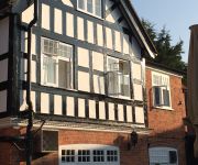
The Miller of Mansfield
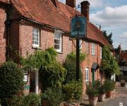
The Royal Oak
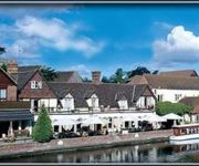
The Swan at Streatley
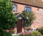
The Bull Stanford Dingley
Kingswell
Videos from this area
These are videos related to the place based on their proximity to this place.
The Berkshire Downs - Aston Tirrold to East Ilsley (Byways, N-S)
NGR Start: SU552845 NGR Finish: SU449811 Byway Number: ? Date: 02.06.12 Condition: Paved road, rutted dirt and chalk track. Notes: Popular with all road users. This video features...
2014 ToB peloton at A417 / Halfpenny Lane
2014 Tour of Britain, Stage 6 Bath to Hemel Hempstead, Friday 12th September. Peloton turns off A417 at Halfpenny Lane towards Cholsey.
HPI Firestorm in Blewbury
just some first clips i got, not the best but i will get better! the HPI firestorm is extremely fun and i recommend one! hope you enjoy it. Filmed by GOPRO hero 2 and edited in iMovie on imac.
Blewburton Hill, Oxfordshire - DJI Phantom 2 Vision
Beautiful day for flying at the iron age hill fort, Blewburton Hill, between Aston Upthorpe and Blewbury, in Oxfordshire. Cold day, clear skies, faultless performance from the Phantom 2 Vision....
Ashbrook Mews 3
Apartment to rent in Blewbury, Oxfordshire. 1 of 4 luxury serviced apartments from Ashbrook Lets. Please see our personal website for more enquiries. www.ashbrooklets.co.uk.
First Great Western HST and DMU, Goring & Streatley
A FGW HST (InterCity 125) train roars through Goring & Streatley station toward London, followed by a pair of Class 166 DMU sets going the opposite direction, toward Oxford. The trailing power...
First Great Western HST at Goring & Streatley
Flying by at speed, a FGW HST (InterCity 125) train passes Goring & Streatley on its route from London.
First Great Western HST in the rain at Goring & Streatley
A London-bound HST (InterCity 125) in FGW's current colors dashes through the rain with a Valenta power car in the lead. Note the spray over the top of the cab caused by the wipers on the...
First Great Western HSTs meet at Goring & Streatley, UK
From the bridge between platforms one and two- which shakes when these trains go through- I saw two HST (InterCity 125) trains pass each other at speed on the afternoon of November 17th, 2007....
Goring and Streatley Golf Club - Course Tour - The 17th Hole
The seventeenth hole at Goring and Streatley golf club. Tour by Jason Hadland. PGA professional.
Videos provided by Youtube are under the copyright of their owners.
Attractions and noteworthy things
Distances are based on the centre of the city/town and sightseeing location. This list contains brief abstracts about monuments, holiday activities, national parcs, museums, organisations and more from the area as well as interesting facts about the region itself. Where available, you'll find the corresponding homepage. Otherwise the related wikipedia article.
Lardon Chase, the Holies and Lough Down
Lardon Chase, the Holies and Lough Down are three adjacent National Trust countryside properties in the English county of Berkshire. They are situated on the edge of the Berkshire Downs above the village of Streatley and overlooking the Goring Gap. Together they comprise an outstanding area of 27 hectares of downland and woodland with many attractive walks and views. The properties adjoin the Goring and Streatley Golf Club.
Battle of Ashdown
The Battle of Ashdown, in Berkshire (possibly the part now in Oxfordshire), took place on 8 January 871. Alfred the Great, then a prince of only 21, led the army of his brother, King Ethelred of Wessex, in a victorious battle against the invading Danes. Accounts of the battle are based to a large extent on Asser's "Life of Alfred", however there is some dispute about whether this is an authentic account.
West Berkshire Brewery
The West Berkshire Brewery is a microbrewery in Yattendon, Berkshire, United Kingdom. Founded in 1995 by husband and wife Dave and Helen Maggs, the brewery grew out of its original brickworks shed in Frilsham and now brews exclusively in Yattendon at a rate of 80 barrels per week.
Ashampstead Common
Ashampstead Common is a common in the English county of Berkshire, within the civil parish of Ashampstead. The common lies north of the M4 motorway, near to Ashampstead, Lower Basildon and Yattendon.
RAF Hampstead Norris
RAF Hampstead Norris is a former RAF station located 1.3 miles north east of Hampstead Norreys, Berkshire and 10.6 miles north west of Reading, Berkshire.
The Living Rainforest
The Living Rainforest is an indoor greenhouse tropical rainforest located in Hampstead Norreys in Berkshire, England. It is a popular ecological centre, educational centre and visitor attraction, run by the Trust for Sustainable Living. The site was once one of Europe’s leading orchid nurseries, Wyld Court Orchids.
Goring and Streatley Golf Club
Goring and Streatley Golf Club is a golf course in the village of Streatley, in the English county of Berkshire. It takes its name partly from that village, and partly from the adjoining village of Goring-on-Thames in the county of Oxfordshire. The course adjoins the National Trust properties of Lardon Chase, the Holies and Lough Down. The club has an 18-hole 6,355-yard, par-71 golf course, designed in part by Harry Colt, and has magnificent views of the Thames, The Goring Gap and Ridgeway.


