Safety Score: 3,0 of 5.0 based on data from 9 authorites. Meaning we advice caution when travelling to United Kingdom.
Travel warnings are updated daily. Source: Travel Warning United Kingdom. Last Update: 2024-08-13 08:21:03
Touring Whatcote
Whatcote in Warwickshire (England) is a town located in United Kingdom about 74 mi (or 119 km) north-west of London, the country's capital place.
Time in Whatcote is now 07:47 AM (Friday). The local timezone is named Europe / London with an UTC offset of zero hours. We know of 7 airports nearby Whatcote, of which 5 are larger airports. The closest airport in United Kingdom is Coventry Airport in a distance of 19 mi (or 31 km), North. Besides the airports, there are other travel options available (check left side).
There are several Unesco world heritage sites nearby. The closest heritage site in United Kingdom is Blenheim Palace in a distance of 43 mi (or 69 km), South-East. Also, if you like the game of golf, there are several options within driving distance. We collected 1 points of interest near this location. Need some hints on where to stay? We compiled a list of available hotels close to the map centre further down the page.
Being here already, you might want to pay a visit to some of the following locations: Warwick, Hanwell, Coventry, Berkswell and Barston. To further explore this place, just scroll down and browse the available info.
Local weather forecast
Todays Local Weather Conditions & Forecast: 8°C / 47 °F
| Morning Temperature | 5°C / 41 °F |
| Evening Temperature | 6°C / 44 °F |
| Night Temperature | 5°C / 41 °F |
| Chance of rainfall | 0% |
| Air Humidity | 77% |
| Air Pressure | 1028 hPa |
| Wind Speed | Light breeze with 5 km/h (3 mph) from North-East |
| Cloud Conditions | Overcast clouds, covering 100% of sky |
| General Conditions | Overcast clouds |
Saturday, 16th of November 2024
8°C (47 °F)
7°C (44 °F)
Light rain, gentle breeze, overcast clouds.
Sunday, 17th of November 2024
7°C (45 °F)
3°C (38 °F)
Light rain, moderate breeze, overcast clouds.
Monday, 18th of November 2024
5°C (42 °F)
1°C (34 °F)
Rain and snow, moderate breeze, overcast clouds.
Hotels and Places to Stay
Ettington Chase Hotels
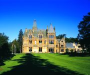
Mercure Warwickshire Walton Hall Hotel & Spa
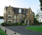
Ettington Park
The George Inn
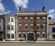
The George Townhouse
Videos from this area
These are videos related to the place based on their proximity to this place.
2014 TKM Extreme Super One Round 1 Shenington Heat 1
2014 TKM Extreme Super One Round 1 Shenington Heat 1.
2014 TKM Extreme Super One Round 1 Shenington Heat 2
2014 TKM Extreme Super One Round 1 Shenington Heat 2.
Newbold-on-Stour - Moss Lane (Bridleway, E-W)
Subscribe for the love of motorcycles and the great outdoors: http://www.youtube.com/subscription_center?add_user=wiltshirebyways Please click 'S H O W M O R E' for route info: ↓↓↓↓↓↓...
English Language Course Feedback (in Russian)
Video feedback from Pavel, our Russian student from Moscow. Filmed in the world famous Stratford on Avon, England. Pavel studied English with one of our online British teachers on Skype for...
Midland offroad club,Parkfarm Challenge may 2007
MOC 4x4 challenge open to all 4x4s.All events are run in the midlands area.
Metalflake , Kandy and lace paint by Wayne Allman
The roof of my 55 rambler wagon after i'd just painted it :-)
1996 Sightings Investigates Remote Viewing on NBC
The investigative journalist author Jim Marrs, tells the story of the US military remote viewing program from the 1970s to its cancelation in the mid-1990s. The psychic, Ingo Swann makes an...
Electric RC Helicopters
Order Code: DV234 - DVD - Blu-ray - Streaming/Download http://www.trapletshop.com They're clean, they're quiet, there's a great choice of size, power and capability, and they've revolutionised...
Videos provided by Youtube are under the copyright of their owners.
Attractions and noteworthy things
Distances are based on the centre of the city/town and sightseeing location. This list contains brief abstracts about monuments, holiday activities, national parcs, museums, organisations and more from the area as well as interesting facts about the region itself. Where available, you'll find the corresponding homepage. Otherwise the related wikipedia article.
Oxhill, Warwickshire
Oxhill is a village in South Warwickshire, England, off the A422 road between Stratford-upon-Avon and Banbury. It lies in the administrative district of Stratford-on-Avon in the area known as the Vale of the Red Horse. The village is mentioned in the Domesday Book as "Octeselve" and has a 12th century church dedicated to Saint Lawrence. The indentions in the chancel window mullions are believed by many to be the marks made by local archers sharpening their arrowheads.
Via Gellia
Via Gellia is a steep sided wooded dry valley and road in Derbyshire. It is probably named after (or by) Phillip Eyre Gell in a mock Latin style; he was responsible for building the road through the valley, and the Gells claimed Roman descent. At its lower (eastern) end is the village of Cromford, near to the town of Wirksworth and the Georgian cotton mill, Cromford Mill, built by inventor/entrepreneur Richard Arkwright. At the western end is the hamlet of Grangemill.
Shipston-on-Stour Rural District
Shipston on Stour was a rural district in England from 1894 to 1974. http://www. visionofbritain. org. uk/relationships. jsp;jsessionid=D49AE9F79F7BD0630E8C81B1C2C84296?u_id=10061921 The district covered an area around Shipston-on-Stour. Originally it was a detached part of Worcestershire, but in 1931 it was transferred to the jurisdiction of Warwickshire, and was expanded by the abolition of Brailes Rural District.
Evolution of Worcestershire county boundaries
The boundaries of Worcestershire, England, have been fluid for over 150 years since the first major changes in 1844. Although the continual expansion of Birmingham and the Black Country during and after the Industrial Revolution altered the county map considerably, even up to the later part of the 20th century.


