Safety Score: 3,0 of 5.0 based on data from 9 authorites. Meaning we advice caution when travelling to United Kingdom.
Travel warnings are updated daily. Source: Travel Warning United Kingdom. Last Update: 2024-08-13 08:21:03
Delve into Stockton
Stockton in Warwickshire (England) with it's 1,347 habitants is a town located in United Kingdom about 75 mi (or 120 km) north-west of London, the country's capital town.
Time in Stockton is now 07:18 AM (Friday). The local timezone is named Europe / London with an UTC offset of zero hours. We know of 10 airports closer to Stockton, of which 5 are larger airports. The closest airport in United Kingdom is Coventry Airport in a distance of 8 mi (or 14 km), North-West. Besides the airports, there are other travel options available (check left side).
There are several Unesco world heritage sites nearby. The closest heritage site in United Kingdom is Blenheim Palace in a distance of 43 mi (or 69 km), South-East. Also, if you like the game of golf, there are some options within driving distance. In need of a room? We compiled a list of available hotels close to the map centre further down the page.
Since you are here already, you might want to pay a visit to some of the following locations: Hanwell, Coventry, Warwick, Keresley and Berkswell. To further explore this place, just scroll down and browse the available info.
Local weather forecast
Todays Local Weather Conditions & Forecast: 8°C / 46 °F
| Morning Temperature | 5°C / 40 °F |
| Evening Temperature | 6°C / 43 °F |
| Night Temperature | 5°C / 41 °F |
| Chance of rainfall | 0% |
| Air Humidity | 78% |
| Air Pressure | 1027 hPa |
| Wind Speed | Light breeze with 5 km/h (3 mph) from North-East |
| Cloud Conditions | Overcast clouds, covering 100% of sky |
| General Conditions | Overcast clouds |
Saturday, 16th of November 2024
8°C (46 °F)
6°C (44 °F)
Light rain, gentle breeze, overcast clouds.
Sunday, 17th of November 2024
7°C (44 °F)
3°C (38 °F)
Light rain, moderate breeze, overcast clouds.
Monday, 18th of November 2024
5°C (41 °F)
0°C (33 °F)
Rain and snow, moderate breeze, overcast clouds.
Hotels and Places to Stay
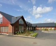
Draycote Hotel and Golf Course
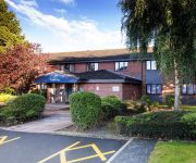
TRAVELODGE RUGBY DUNCHURCH
Videos from this area
These are videos related to the place based on their proximity to this place.
Southam Floods 2007 Part 1
The undepass between the Welsh Road East and Pound Way totally flooded! You can just see the roof!
GU Canal - Radford Lock to Bascote Staircase (time lapse)
From Radford Bottom Lock to the Bascote Staircase, ten broad locks raise the canal 68 and a half feet in a three mile section of the Grand Union Canal (Warwick and Napton Canal) We shared...
There's no Zombies in Southam
The production team working on Brad Pitt's new movie, 'World War Z', visited the Southam Cemex Quarry keen to use the abandoned.kiln building pictured here. The Building and industrial interior...
BC Cleaning Employs Non-Human
Southam cleaning firm BC Cleaning has employed its first non-human employee: a robot called Robert. Robert has been taken on for his vacuuming skills and is working at a number of commercial...
Alumet's new Schuco ERC 50 retrofit facade system on Jubilee House
The new Schuco ERC 50 regeneration facade being retrofitted on Jubilee House, Southam. Note how fast the units can be installed.
Warwick House Wedding photography
A beautiful wedding at Warwick House in Southam, Warwickshire on a very rainy day in June. The bride and groom had a civil ceremony followed by their wedding breakfast in the Banqueting Hall....
rivetting
Hot rivetting the knees back into a Thomas Bantock (built 1850-1890) iron hulled narrowboat. Stockton Dry Dock, Warwickshire.
Videos provided by Youtube are under the copyright of their owners.
Attractions and noteworthy things
Distances are based on the centre of the city/town and sightseeing location. This list contains brief abstracts about monuments, holiday activities, national parcs, museums, organisations and more from the area as well as interesting facts about the region itself. Where available, you'll find the corresponding homepage. Otherwise the related wikipedia article.
Ed Bishop
Ed Bishop (June 11, 1932 – June 8, 2005) was an American film, television, stage, radio and voice actor based in the United Kingdom.
Stockton, Warwickshire
Stockton is a village and civil parish, in the Stratford-on-Avon district of Warwickshire, England. In the 2001 census it had a population of 1,391. The village is located just to the east of the A426 road two miles north-east of Southam, and eight miles south-west of Rugby. Stockton's name was first recorded in 1272, the name meaning 'a fenced enclosure'. During the 19th century, it developed as an industrial village.
Hill, Warwickshire
Hill is a hamlet in the English county of Warwickshire. Administratively it is in the civil parish of Leamington Hastings that, in turn, forms part of the borough of Rugby. It lies between Leamington Hastings and the A426 road from Rugby to Southam.
Southam United F.C
Southam United F.C. are a football club situated in the small rural town of Southam, Warwickshire, in the Midlands, England, who currently play in the Midland Football Combination, Premier Division, step 6 in the non-league pyramid system.
Birdingbury Hall
Birdingbury Hall is a 17th century country house situated at Birdingbury, near Rugby, Warwickshire. It is a Grade II listed building and now serves as the head office of a commercial organisation. The manor of Birdingbury was held in ancient times by the Priory of Coventry. After the Dissolution of the Monasteries it was acquired by the Throckmorton family. In 1674 it was sold to Sir Charles Wheler Bt. and in 1687 to the Biddulph family who remained in occupation until 1914.
Napton and Stockton railway station
Napton and Stockton railway station was a railway station on the London and North Western Railway branch line between Weedon and Leamington Spa. The station was built of wood and opened in 1 August 1895. It had two platforms, one having the main station facilities and the other being on a passing loop. The station was about 0.75 miles north of Stockton and 1 mile south of Broadwell. Napton was at least 2.5 miles away.
Southam and Long Itchington railway station
Southam and Long Itchington railway station was a railway station that served the villages of Southam and Long Itchington in Warwickshire, England. On the Weedon to Leamington Spa branch line the station was built a couple of miles to the north of Southam. The brick built station was opened on 1 August 1895 along with the other stations on the Daventry to Marton Junction extension of the Daventry line.
RAF Southam
RAF Southam was a Royal Air Force relief landing ground (RLG) located 0.7 miles east of Southam, Warwickshire, England and 7.3 miles south east of Royal Leamington Spa, Warwickshire, England. The airfield opened in 1940 and was mainly used by 9 Elementary Flying Training School training pilots. The airfield closed 18 December 1944.


