Safety Score: 3,0 of 5.0 based on data from 9 authorites. Meaning we advice caution when travelling to United Kingdom.
Travel warnings are updated daily. Source: Travel Warning United Kingdom. Last Update: 2024-08-13 08:21:03
Discover Fillongley
Fillongley in Warwickshire (England) with it's 695 citizens is a place in United Kingdom about 92 mi (or 147 km) north-west of London, the country's capital city.
Current time in Fillongley is now 07:50 AM (Friday). The local timezone is named Europe / London with an UTC offset of zero hours. We know of 9 airports near Fillongley, of which 5 are larger airports. The closest airport in United Kingdom is Birmingham International Airport in a distance of 7 mi (or 11 km), West. Besides the airports, there are other travel options available (check left side).
There are several Unesco world heritage sites nearby. The closest heritage site in United Kingdom is Derwent Valley Mills in a distance of 59 mi (or 94 km), North-East. Also, if you like playing golf, there are a few options in driving distance. If you need a hotel, we compiled a list of available hotels close to the map centre further down the page.
While being here, you might want to pay a visit to some of the following locations: Keresley, Meriden, Berkswell, Coventry and Hampton in Arden. To further explore this place, just scroll down and browse the available info.
Local weather forecast
Todays Local Weather Conditions & Forecast: 8°C / 47 °F
| Morning Temperature | 5°C / 41 °F |
| Evening Temperature | 6°C / 44 °F |
| Night Temperature | 5°C / 42 °F |
| Chance of rainfall | 0% |
| Air Humidity | 76% |
| Air Pressure | 1027 hPa |
| Wind Speed | Light breeze with 5 km/h (3 mph) from North-East |
| Cloud Conditions | Overcast clouds, covering 100% of sky |
| General Conditions | Overcast clouds |
Saturday, 16th of November 2024
9°C (47 °F)
7°C (44 °F)
Light rain, gentle breeze, overcast clouds.
Sunday, 17th of November 2024
7°C (45 °F)
4°C (39 °F)
Light rain, moderate breeze, overcast clouds.
Monday, 18th of November 2024
5°C (41 °F)
0°C (32 °F)
Snow, moderate breeze, overcast clouds.
Hotels and Places to Stay
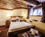
Old Hall House
Best Western Plus Windmill Village Hotel Golf & Leisure Club Allesley
Best Western Plus Manor
Forest of Arden Marriott Hotel & Country Club
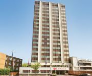
Ramada Hotel and Suites Coventry The Butts Earlsdon
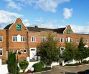
Quality Coventry
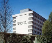
Britannia Coventry Hill
Royal Court
The Beechwood
Ye Olde Station Guest House
Videos from this area
These are videos related to the place based on their proximity to this place.
Warwickshire Coventry videos, download videos CoventryTelegraph net
Betty Figg, aged 86, was taken from her daughter Rosalind Figgss home Keresley Coventry pensioner.
Hail storm, M6, Corley Services, Coventry
Just as I pulled in to the service area I was hit by a wall of hail.
Unboxing Nikon D3200 18 55 VR II Kit
Unboxing new Nikon D3200 camera Recorded: Apple iPad mini 2 Edited: GoPro Studio.
England Wikipedia travel guide video. Created by Stupeflix.com
Create your own video on http://studio.stupeflix.com ! Stonehenge, a Neolithic and Bronze Age megalithic monument in Wiltshire, thought to have been erected c.2000-2500BC. An Anglo-Saxon helmet.
Demolition of Massey Ferguson / AGCO Tower
The disused office block at the one-time Massey Ferguson factory site on Banner Lane, Coventry, being demolished on Sunday 8th July 2012. The 16 storey block had been a landmark of Tile Hill...
Massey Ferguson Building Demolition Coventry & Dustcloud
This is the former Massey Ferguson tower on Banner Lane, Tile Hill, demolished in a controlled explosion around 10:00 BST on Sunday 8th July, 2012. The 16-storey tower, built in the 1960s,...
Coventry's AGCO Building Blow Up (08/07/12)
Coventry's locally famous AGCO building located on the newly developed housing estate, formerly known as Massey Ferguson's Industrial Estate has Finally been Blown up and this is my video,...
Pure Properties - SOLD SUBJECT TO CONTRACT!
Pure Properties are pleased to offer for sale this semi detached 2/3 bedroom home situated in the Eastern Green area of Coventry. Requiring some modernization and improvement; this is an ideal...
Hail Storm Coventry 28th June 2012
Aftermath of a hailstorm in Coventry West Midlands UK - see other video for a before and during the storm. Individual stones as big as a 1p coin, frozen together lumps as big as a small child's fist!
Videos provided by Youtube are under the copyright of their owners.
Attractions and noteworthy things
Distances are based on the centre of the city/town and sightseeing location. This list contains brief abstracts about monuments, holiday activities, national parcs, museums, organisations and more from the area as well as interesting facts about the region itself. Where available, you'll find the corresponding homepage. Otherwise the related wikipedia article.
Arley, Warwickshire
Arley is a civil parish in the North Warwickshire district of Warwickshire, England. The parish includes two settlements, New Arley and Old Arley. Old Arley is to the west of the Bourne Brook and the railway line, and New Arley is to the east. Old Arley contains the mediaeval church of St Wilfred, and a Methodist church nearby. New Arley contains St Michael's C of E and St Joseph's Catholic Church, both originally built in response to the influx of miners in the first half of the 20th century.
Over Whitacre
Over Whitacre is a hamlet in the North Warwickshire district of the county of Warwickshire in England. It is one of 'The Whitacres' – Over Whitacre, Nether Whitacre and Whitacre Heath, although Whitacre heath is actually the heath of Nether Whitacre and not a separate parish. The hamlet appears in the Domesday Book so it was already established in the Saxon period. However, objects belonging to much earlier Neolithic and Bronze Age times have been found in the soil.
Corley
Corley (and the associated hamlets of Corley Ash and Corley Moor) is a village and civil parish in the North Warwickshire district of Warwickshire, England. It is located about 8 kilometres northwest of Coventry and is adjacent to the village of Fillongley. The M6 motorway runs close by, and the village is familiar to motorists as it is the site of Corley Services. Other significant buildings in the area include Corley Hall, which was built in the 16th century.
Brownshill Green
Brownshill Green is a small suburb in the north-west of Coventry, adjacent to the suburbs of Keresley and Coundon. It is bordered on its north side by the northern boundary of Coventry and the village of Corley. Its main thoroughfare is Brownshill Green Road, which runs from its junction with Coundon Wedge Drive in the north to join Keresley Road in the south.
Arley and Fillongley railway station
Arley and Fillongley railway station was a station on the Midland Railway, which operated in the Midland county of Warwickshire, in England.
East Warwickshire Plateau
The East Warwickshire Plateau is a plateau in the Midlands of England. Forming the eastern part of the larger Midlands Plateau, it is separated by the valley of the River Blythe from the Birmingham Plateau to the west. To the north and south it is bounded by the valleys of the Trent and the Avon.
Daw Mill
Daw Mill was a coal mine located near the village of Arley, near Nuneaton, in the English county of Warwickshire. The mine was Britain's biggest coal producer. On 7 March 2013 the owner, UK Coal, announced the mine would be closed following a major fire. It was the last remaining colliery in the West Midlands.


