Safety Score: 3,0 of 5.0 based on data from 9 authorites. Meaning we advice caution when travelling to United Kingdom.
Travel warnings are updated daily. Source: Travel Warning United Kingdom. Last Update: 2024-08-13 08:21:03
Delve into Padgate
Padgate in Warrington (England) is a town located in United Kingdom about 166 mi (or 268 km) north-west of London, the country's capital town.
Time in Padgate is now 06:56 AM (Tuesday). The local timezone is named Europe / London with an UTC offset of zero hours. We know of 9 airports closer to Padgate, of which 5 are larger airports. The closest airport in United Kingdom is Manchester Airport in a distance of 12 mi (or 20 km), East. Besides the airports, there are other travel options available (check left side).
There are several Unesco world heritage sites nearby. The closest heritage site in United Kingdom is Pontcysyllte Aqueduct and Canal in a distance of 33 mi (or 54 km), South-West. Also, if you like the game of golf, there are some options within driving distance. In need of a room? We compiled a list of available hotels close to the map centre further down the page.
Since you are here already, you might want to pay a visit to some of the following locations: Warrington, Croft, Stockton Heath, Winwick and Appleton. To further explore this place, just scroll down and browse the available info.
Local weather forecast
Todays Local Weather Conditions & Forecast: 12°C / 54 °F
| Morning Temperature | 9°C / 48 °F |
| Evening Temperature | 12°C / 53 °F |
| Night Temperature | 10°C / 50 °F |
| Chance of rainfall | 0% |
| Air Humidity | 74% |
| Air Pressure | 1022 hPa |
| Wind Speed | Light breeze with 5 km/h (3 mph) from North-West |
| Cloud Conditions | Overcast clouds, covering 90% of sky |
| General Conditions | Overcast clouds |
Wednesday, 6th of November 2024
14°C (58 °F)
12°C (53 °F)
Broken clouds, light breeze.
Thursday, 7th of November 2024
14°C (57 °F)
11°C (52 °F)
Sky is clear, gentle breeze, clear sky.
Friday, 8th of November 2024
13°C (55 °F)
9°C (48 °F)
Overcast clouds, light breeze.
Hotels and Places to Stay
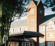
Daresbury Park
pentahotel Warrington
Mercure Haydock Hotel (Newly Refurbished)
THE PARK ROYAL - QHOTELS
Amado Boutique Hotel
VILLAGE WARRINGTON
Happy Guests Lodge
Holiday Inn WARRINGTON
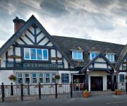
Greyhound Restaurant & Hotel
Holiday Inn Express LEIGH - SPORTS VILLAGE
Videos from this area
These are videos related to the place based on their proximity to this place.
HD River Mersey In Warrington
Quick video shot close to the Warrington Rowing Club on the River Mersey in Warrington. To be honest it took me ages to find some decent water to take the Phantom over as the ground was pretty...
CPM Warrington Movember Reservoir Dogs
As part of the Movember 2013 fundraising efforts, our CPM Warrington Mo-Pack become "The Reservoir Dogs" in this Movember special edition video.
Dragon Boat Race 2014, Team Horseshoe Inn, Croft
Warrington Rowing Club, Howley Lane Warrington. Dragon Boat Race, Team Horseshoe Inn, Croft Last year the event was a sell out and raised over £20000 for St. Rocco's hospice. Every year...
Half an Hour at (17) - Padgate Station 2.3.2014 Class 142 150 156 158 185 Warrington
Video 17 of the series was filmed at Padgate Station in Warrington, and surprisingly for a Sunday afternoon there was quite a number of trains with a very varied selection of DMU's passing...
Fast Times on Trials Evolution Episode 1 | Elevation
Hello everyone, today I am going to be starting a new Episode called "Fast Times" where I try my best to get the fastest times possible on the tracks in Trials Evolution, then break them down...
Severe Heavy Impact Test on The Safevent Window (www.britplas.com)
A test of the incredible strength of the Muti-Award winning Safevent window. This test is over 5 time more severe than the ultimate UK Heavy Body Impact test and repeats this impact 9 times....
Videos provided by Youtube are under the copyright of their owners.
Attractions and noteworthy things
Distances are based on the centre of the city/town and sightseeing location. This list contains brief abstracts about monuments, holiday activities, national parcs, museums, organisations and more from the area as well as interesting facts about the region itself. Where available, you'll find the corresponding homepage. Otherwise the related wikipedia article.
Padgate
Padgate was a village on the edge of Warrington, England, and today it is a large residential part of the town. During World War II it had a small RAF Station. RAF Padgate will be well-remembered by thousands of young men who were selected for RAF national service and on this site received their first taste of military discipline, ill-fitting uniforms and a severe haircut. It has an unmanned railway station on the Manchester-Liverpool line served by the local stopping service.
Bruche
Bruche is a large suburb of Warrington, England. It forms the old border of Poulton and Warrington. As of 2005 it is home to the Bruche Police Training Centre, a national police training centre.
Warrington North (UK Parliament constituency)
Warrington North is a parliamentary constituency represented in the House of Commons of the Parliament of the United Kingdom. It elects one Member of Parliament (MP) by the first past the post system of election.
Poulton-with-Fearnhead
Poulton-with-Fearnhead is a civil parish in the Borough of Warrington in Cheshire, England. According to the 2001 census it had a population of 17,019. The parish includes northern and eastern suburbs of Warrington, including Padgate, Fearnhead, Cinnamon Brow, Blackbrook, Longbarn, Bruche and Paddington. From northwards clockwise, it borders the parishes of Croft (at a point on a motorway junction), Birchwood, Woolston, the unparished area of Warrington, then the parish of Winwick.
Paddington Meadows
Paddington Meadows is a nature reserve in Warrington, England. The land was donated to Warrington Borough council in 1995. It was designated in November 2005. The site comprises almost 30 hectares of meadow grassland occupying the area to the south of Manchester Road and to the north of the Mersey. It is five minutes by car from Warrington town centre. There is ongoing active management of the hedgerows which include thinning and laying of the various edges.
Bruche Police National Training Centre
The Bruche Police Training Centre was a training complex for probationary police officers in the United Kingdom. It trained many thousands of officers over a period of around sixty years, until its closure in May 2006. The site in a suburb of Warrington was operated by CENTREX, the 'Central Police Training and Development Authority'.
A574 road
The A574 is a road in England, running through the borough of Warrington before terminating at the end of Butts Bridge in Leigh, Greater Manchester. The route covers a distance of approximately 13 miles and links Warrington town centre with the outer suburbs of Birchwood and Sankey.
Sandford (Police Training Village)
Sandford was a police training village in Cheshire, England. Part of the Bruche Police National Training Centre, it focused on creating a replica village where police recruits could engage in simulations of routine police activities such as dealing with traffic accidents, football hooligans, and investigating robberies. Criminals, victims and bystanders were portrayed by civilian locals of the Bruche area.
Lysander Community High School
Lysander Community High School, formerly known as Padgate Community High School was a Secondary School for 11-16 year old students in Warrington. It became University Academy in 2013, under the University of Chester Academies Trust.


