Safety Score: 3,0 of 5.0 based on data from 9 authorites. Meaning we advice caution when travelling to United Kingdom.
Travel warnings are updated daily. Source: Travel Warning United Kingdom. Last Update: 2024-08-13 08:21:03
Explore Crigglestone
Crigglestone in Wakefield (England) is located in United Kingdom about 159 mi (or 256 km) north of London, the country's capital.
Local time in Crigglestone is now 07:24 PM (Sunday). The local timezone is named Europe / London with an UTC offset of zero hours. We know of 9 airports in the wider vicinity of Crigglestone, of which 5 are larger airports. The closest airport in United Kingdom is Leeds Bradford Airport in a distance of 16 mi (or 26 km), North. Besides the airports, there are other travel options available (check left side).
There are several Unesco world heritage sites nearby. The closest heritage site in United Kingdom is Liverpool – Maritime Mercantile City in a distance of 27 mi (or 43 km), South-East. Also, if you like golfing, there are multiple options in driving distance. If you need a place to sleep, we compiled a list of available hotels close to the map centre further down the page.
Depending on your travel schedule, you might want to pay a visit to some of the following locations: Woolley, Wakefield, Walton, Notton and Cawthorne. To further explore this place, just scroll down and browse the available info.
Local weather forecast
Todays Local Weather Conditions & Forecast: 7°C / 45 °F
| Morning Temperature | 7°C / 44 °F |
| Evening Temperature | 6°C / 43 °F |
| Night Temperature | 6°C / 43 °F |
| Chance of rainfall | 2% |
| Air Humidity | 68% |
| Air Pressure | 1014 hPa |
| Wind Speed | Gentle Breeze with 8 km/h (5 mph) from East |
| Cloud Conditions | Few clouds, covering 23% of sky |
| General Conditions | Light rain |
Monday, 18th of November 2024
4°C (40 °F)
1°C (33 °F)
Snow, gentle breeze, overcast clouds.
Tuesday, 19th of November 2024
1°C (34 °F)
-2°C (28 °F)
Snow, gentle breeze, broken clouds.
Wednesday, 20th of November 2024
2°C (35 °F)
1°C (34 °F)
Snow, gentle breeze, few clouds.
Hotels and Places to Stay
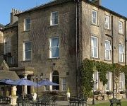
Clarion Collection Cedar Court Hotel Wakefield
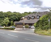
Waterton Park
BEST WESTERN HOTEL ST PIERRE
JCT.40 Holiday Inn LEEDS - WAKEFIELD M1
Ramada Wakefield M1 Jct 40
York House Hotel
Jct39) Premier Inn Wakefield South (M1
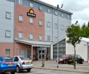
TRAVELODGE WAKEFIELD WOOLLEY EDGE M1 SOU
TRAVELODGE WAKEFIELD WOOLLEY EDGE M1 NOR
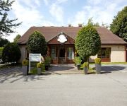
Campanile Wakefield
Videos from this area
These are videos related to the place based on their proximity to this place.
Wakefield RISC OS Show 2014: Chris Evans, CJE Micro's
Chris Evans' talk at the Wakefield RISC OS Show, 2014.
Events: Wakefield Railway Modellers Society Annual Exhibition - 30th November 2013 (Part 3)
Third and final episode in a series of videos of footage taken of some of the layouts on display at the "Wakefield Railway Modellers Society" show held in Wakefield on the 30th November, 2013....
Events: Wakefield Railway Modellers Society Annual Exhibition - 30th November 2013 (Part 2)
Some more footage taken of some of the layouts on display at the "Wakefield Railway Modellers Society" show held in Wakefield on the 30th November, 2013. Includes: "Acton Parkway", "New Hey",...
Wakefield RISC OS Show 2014: Steve Revill, RISC OS Open Ltd
Steve Revill's talk at the Wakefield RISC OS Show, 2014.
Events: Wakefield Railway Modellers Society Annual Exhibition - 30th November 2013 (Part 1)
Footage taken of some of the layouts on display at the "Wakefield Railway Modellers Society" show held in Wakefield on the 30th November, 2013. Includes: "Untermutten", "Purbeck", "Anseby...
Wakefield RISC OS Show 2014: Martin Wuerthner, MW Software
Martin Wuerthner's (unplanned) talk at the Wakefield RISC OS Show, 2014.
Wakefield RISC OS Show 2014: Matthew Phillips, Sine Nomine Software
Matthew Phillips' talk at the Wakefield RISC OS Show, 2014.
MG ZR TDi, quick hoof down a country lane
MG ZR TDi: SDI Injectors, Reidy Maff-less Remap, Green K4.80bc open cone, Decatted, 19psi of boost, Janspeed/Xpower twin backbox, DD stainless turbo outlet pipe, ZR160 front brakes. No speed...
Riding along the River Calder, near Horbury in West Yorkshire
Messing around with mounting a camera on the bars of my bike, and riding along a lovely flowing section on single track by the M1.
44 - West Yorkshire Bash, Horbury, 03 July 2011
Clips from the bash at Horbury, Wakefield, on Sunday 3rd July 2011.
Videos provided by Youtube are under the copyright of their owners.
Attractions and noteworthy things
Distances are based on the centre of the city/town and sightseeing location. This list contains brief abstracts about monuments, holiday activities, national parcs, museums, organisations and more from the area as well as interesting facts about the region itself. Where available, you'll find the corresponding homepage. Otherwise the related wikipedia article.
Newmillerdam
Newmillerdam is a village and suburb of Wakefield, in West Yorkshire, England. The name also refers to the lake and country park adjacent to the village. Formerly known as Thurstonhaigh, the village got its current name from the construction of a grain mill powered by water from the dammed lake, thus the 'New mill on the dam". The mill still stands, though is nonoperational, and is privately owned.
Woolley Colliery
Woolley Colliery is a village on the edge of the Barnsley and Wakefield districts in Yorkshire, England. The village itself is in South Yorkshire whilst the former colliery is situated in West Yorkshire. Union leader Arthur Scargill started work at the colliery aged 14 in 1953. The village is known locally as 'Mucky Woolley', a tribute to its coal mining heritage and to distinguish it from the more affluent village of Woolley situated 2 miles away.
Durkar
Durkar is a small village in the southwestern suburbs of the City of Wakefield, West Yorkshire, England. It is bordered by the parish of Crigglestone to the southwest and Kettlethorpe to the east. It is under the local administration of Crigglestone Parish Council with authoritative powers exercised by Wakefield Metropolitan District Council. Its nearest schools are Kettlethorpe High and St James CofE Junior.
Pugneys Country Park
Pugneys Country Park is a 250-acre park located on the A636 between Wakefield, West Yorkshire, England and Junction 39 of the M1 motorway. The area was developed from a former opencast mine and a sand and gravel quarry and was opened to the public in 1985. It is overlooked by Sandal Castle. The park comprises two lakes, the larger of which is dedicated to non-powered watersports and the smaller lake is designated as a nature reserve.
Woolley, West Yorkshire
Woolley is a village and civil parish in the City of Wakefield in West Yorkshire, England. It has a population of 575. Until 1974 it formed part of Wakefield Rural District. West of the village is the escarpment known as Woolley Edge, which has given its name to the nearby Woolley Edge Services on the M1 motorway.
St Peter and St Leonard's Church, Horbury
St Peter and St Leonard's Church, Horbury is in Horbury, West Yorkshire, England. It is an active Church of England parish church and part of the Wakefield deanery in the archdeaconry of Pontefract, diocese of Wakefield and commonly known as St Peter's. It is on the site of a Norman church built in about 1100 and probably an Anglo-Saxon church before that.
Painthorpe
Painthorpe is a residential area in the Wakefield District, in the English county of West Yorkshire.
Kettlethorpe High School
Kettlethorpe High School (or KHS) is a secondary school situated in Wakefield, West Yorkshire, England that specialises in both Maths and Computing.


