Safety Score: 3,0 of 5.0 based on data from 9 authorites. Meaning we advice caution when travelling to United Kingdom.
Travel warnings are updated daily. Source: Travel Warning United Kingdom. Last Update: 2024-08-13 08:21:03
Discover Stretford
Stretford in Trafford (England) with it's 41,953 citizens is a town in United Kingdom about 163 mi (or 262 km) north-west of London, the country's capital city.
Current time in Stretford is now 06:46 AM (Tuesday). The local timezone is named Europe / London with an UTC offset of zero hours. We know of 8 airports near Stretford, of which 5 are larger airports. The closest airport in United Kingdom is Manchester Airport in a distance of 7 mi (or 11 km), South. Besides the airports, there are other travel options available (check left side).
There are several Unesco world heritage sites nearby. The closest heritage site in United Kingdom is Pontcysyllte Aqueduct and Canal in a distance of 41 mi (or 66 km), South-West. Also, if you like playing golf, there are a few options in driving distance. Looking for a place to stay? we compiled a list of available hotels close to the map centre further down the page.
When in this area, you might want to pay a visit to some of the following locations: Salford, Carrington, Manchester, Ashley and Ringway. To further explore this place, just scroll down and browse the available info.
Local weather forecast
Todays Local Weather Conditions & Forecast: 12°C / 54 °F
| Morning Temperature | 9°C / 48 °F |
| Evening Temperature | 12°C / 54 °F |
| Night Temperature | 10°C / 51 °F |
| Chance of rainfall | 0% |
| Air Humidity | 71% |
| Air Pressure | 1022 hPa |
| Wind Speed | Light breeze with 4 km/h (2 mph) from North |
| Cloud Conditions | Overcast clouds, covering 94% of sky |
| General Conditions | Overcast clouds |
Wednesday, 6th of November 2024
14°C (58 °F)
12°C (53 °F)
Broken clouds, light breeze.
Thursday, 7th of November 2024
15°C (58 °F)
12°C (53 °F)
Few clouds, light breeze.
Friday, 8th of November 2024
13°C (56 °F)
10°C (49 °F)
Overcast clouds, calm.
Hotels and Places to Stay
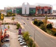
Manchester Old Trafford
TheHeart Serviced Apartments
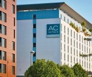
AC Hotel Manchester Salford Quays
Hilton Garden Inn Manchester
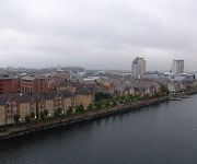
Quay Apartments
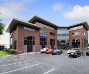
Copthorne Manchester
TRAVELODGE MANCHESTER SALE
Ivy Mount Guest House
Normanhurst
Trafford Hall
Videos from this area
These are videos related to the place based on their proximity to this place.
Trent, Mersey & Bridgewater Canals to Stretford (time lapse)
Red sky at night; Sailors Delight, Red sky at morning; Sailors Warning, Or so the ancient weather --lore rhyme goes. On the BBC Radio 5 Live 6:30 am weather forecast, John Kettley informed...
Drain unblocking stretford Blocked drains stretford
http://stockportdrains.co.uk/ Unblocking a drain in stretford manchester customers toilets were blocked in property due to blockage in drain outside,we jetted and rodded the drain to clear...
Burst Water Main - Stretford Manchester
Igonre the title secquence for got to change it So I get a call to come into work this morning, apparently a water mains blown next to where I work and there worried it might flood the place...
Dismantling cuts on birch tree in Stretford, Manchester
An example of the correct chainsaw cuts made when dismantling a tree with a confined drop zone.
City Sprint A13 RCE and ML57 GFX Dangerous Close Pass
Another pair of pointless close passers on a dual carriageway. ML57 GFX does it first, and then A13 RCE follows shortly after. I throw my arm out to tell following traffic that I am not happy...
Human Appeal - A journey of 15 years - part 2
the 15 years journey for Human Appeal International, all the jobs been done by Human appeal since 1991.
Circuit Bent Talking Jimmy Hill by freeform delusion
Circuit Bent & rehoused Talking Jimmy Hill Nice bit of turf with Coventry City #Subbuteo player and Subbuteo Italia 90 Football to control the Pitch of Jimmy Hills talking. Decorated with...
Metrolink Salford Quays
Films Manchester Metrolink in Salford Quays. Opening scene is on the X57 bus going down Gillbent Road in Cheadle Hulme. The rest are basically views taken through the front of the train from...
Stormkings - The Steamhouse, Sale, Manchester, 14/03/15
First two songs from 14th March gig at The Steamhouse, Sale, Manchester UK. 747 by Saxon and Detroit Rock City by KISS. StormKings are a covers band working in the NW or England.
Videos provided by Youtube are under the copyright of their owners.
Attractions and noteworthy things
Distances are based on the centre of the city/town and sightseeing location. This list contains brief abstracts about monuments, holiday activities, national parcs, museums, organisations and more from the area as well as interesting facts about the region itself. Where available, you'll find the corresponding homepage. Otherwise the related wikipedia article.
Trafford
Trafford is a metropolitan borough of Greater Manchester, England. With an estimated population of about 211,800 in 2006, it covers 41 square miles and includes the towns of Altrincham, Partington, Sale, Stretford, and Urmston. The borough was formed on 1 April 1974 by the Local Government Act 1972 as a merger of the municipal boroughs of Altrincham, Sale, and Stretford, the urban districts of Bowdon, Hale, and Urmston and part of Bucklow Rural District.
Stretford
Stretford (pop. 37,500) is a town within the Metropolitan Borough of Trafford, in Greater Manchester, England. Lying on flat ground between the River Mersey and the Manchester Ship Canal, it is 3.8 miles to the southwest of Manchester city centre, 3.0 miles south-southwest of Salford and 4.2 miles northeast of Altrincham. Stretford is contiguous with the suburb of Chorlton-cum-Hardy to the east, and the towns of Urmston to the west, Salford to the north, and Sale to the south.
Stretford and Urmston (UK Parliament constituency)
Stretford and Urmston is a constituency represented in the House of Commons of the UK Parliament since 2010 by Kate Green, a member of the Labour Party.
Sale Water Park
Sale Water Park is a 152-acre area of countryside and parkland including a 52-acre artificial lake in the Metropolitan Borough of Trafford in Greater Manchester, England. Opened in 1979 and owned by Trafford council, the water park lies in an area of the green belt running through the Mersey river valley between Sale and Stretford, located between the river and the M60 motorway.
Municipal Borough of Stretford
Stretford was, from 1868 to 1974, a local government district coterminate with the town of Stretford in the then county of Lancashire, England.
Trafford Park Aerodrome (Manchester)
Trafford Park Aerodrome (Manchester) was the first purpose-built airfield in the Manchester area. Its large all-grass landing field was just south of the Manchester Ship Canal between Trafford Park Road, Moseley Road and Ashburton Road and occupied a large part of the former deer park of Trafford Hall. Today's Tenax Road runs north-south through the centre of the site of the old airfield, which was 0.7 miles northeast of today's Trafford Centre.
St. Antony's Catholic College
St. Antony's Catholic College is a comprehensive school situated in Urmston, Greater Manchester, England. The GCSE results have varied from excellent to average since it opened in 1992. The school was formed in 1992 from the merger of three Catholic Secondary Schools; St Mary's, Stretford which was opened in 1952, Cardinal Vaughan, Stretford which was opened in 1964 and St Paul's, Urmston. St Anthonys was established in the modernised buildings of St Pauls. St.
St Ann's, Stretford
St Ann's, Church, Stretford is a Grade II listed Roman Catholic church in Stretford, Greater Manchester, England, and is located on East side of Chester Road A56. The church was constructed between 1862 and 1863. The parish functions under the jurisdiction of the Roman Catholic Diocese of Salford.


