Safety Score: 3,0 of 5.0 based on data from 9 authorites. Meaning we advice caution when travelling to United Kingdom.
Travel warnings are updated daily. Source: Travel Warning United Kingdom. Last Update: 2024-08-13 08:21:03
Touring Draycot Foliat
Draycot Foliat in Swindon (England) is a town located in United Kingdom about 69 mi (or 112 km) west of London, the country's capital place.
Time in Draycot Foliat is now 04:48 AM (Thursday). The local timezone is named Europe / London with an UTC offset of zero hours. We know of 8 airports nearby Draycot Foliat, of which 5 are larger airports. The closest airport in United Kingdom is RAF Lyneham in a distance of 11 mi (or 18 km), West. Besides the airports, there are other travel options available (check left side).
There are several Unesco world heritage sites nearby. The closest heritage site in United Kingdom is City of Bath in a distance of 9 mi (or 15 km), South-East. Also, if you like the game of golf, there are several options within driving distance. Need some hints on where to stay? We compiled a list of available hotels close to the map centre further down the page.
Being here already, you might want to pay a visit to some of the following locations: Chiseldon, Wanborough, Swindon, Marlborough and Mildenhall. To further explore this place, just scroll down and browse the available info.
Local weather forecast
Todays Local Weather Conditions & Forecast: 10°C / 51 °F
| Morning Temperature | 9°C / 48 °F |
| Evening Temperature | 7°C / 45 °F |
| Night Temperature | 6°C / 42 °F |
| Chance of rainfall | 0% |
| Air Humidity | 78% |
| Air Pressure | 1033 hPa |
| Wind Speed | Gentle Breeze with 7 km/h (4 mph) from South-West |
| Cloud Conditions | Scattered clouds, covering 27% of sky |
| General Conditions | Scattered clouds |
Friday, 15th of November 2024
9°C (48 °F)
7°C (45 °F)
Scattered clouds, light breeze.
Saturday, 16th of November 2024
10°C (50 °F)
8°C (47 °F)
Overcast clouds, gentle breeze.
Sunday, 17th of November 2024
7°C (45 °F)
4°C (39 °F)
Moderate rain, fresh breeze, overcast clouds.
Hotels and Places to Stay
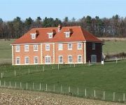
Poulton Grange - B&B
Alexandra House
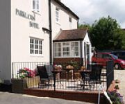
Parklands Hotel & Bentley's Chop House
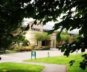
Swindon Marriott Hotel
The Sun Inn
Holiday Inn SWINDON
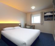
TRAVELODGE SWINDON CENTRAL
Jurys Inn Swindon
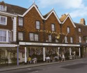
Castle and Ball
Holiday Inn Express SWINDON CITY CENTRE
Videos from this area
These are videos related to the place based on their proximity to this place.
Chiseldon Jammers 1
A Jam Session which is held at The Sun Inn Coate Water Swindon Wiltshire Every Thursday Night.
2010-04-20 Liddington Paragliding
Nice evening Paragliding at Liddington Castle on my Team 5 GREEN wing.
Steam traction engine rally - Lotmead Farm, Wiltshire, England
Lotmead Farm's Strawberries and Steam Rally on 27th June, 2009. 'Strawberries, because Lotmead also do pick-your-own strawberiies and other fruits and vegetables. Lotmead is a family owned...
Suburban walk past Dorcan Academy, Swindon
Starting alongside Dorcan Way near the Morrisons supermarket we walk north on a bright December day past Dorcan Academy before turning east towards Eldene.
Tim Skydiving @ Redlands Airfield in Swindon, UK - SkyDiveLondon
This was a tandem jump from 10000 feet (my first ever). My instructor was "Dunny" and the fantastic videography was done by "Buncey." These guys made this a fun experience from start to...
Ogbourne St. Andrew - Ermin Street to Wet Pits Lane (Byway, E-W)
NGR Start: SU207726 NGR Finish: SU203724 Byway Number: OSTA17 Date: 09.09.12 Condition: Deeply rutted and overgrown dirt track. Notes: Popular with walkers and horse riders.
Riding the Byway from Chiseldon to Barbury Castle in wiltshire on Honda some Honda CRF250L 's
Out riding the byways around Wiltshire again on our CRF250L's. It had been raining a lot the night before so its nice and slippery out here today.
Chiseldon House Hotel Wedding Photography.wmv
Chiseldon House Hotel wedding photography, Swindon, Wiltshire, by Karl Burry Photography.
Videos provided by Youtube are under the copyright of their owners.
Attractions and noteworthy things
Distances are based on the centre of the city/town and sightseeing location. This list contains brief abstracts about monuments, holiday activities, national parcs, museums, organisations and more from the area as well as interesting facts about the region itself. Where available, you'll find the corresponding homepage. Otherwise the related wikipedia article.
Liddington Castle
Liddington Castle, locally called Liddington Camp, is a late Bronze Age and early Iron Age hill fort in the English county of Wiltshire. It is sited on a commanding high points close to The Ridgeway and covers an area of 3ha. Liddington Castle was one of the earliest hill forts in Britain, with first occupation dating to the seventh century BC.
Coate Water Country Park
Coate Water is a country park situated 5 km to the southeast of central Swindon, near Junction 15 of the M4. It takes its name from the main feature, a reservoir originally built to provide water for the Wilts and Berks Canal. Coate is the site of a 70-acre lake, built in 1822 and formed by diverting the River Cole. Its primary purpose was to provide water for the Canals and it remained outside the borough until expansion in 1928. In 1914, with the canal abandoned, Coate became a Pleasure Park.
Burderop Wood
Burderop Wood is a 48.5 hectare biological Site of Special Scientific Interest in Wiltshire, notified in 1971. The site contains wet Ash-maple and acid Pedunculate oak-Hazel-Ash woodland, and its notification as an SSSI is due to this, and in particular the richness of the associated ground flora. Ash is the most widespread tree in the wood, but a large number of mature oaks also occur.
Draycot Foliat
Draycot Foliat is an hamlet in Wiltshire, England, on the back road between Chiseldon to the north and Ogbourne St. George to the south. The nearest major town is Swindon which is about 5 miles north. The most notable feature is probably the small Airstrip with its model helicopter instruction centre. There is one smallholding, called Draycot Farm, and a larger farm, Sheppard's Farm which comprises some 750 acres (300 hectares).
Liddington
Liddington is a village near Swindon in Wiltshire, England. The settlement lies south east of Swindon town, close to the M4 motorway, junction 15 which is approximately 1.5 kilometres away via the B4192 - known as Purley Road, where it passes through Liddington village. The parish, as a whole, has been an area of settlement since the earliest times.
Chiseldon railway station
Chiseldon railway station was on the Midland and South Western Junction Railway in Wiltshire.
Hodson, Wiltshire
Hodson is an unspoilt hamlet in a small valley, just south of Swindon, Wiltshire, England and the M4 Motorway, and near a junction with the Chiseldon to Wroughton main road. It has a popular traditional English public house called the Calley Arms.


