Safety Score: 3,0 of 5.0 based on data from 9 authorites. Meaning we advice caution when travelling to United Kingdom.
Travel warnings are updated daily. Source: Travel Warning United Kingdom. Last Update: 2024-08-13 08:21:03
Delve into Givons Grove
The district Givons Grove of in Surrey (England) is a district located in United Kingdom about 18 mi south-west of London, the country's capital town.
In need of a room? We compiled a list of available hotels close to the map centre further down the page.
Since you are here already, you might want to pay a visit to some of the following locations: Mickleham, Headley, Newdigate, Kingston and Ockley. To further explore this place, just scroll down and browse the available info.
Local weather forecast
Todays Local Weather Conditions & Forecast: 9°C / 48 °F
| Morning Temperature | 5°C / 41 °F |
| Evening Temperature | 9°C / 48 °F |
| Night Temperature | 9°C / 48 °F |
| Chance of rainfall | 0% |
| Air Humidity | 76% |
| Air Pressure | 1020 hPa |
| Wind Speed | Light breeze with 5 km/h (3 mph) from South-East |
| Cloud Conditions | Overcast clouds, covering 96% of sky |
| General Conditions | Overcast clouds |
Sunday, 17th of November 2024
8°C (46 °F)
4°C (39 °F)
Broken clouds, gentle breeze.
Monday, 18th of November 2024
10°C (51 °F)
12°C (53 °F)
Moderate rain, fresh breeze, overcast clouds.
Tuesday, 19th of November 2024
4°C (40 °F)
2°C (36 °F)
Light rain, moderate breeze, broken clouds.
Hotels and Places to Stay
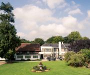
Mercure Box Hill Burford Bridge Hotel
Woodlands Park
De Vere Wotton Estate PH Hotels
Mercure Dorking White Horse Hotel
Hartsfield Manor
Holiday Inn Express LONDON - EPSOM DOWNS
Foley
Rosemead Guest House
Epsom North
TRAVELODGE LEATHERHEAD
Videos from this area
These are videos related to the place based on their proximity to this place.
Food Preservation - Leatherhead Food Research
Leatherhead Food Research employs a multi-disciplinary, concept-to-market approach (Regulatory/Process Optimisation/Sensory) to investigate the microbiological safety of raw and processed foods,...
Concept to Consumer - Leatherhead Food Research
Leatherhead Food Research is an integral partner to the food and drinks industry, helping to develop products from the initial concept stage to final launch to consumers. Our client wants a...
LeatherHead Start - Improving the lives of homeless people
Share the experiences of four homeless people and learn about how LeatherHead Start offered them hope and a place to start again.
Kris Mikkelson introducing Vision Sunday in Hillsong Surrey, Leatherhead.
Out last service in Leatherhead surrey was a special service. Next week we are in G-Live Guildford for a 10:30 and 15:00 service. See you there. Kris Mikkelson was on form as usual.
Olympic Games London 2012: Men's Cycle Race Through Leatherhead (Surrey)
Olympic Games London 2012: Men's Cycle Race Through Leatherhead (Surrey) Watch as the riders race through Leret Way in Leatherhead.
Olympic Men's Road Race: Box Hill & Leatherhead
London 2012: Olympic Men's Road Race The race completes 9 laps of the Box Hill circuit before heading north through Leatherhead to finish on The Mall.
[HD] Olympic Mens Cycling B2450 Dorking Rd Leatherhead Surrey July 28th 2012 Crowd Marshalls Police
No cyclists just the Police milking the crowd mainly.
Lads in Leatherhead
At the Penny Black pub in Leatherhead, Russell introduces his two drunk friends Darran Brown and Mick Sellors.
Videos provided by Youtube are under the copyright of their owners.
Attractions and noteworthy things
Distances are based on the centre of the city/town and sightseeing location. This list contains brief abstracts about monuments, holiday activities, national parcs, museums, organisations and more from the area as well as interesting facts about the region itself. Where available, you'll find the corresponding homepage. Otherwise the related wikipedia article.
Denbies Wine Estate
Denbies Wine Estate near Dorking, Surrey has the largest vineyard in England with 265 acres under vines, representing over 10% of the plantings in the whole of the United Kingdom. It has a visitors' centre which attracts around 300,000 visitors a year. The estate is named for an early owner called John Denby. Originally Denbies was a farmhouse. In the mid 18th century it was rebuilt as a gentleman's residence by Jonathan Tyers, proprietor of Vauxhall Gardens near London.
Mole Valley (UK Parliament constituency)
Mole Valley is a constituency represented in the House of Commons of the UK Parliament since 1997 by Sir Paul Beresford, a Conservative.
St John's School, Leatherhead
St. John's School, Leatherhead is a boarding and day independent school in the town of Leatherhead, in the Mole Valley district of Surrey, in Southern England. It has about 430 male pupils and 140 female pupils. In 2010 it became fully co-educational. Originally formed for the sons of the Clergy in the 1850s, it has relocated from St. John's Wood, London to its current residence in Leatherhead.
Epsom Rural District
Epsom was a rural district of Surrey from 1894 to 1933. It was created in 1894 and covered the area of the formed Epsom Rural Sanitary District - i.e. the parishes of Ashtead, Banstead, Cheam, Chessington, Cobham, Cuddington, Ewell, Fetcham, Great Bookham, Headley, Little Bookham and Stoke d'Abernon. The parish of Woodmansterne was added from the disbanded Croydon Rural District in 1915, whilst Cheam became part of the Sutton and Cheam urban district in 1918.
Mole Valley SCR F.C
Mole Valley Sutton Common Road F.C. is a football club currently based in Cobham, Surrey, England. The club competes in the Combined Counties League Division One. The club was originally based in Carshalton but in 2009 moved to Cobham, currently groundsharing with Cobham Football Club.
The Rye (brook)
The Rye is a stream rising east of Ashtead and flowing into the River Mole near Leatherhead, Surrey. The Rye Brook flows westwards across Ashtead Common, through the Ashtead Common National Nature Reserve, managed by the City of London Corporation. For much of its course the brook follows a straight channelled course which was dug during the Second World War in order to drain the surrounding land so that it could be used for agriculture.
Ashtead Common
Ashtead Common (c. 200 ha) is a wooded area to the north of the village of Ashtead in England which is open to the public. It is owned and managed by the City of London Corporation at no cost to the public. There are 180.5 ha of this common in the National Nature Reserve. It forms part of a larger area of open countryside called Epsom and Ashtead Commons which is classed as a Site of Special Scientific Interest.
Bocketts Farm
Bocketts Farm in Leatherhead, Surrey, England is a working family farm set in the countryside on the slopes of the North Downs. Animals on the farm include lambs, piglets, goat kids, chicks and ducklings born throughout the year. In addition there are play areas for children of all ages. Inside there are 2 huge playbarns with a 70 ft 4-lane astroslide, trampolines and rides on tractors. Outside there are adventure trails, a giant slide tower and a jumping pillow.
The Running Horse
The Running Horse is a pub in the town of Leatherhead, Surrey, England. Dating back to 1403, on the bank of the River Mole, the Running Horse is one of the oldest buildings in Leatherhead and offers good food and good drink in an historic setting. Located just down the hill from the central shopping areas in Leatherhead, the pub is a popular location for lunch and early evening drinks.
Ashtead railway station
Ashtead railway station is in Surrey, England.
Box Hill & Westhumble railway station
Box Hill & Westhumble railway station is a railway station in the village of Westhumble in Surrey, England, approximately two miles north of Dorking town centre. Box Hill is located approximately half a mile to the east. The station is served by one train every hour towards London Victoria and one train every hour towards Horsham off peak, operated by Southern. More trains operate on Sundays and Public Holidays in each direction.
Cherkley Court
Cherkley Court, near Leatherhead, Surrey, in England, is a late Victorian mansion and estate of 370 acres, once the home of Lord Beaverbrook.
Dorking railway station
Dorking railway station is one of three railway stations that serve the town of Dorking in Surrey, England. The station is within walking distance of Dorking Deepdene station and interchange on a through ticket is permitted. Dorking West and Dorking (Deepdene) are located on the North Downs Line. There are 2 trains per hour (tph) towards London Waterloo, 2tph towards London Victoria and an hourly service to Horsham (Monday to Saturday off-peak).
Downsend School
Downsend School is a private school located in Ashtead, Leatherhead and Epsom, Surrey, UK. Founded in 1891 as a non-denominational preparatory school for boys since 1927 aged 8 to 13, it is now a school for boys and girls, and takes on pupils from 6 to 13 years of age. Unusually the school does not have charitable status, being run as a profitable business by Cognita Limited.
Box Hill School
Box Hill School is an independent coeducational boarding and day school situated in the village of Mickleham near Dorking, Surrey, England. The school has approximately 425 pupils aged 11–18. The school has a 60% day student:40% boarding student ratio, and as part of an international network (Round Square), around 25% of the students come from over 25 nations. The international environment of the school is deliberate, as part of the school's mission to develop students for life beyond school.
Dorking (UK Parliament constituency)
Dorking was a parliamentary constituency centred on the town of Dorking in Surrey. It returned one Member of Parliament to the House of Commons of the Parliament of the United Kingdom from the 1950 general election until it was abolished for the 1983 general election and replaced by the Mole Valley seat.
Dorking West railway station
Dorking West railway station serves the town of Dorking in Surrey, England. It is the quietest of the three stations in the town, the others being Dorking and Dorking Deepdene. It is situated on the North Downs Line. With 22 passenger entries and exits between April 2010 and March 2011, Dorking West is the second-least used station in Great Britain.
Church of St. Mary, Fetcham
St. Mary's Church, Fetcham, Surrey, England is a Church of England parish church that has been in existence for over 1000 years and is Fetcham's oldest building. It is located in The Ridgeway in Fetcham. Built during Anglo-Saxon and early Norman periods, it is probably on the site of an even earlier timber church. There are many hints of its past in its structure.
Parsons Mead School
Parsons Mead School was a private girls school founded by Jessie Elliston in Ashtead, Surrey, England.
Norbury Park
Norbury Park is a swathe of land arranged around a small manor house near Leatherhead and Dorking, Surrey, which appears in the Domesday Book of 1086. The manor was also known as Northbury for some time. A small Bronze Age hoard consisting of two palstave axes and a scabbard chape dating from around 1150-1000 BC was discovered in 2003 in woodland on the western side of the park. The park also contain an important grove of yew trees used by Druids for rituals and ceremony.
Juniper Hall
This article is about the house in North Downs, Surrey. For the house in the Sydney suburb of Paddington see Juniper Hall, Paddington Juniper Hall Field Centre, leased from the National Trust, is an 18th-century country house in a quiet wooded valley within the chalk North Downs in Surrey. It is about 1 kilometre from Box Hill and only 40 kilometres from central London.
Mole Gap to Reigate Escarpment
Mole Gap to Reigate Escarpment is a Site of Special Scientific Interest in Surrey, England. It is owned and managed by the National Trust. The site includes part of the North Downs which has remained relatively undisturbed by the pressures of modern farming and building. It stretches for 8 miles (12km) between Leatherhead and Reigate. It includes Box Hill and Headley Heath.
Fetcham Park House
Fetcham Park House is a Grade II listed, Queen Anne mansion designed by the English architect William Talman with internal murals by the renowned artist Louis Laguerre and grounds originally landscaped by Capability Brown. It is located in the parish of Fetcham in Surrey. Construction of the present mansion began in 1699 although a reference in the Domesday survey suggests that there was already then a house at Fetcham Park. It is a Grade II* listed building, the second highest ranking.
Dorking Cricket Club Ground
Dorking Cricket Club Ground is a cricket ground in Dorking, Surrey. The first recorded match on the ground was in 1993, when the ground hosted a single Women's One Day International in the 1993 Women's Cricket World Cup between Ireland women and West Indies women. In local domestic cricket, the ground is the home venue of Dorking Cricket Club.
Mole Gap Trail
The Mole Gap Trail is a 10-kilometre official walking route alongside the River Mole, linking the Surrey towns of Dorking and Leatherhead. The trail is marked on Ordnance Survey maps. The trail runs through Norbury Park, the village of Westhumble and across Denbies Wine Estate.


!['[HD] Olympic Mens Cycling B2450 Dorking Rd Leatherhead Surrey July 28th 2012 Crowd Marshalls Police' preview picture of video '[HD] Olympic Mens Cycling B2450 Dorking Rd Leatherhead Surrey July 28th 2012 Crowd Marshalls Police'](https://img.youtube.com/vi/DBdlZD7Ewts/mqdefault.jpg)


