Safety Score: 3,0 of 5.0 based on data from 9 authorites. Meaning we advice caution when travelling to United Kingdom.
Travel warnings are updated daily. Source: Travel Warning United Kingdom. Last Update: 2024-08-13 08:21:03
Delve into Dunsfold
Dunsfold in Surrey (England) with it's 317 habitants is located in United Kingdom about 33 mi (or 53 km) south-west of London, the country's capital town.
Current time in Dunsfold is now 06:29 PM (Friday). The local timezone is named Europe / London with an UTC offset of zero hours. We know of 11 airports close to Dunsfold, of which 5 are larger airports. The closest airport in United Kingdom is Farnborough Airport in a distance of 14 mi (or 23 km), North-West. Besides the airports, there are other travel options available (check left side).
There are several Unesco world heritage sites nearby. The closest heritage site in United Kingdom is Stonehenge, Avebury and Associated Sites in a distance of 17 mi (or 28 km), East. Also, if you like playing golf, there are some options within driving distance. We encountered 3 points of interest near this location. If you need a hotel, we compiled a list of available hotels close to the map centre further down the page.
While being here, you might want to pay a visit to some of the following locations: Godalming, Shalford, Seale, Pirbright and Ockley. To further explore this place, just scroll down and browse the available info.
Local weather forecast
Todays Local Weather Conditions & Forecast: 9°C / 49 °F
| Morning Temperature | 4°C / 39 °F |
| Evening Temperature | 7°C / 44 °F |
| Night Temperature | 5°C / 41 °F |
| Chance of rainfall | 0% |
| Air Humidity | 79% |
| Air Pressure | 1027 hPa |
| Wind Speed | Light breeze with 3 km/h (2 mph) from North-East |
| Cloud Conditions | Overcast clouds, covering 86% of sky |
| General Conditions | Overcast clouds |
Saturday, 16th of November 2024
9°C (49 °F)
9°C (48 °F)
Overcast clouds, light breeze.
Sunday, 17th of November 2024
8°C (46 °F)
2°C (36 °F)
Light rain, gentle breeze, overcast clouds.
Monday, 18th of November 2024
11°C (51 °F)
12°C (53 °F)
Moderate rain, fresh breeze, overcast clouds.
Hotels and Places to Stay
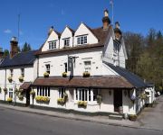
Kings Arms & Royal Relaxinnz
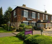
Barnett Hill
The Stag On The River
The Drummond at Albury
Godalming
Videos from this area
These are videos related to the place based on their proximity to this place.
Vulcan Bomber Low Flight Path Loud RAF
The last working Vulcan bomber in low flight, great close up of the plane.
McLaren MP4-12C Sideways / McLaren MP4-12C Drifting
McLaren MP4-12C drifting at the Top Gear Test Track, Dunsfold.
Hesketh V1000 Motorcycle
Hesketh V1000 Motorcycle at Wings and Wheels 2014 at Dunsfold filmed with a GoPro Hero 3 Black in 1080p 30fps Raw white balance http://www.heskethmotorcycles.co.uk/ ...
McLaren MP4-12C Model Year 2012 At Top Gear Test Track
B-roll footage of the McLaren MP4-12C Model Year 2012 at the Top Gear Test Track, Dunsfold.
First Drive : McLaren MP4-12C (Option Auto)
McLaren MP4-12C - V8 Biturbo 3.8 de 600 ch / 61.5 mkg - boîte SSG Pre-Cog à double embrayage et 7 rapports - 0 à 100 km/h en 3.1 s - 0 à 200 km/h en 9.1 s / Vmax : 330 km/h - Poids à vide...
Wings and Wheels August 2009
Highlights from the 2009 wings & wheels held at Dunsfold, Surrey on 30 August 2009. Proceeds from this years show sponsored by "Spitfire" real Ale went to Help for Heros, Surrey & Sussex Air...
Lancaster Bomber / Hurricane / Spitfire - Dunsfold Aerodrome Wings and Wheels August 2012 1080p HD
Flyover of the Battle of Britain Memorial Flight (Lancaster/Hurricane/Spitfire) at the Wings and Wheels, Dunsfold Aerodrome (Top Gear test track), Surrey. 26th August 2012 The Avro Lancaster...
D-Day 70th Anniversary Flypast - Dunsfold Wings & Wheels 2014
Dunsfold Wings & Wheels 2014. North American P51 Mustang 'Ferocious Frankie', Supermarine Spitfire MH434, North American B-25 Mitchell 'Sarinah' and Aces High's Douglas DC3 Dakota L4, ...
Military Vehicle Parade at Wings and Wheels, Dunsfold Aerodrome, Surrey 1080p HD (8 min)
Filmed at Wings and Wheels, Dunsfold Aerodrome (Top Gear test track), Surrey. Military Vehicles (as listed on the Wings and Wheels website): Land Rover Series III - Bomb Disposal Hotchkiss/Willys...
'Fighter Sweep' - Spitfire & Mustang - Dunsfold Wings & Wheels 2014
The Old Flying Machine Company's Supermarine Spitfire, MH434, and North American P-51 Mustang, 'Ferocious Frankie', being gracefully put through their paces together at Dunsfold Wings & Wheels ...
Videos provided by Youtube are under the copyright of their owners.
Attractions and noteworthy things
Distances are based on the centre of the city/town and sightseeing location. This list contains brief abstracts about monuments, holiday activities, national parcs, museums, organisations and more from the area as well as interesting facts about the region itself. Where available, you'll find the corresponding homepage. Otherwise the related wikipedia article.
Wey and Arun Canal
The Wey and Arun Canal is a 23-mile-long (37 km) canal in the south of England, between the River Wey at Shalford, Surrey and the River Arun at Pallingham, in West Sussex. The canal comprises parts of two separate undertakings – the northern part of the Arun Navigation, between Pallingham and Newbridge Wharf, which opened in 1787, and the Wey and Arun Junction Canal, which connected the Arun at Newbridge to the Godalming Navigation near Shalford, south of Guildford, opened in 1816.
Hydon's Ball
Hydon's Ball is a 587-foot hill on Hydon Heath, Surrey, England. It is situated roughly 6 km southeast of Godalming, in central southern England. It is adjacent to the hamlet of Hydestile, near the village of Hambledon. Sometimes known as Hydon Ball, or Cup Hill, it is now in the care of the National Trust. At its highest point is a large stone seat which was placed there in 1915 as a memorial to Octavia Hill, one of the Trust's founders.
London to Portsmouth canal
The London to Portsmouth canal was a proposal for the construction of a secure inland canal route from the capital London to the headquarters of the Royal Navy at Portsmouth. It would have allowed craft to move between the two without having to venture into the English Channel and possibly encounter enemy ships. There is no naturally navigable route between the two cities, resulting in several schemes.
Top Gear test track
The Top Gear test track is used by the BBC automotive television programme Top Gear. It is located at Dunsfold Aerodrome in Surrey, United Kingdom. The track was designed by Lotus Cars as a testing facility for the Colin Chapman run company, with many of its Formula One cars tested there. It is used to test both cars and drivers seen on the programme, mainly in Power Laps and Star in a Reasonably Priced Car.
Dunsfold Aerodrome
Dunsfold Aerodrome in Surrey, England, near the village of Cranleigh, was built by the Canadian Army and civilian contractors as a Class A Bomber Airfield for Army Co-operation Command. It was commanded by the Royal Canadian Air Force from 1942–1944 and was known as Royal Canadian Air Force Station Dunsfold.
Hascombe Hill
Hascombe Hill is the site of an Iron Age hillfort close to the village of Hascombe in Surrey, England. The site was excavated in 1931 by S. E. Winbolt, who dated the occupation of the site to the 1st century BC. The hillfort encloses a thickly wooded area of approximately 2.4 hectares . The sides of the fort, which are naturally very steep, were scarped at the top to make them almost unassailable. Encircling the crest of the hill is a defensive ditch 1.5 metres deep.
Hascombe Court
Hascombe Court is a 172-acre estate in Godalming, Surrey, best known for its vast garden designed by Gertrude Jekyll.
List of United Kingdom locations: Upper I-Upper W


