Safety Score: 3,0 of 5.0 based on data from 9 authorites. Meaning we advice caution when travelling to United Kingdom.
Travel warnings are updated daily. Source: Travel Warning United Kingdom. Last Update: 2024-08-13 08:21:03
Delve into Castle End
The district Castle End of in Surrey (England) is a district located in United Kingdom about 84 mi north-west of London, the country's capital town.
In need of a room? We compiled a list of available hotels close to the map centre further down the page.
Since you are here already, you might want to pay a visit to some of the following locations: Warwick, Coventry, Berkswell, Keresley and Meriden. To further explore this place, just scroll down and browse the available info.
Local weather forecast
Todays Local Weather Conditions & Forecast: 3°C / 37 °F
| Morning Temperature | 0°C / 33 °F |
| Evening Temperature | 2°C / 35 °F |
| Night Temperature | 1°C / 34 °F |
| Chance of rainfall | 0% |
| Air Humidity | 70% |
| Air Pressure | 1001 hPa |
| Wind Speed | Gentle Breeze with 9 km/h (5 mph) from East |
| Cloud Conditions | Broken clouds, covering 80% of sky |
| General Conditions | Light rain |
Friday, 22nd of November 2024
4°C (39 °F)
1°C (34 °F)
Rain and snow, moderate breeze, broken clouds.
Saturday, 23rd of November 2024
8°C (47 °F)
14°C (57 °F)
Moderate rain, strong breeze, overcast clouds.
Sunday, 24th of November 2024
15°C (58 °F)
10°C (50 °F)
Light rain, strong breeze, overcast clouds.
Hotels and Places to Stay
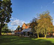
CHESFORD GRANGE HOTEL-QHOTELS
Woodside A Sundial Venue
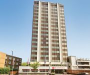
Ramada Hotel and Suites Coventry The Butts Earlsdon
Hilton Warwick - Stratford-upon-Avon
Holiday Inn KENILWORTH - WARWICK
Milsoms Hotel
Holiday Inn Express WARWICK - STRATFORD-UPON-AVON
DAYS HOTEL COVENTRY
The Oak
Honiley Court Hotel & Conference Centre
Videos from this area
These are videos related to the place based on their proximity to this place.
Coventry RC Boxing Day 2011 Cyclo Cross Seniors and Vets
Seniors race, Coventry Road Club, Boxing Day 2011 Cyclo Cross. Kenilworth. See post race interviews here: http://www.youtube.com/watch?v=AI5G4KeKFYg First ten were: 1 Dan Booth Cult Racing...
2014.12.26 Boxing Day Kenilworth Common Cyclocross, England 02
Irene and Dave Hurr watch the Boxing Day Kenilworth Common Cyclocross, England.
Sarah-Jane Perry and Steve Townsend at Kenilworth Squash Club 6 March 2015.
There was a party for Sarah-Jane Perry at Kenilworth Squash Club on 6 March 2015 to celebrate her recent successes in winning the British National Squash Championships and the World Team ...
Lower Back Strengthening Exercises in Kenilworth Warwickshire
http://www.sooniuschiropractic.co.uk/index.php/conditions_treatments/1 LOW BACK STRENGTHENING EXERCISES Soonius Chiropractic is very happy to team up with top personal trainer and Iron ...
Bad Cyclo Cross Crash - Boxing Day 2011 - Coventry RC Kenilworth
A bad crash on the final straight of the 2011 Boxing Day Cyclo Cross, Coventry RC, Kenilworth. See the whole race here: http://www.youtube.com/watch?v=0nO099Rv79k.
2014.12.07 Christmas Tree Festival St Nicholas Kenilworth England 02
Dave reviews the entries for the Christmas Tree Festival St Nicholas Kenilworth England.
2012.11.25 Flooded road at the ford near Kenilworth Castle UK.mp4
Flooded road at the ford near Kenilworth Castle, UK.
Castle Farm Skate Park welcomes the Lights - Kenilworth, Warwickshire
Lights are now fitted and can be available until 9.30pm.
Royal Fusiliers parade in Kenilworth April 21st 2010
The Second Battalion of the Royal Fusiliers parade through Kenilworth on April 21st 2010 to be welcomed by Mayor Richard Davies and the people of Kenilworth on their return from a six month...
Kenilworth Dentist
http://penningtondental.co.uk 4 locations serving Kenilworth, Coventry, Southam and Stratford. Our services include general family dentistry as well as cosmetic dentistry and dental implants....
Videos provided by Youtube are under the copyright of their owners.
Attractions and noteworthy things
Distances are based on the centre of the city/town and sightseeing location. This list contains brief abstracts about monuments, holiday activities, national parcs, museums, organisations and more from the area as well as interesting facts about the region itself. Where available, you'll find the corresponding homepage. Otherwise the related wikipedia article.
University of Warwick
The University of Warwick (informally known as Warwick University or Warwick) is a public research university located in Coventry, United Kingdom. It was founded in 1965 as part of a government initiative to expand access to higher education. Warwick Medical School was opened in 2000. Warwick is primarily located on a 290 hectare cutting-edge campus on the outskirts of Coventry, with an additional site in Wellesbourne.
Warwickshire
Warwickshire is a landlocked non-metropolitan county in the West Midlands region of England. The county town is Warwick, although the largest town is Nuneaton. The county is famous for being the birthplace of William Shakespeare and George Eliot. Commonly used abbreviations for the county are Warks or Warwicks. The county is divided into five districts of North Warwickshire, Nuneaton & Bedworth, Rugby, Warwick and Stratford-on-Avon.
Leek Wootton
Leek Wootton is a village in Warwickshire, England, roughly one mile from Kenilworth and two miles from Warwick. It lies in the triangle created by Kenilworth, Warwick and Leamington Spa.
Warwick Arts Centre
Warwick Arts Centre is a multi-venue arts complex at the University of Warwick in Coventry, England. It attracts around 300,000 visitors a year to over 3,000 individual events embracing contemporary and classical music, drama, dance, comedy, films and visual art. The Warwick Art Centre is the largest Art Centre in the Midlands, and the largest venue of its kind in the UK outside the Barbican Centre in London.
Warwick Business School
Warwick Business School (WBS) is an academic department of the University of Warwick, that was originally established in 1967 as the School of Industrial and Business Studies. It is is one of the most prestigious and highly selective business schools worldwide. The school offers undergraduate, postgraduate and PhD degree programmes, as well as non-degree executive education for individuals and companies.
Warwick Rural District
Warwick Rural District was a rural district of Warwickshire, England. It was created in 1894, and covered an area around, but not including, Warwick. It expanded in 1932 with the abolition of Foleshill Rural District and Solihull Rural District. The district was abolished in 1974 under the Local Government Act 1972, merging with Warwick, Leamington Spa, and Kenilworth to form the modern non-metropolitan district of Warwick.
Blackdown, Warwickshire
Blackdown is a village and civil parish in the Warwick district of Warwickshire, England. According to the 2001 census it had a population of 128. The village is about two miles north of Leamington Spa, between Leamington/Warwick and Kenilworth. Just outside the village is Quarry Park Disc Golf Club which is one of only 17 courses in the UK, and was the venue for the 2008 UK championships as well as being due to host the 2009 championships.
Old Milverton
Old Milverton is a hamlet in Warwickshire situated in a bend of the River Avon just north of Leamington Spa. It lies at an altitude of 60-65 metres above sea level. The Anglican parish church of St. James includes a stained-glass window honouring Henry Jephson, who promoted the therapeutic benefits of Leamington Spa water and was instrumental in that town's initial success. Access to the hamlet can be difficult in extreme weather as there is only one road leading to it.
Westwood Heath
Westwood Heath is a village which is now a western suburb of the City of Coventry in the West Midlands, England. It is bordered by the suburbs of Canley and Cannon Park, and by the University of Warwick campus to the east, the suburb of Tile Hill to the north, the village of Burton Green to the west, and rural Warwickshire to the south.
Canley
Canley is a suburban neighbourhood located in southwest Coventry, England. Canley became part of Coventry as a result of successive encroachment of the latter's boundaries between 1928 and 1932, having historically been part of the Stoneleigh parish. The area is home to a large number of students attending the nearby University of Warwick. There was a level crossing adjacent to Canley railway station until 2003, when the road was closed and a foot bridge was built over the railway.
Wootton bridge collapse
The Wootton bridge collapse occurred on 11 June 1861, when the rail bridge over the road between Leek Wootton and Hill Wootton in Warwickshire collapsed under the weight of a passing goods train on the line between Leamington Spa and Kenilworth owned by the London and North Western Railway Company. The train had passed over the bridge safely in the morning with a full load of coal, and was returning to Kenilworth with the empty wagons at 7 am.
Warwick Medical School
Warwick Medical School is the medical school of the University of Warwick and is located in Coventry, United Kingdom. It was opened in 2000 in partnership with Leicester Medical School, and was granted independent degree-awarding status in 2007. Warwick Medical School is one of only two solely graduate-entry medical schools in the UK.
Warwick Manufacturing Group
The Warwick Manufacturing Group (WMG) is an academic department at the University of Warwick, providing research, education and knowledge transfer in engineering, manufacturing and technology. The group provides taught and research degrees for postgraduate students at the University of Warwick campus, as well as at overseas centres in China, India, Singapore, Malaysia, Cyprus, Russia and Thailand.
Gibbet Hill
Gibbet Hill is the location of, and name for the University of Warwick's southern campus, based close to the outskirts of Coventry, in the West Midlands, England. The Gibbet Hill campus is home to the School of Life Sciences, the University's Estates Office, Warwick Medical School, and some maths houses. The campus also has its own cafe, serving hot and cold meals throughout the day. Gibbet Hill is linked to the university's main campus by a path through Tocil Wood, as well as Gibbet Hill Road.
Guy's Cliffe
Guy's Cliffe (variously spelled with and without an apostrophe and a final "e") is a hamlet on the River Avon between Warwick and Old Milverton in Warwickshire, England, in the civil parish of Leek Wootton. Guy's Cliffe House, a country house, has been in a ruined state since the late 20th century.
Stoneleigh Park
Stoneleigh Park is located south west of the village of Stoneleigh, Warwickshire, in the West Midlands (region) of England. The site covers about 800 acres, 250 acres of which is maintained.
St Nicholas' Church, Kenilworth
St Nicholas' Church is situated a short distance south of High Street in the Warwickshire town of Kenilworth, England, and is a fine example of an English parish church in Perpendicular style with Tudor alterations, in the handsome red sandstone of the region. It sits right beside the Norman and medieval ruins of St Mary's Abbey, over which a large part of its graveyard now lies.
Tile Hill
Tile Hill is a suburb in the west of Coventry, West Midlands, England. It is mostly residential and partly industrial, with some common land and wooded areas. Tile Hill railway station is located on the West Coast Mainline which links Coventry with London and Birmingham, and is situated at the south-western border with Canley and Solihull.
St Mary's Abbey, Kenilworth
The remains of St Mary's Abbey, of Kenilworth, Warwickshire, England are situated in the grounds of St Nicholas' Church and in an adjacent area of Abbey Fields. Some of its ruins are above ground and some are below ground.
Stoneleigh Abbey
Stoneleigh Abbey is a large country mansion situated to the southwest of the village of Stoneleigh, Warwickshire, England. It is a Grade I listed building. The Abbey was founded by the Cistercians in 1154. but very little trace remains of the original Abbey buildings except for the 14th century Gatehouse.
Stoneleigh Abbey Gatehouse
Stoneleigh Abbey Gatehouse is the 14th century gatehouse to the medieval Stoneleigh Abbey which was established near Stoneleigh, Warwickshire in the 12th century. It is a Grade I listed building. The red brick Decorated style Gatehouse, built in 1346 by Abbot Adam de Hokele, is all that remains visible of the monastic buildings.
Saxon Mill
The Saxon Mill is a former mill at Guy's Cliffe, Warwickshire, England, situated about one mile northeast of the town of Warwick. It is now a restaurant and bar. It is on the River Avon and it has a water wheel, although a larger waterwheel has gone.
Warwickshire Nuffield Hospital
Warwickshire Nuffield Hospital is a not-for-profit private hospital situated in the north of Leamington Spa, Warwickshire, England. It was established in 1981 as a charitable trust and joined the Nuffield Hospitals group in 1994, which rebranded to Nuffield Health.
The Water Tower, Kenilworth
The Water Tower is a building in Kenilworth, Warwickshire, England. In the mid 20th century it was nicknamed 'Kenilworth Lighthouse', though the name has now fallen out of usage. Made of brick, it is 90-foot tall and was built by Joseph Lee and John Lamb a haberdasher from Warwick in the mid-18th century, and for the next 76 years was a windmill used to grind the corn for the townsfolk.
Siege of Kenilworth
The Siege of Kenilworth (June–December 1266) was a six-month siege on the Kenilworth Castle and a battle of the Second Barons' War. The siege was a part of an English civil war fought from 1264 to 1267 by the forces of Simon de Montfort against the Royalist forces led by Prince Edward (later Edward I of England). The siege was one of few castle attacks during the war.


