Safety Score: 3,0 of 5.0 based on data from 9 authorites. Meaning we advice caution when travelling to United Kingdom.
Travel warnings are updated daily. Source: Travel Warning United Kingdom. Last Update: 2024-08-13 08:21:03
Explore Burgh Heath
The district Burgh Heath of in Surrey (England) is located in United Kingdom about 15 mi south of London, the country's capital.
If you need a place to sleep, we compiled a list of available hotels close to the map centre further down the page.
Depending on your travel schedule, you might want to pay a visit to some of the following locations: Sutton, Headley, Morden, Mickleham and Kingston. To further explore this place, just scroll down and browse the available info.
Local weather forecast
Todays Local Weather Conditions & Forecast: 2°C / 35 °F
| Morning Temperature | 1°C / 33 °F |
| Evening Temperature | 1°C / 34 °F |
| Night Temperature | 1°C / 34 °F |
| Chance of rainfall | 0% |
| Air Humidity | 78% |
| Air Pressure | 998 hPa |
| Wind Speed | Moderate breeze with 9 km/h (6 mph) from East |
| Cloud Conditions | Scattered clouds, covering 36% of sky |
| General Conditions | Scattered clouds |
Friday, 22nd of November 2024
5°C (41 °F)
1°C (34 °F)
Scattered clouds, moderate breeze.
Saturday, 23rd of November 2024
7°C (45 °F)
13°C (55 °F)
Moderate rain, strong breeze, overcast clouds.
Sunday, 24th of November 2024
14°C (57 °F)
13°C (55 °F)
Light rain, strong breeze, overcast clouds.
Hotels and Places to Stay
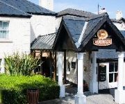
The Dukes Head Hotel
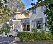
Nutfield Priory Hotel and Spa
Holiday Inn Express LONDON - EPSOM DOWNS
Best Western Reigate Manor Htl
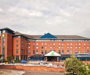
Holiday Inn LONDON - SUTTON
Epsom North
Hartsfield Manor
Greyhound Hotel
TRAVELODGE LONDON WIMBLEDON MORDEN
TRAVELODGE REDHILL
Videos from this area
These are videos related to the place based on their proximity to this place.
Your Golf Travel Srixon Golf Ball Test at Kingswood Golf & Country Club
Your Golf Travel teamed up with Srixon to test the latest golf balls at one of Surrey's top golf courses, Kingswood Golf and Country Club.
Epsom Derby 1973
Epsom Downs on 6 June 1973. A glimpse of the Derby can be seen at the end of the film. Shot on Super 8mm. For a video of the race search for: Morston - 1973 Derby.
El Rincon Epsom
El Rincon Spanish Restaurant, Tapas and High Quality Spanish food in Epsom. Video advert by pro business photos contact http://www.probusinessphotos.co.uk we can help you make the most of...
Golf : Signature Golf Hole. Epsom Golf Course, Epsom, Surrey
Golf Professional Stuart Walker, plays the signature golf hole at Epsom Golf Course, Epsom. This iconic golf hole is a par 4 and plays 443 yards from the white tees. What makes it unique is...
The Epsom Derby 2012
The 3rd Annual trip for the 44 Crew to Epsom threw up more Banter, the usual mix of horses and pimms! This year, the added bonus of £3 masks to celebrate the Royal family having a big summer!...
They are off Epsom Race For Life 2012
And They are off Epsom Race For Life 2012 at Epsom Downs. Well done to everyone who took part.
The noise at the Epsom Derby Festival
Too noisy! Oh well, I won that race. I won 3 out of 6 races. Not too bad!
Banstead Horticultural Society - Spring Show 2015 (Floral Arrangements)
Banstead Horticultural Society - Spring Show 2015 (Floral Arrangements)
Banstead Air Training Corp - Squadron No. 1044 Dedication of Drums Sunday 22 3 1942
Film taken by Stephen Wingrove of the Banstead Air Training Corps Squadron No. 1044 Inspection and march past to Banstead All Saints Church. Dedication of the drums. Sunday 22 March 1942.
Videos provided by Youtube are under the copyright of their owners.
Attractions and noteworthy things
Distances are based on the centre of the city/town and sightseeing location. This list contains brief abstracts about monuments, holiday activities, national parcs, museums, organisations and more from the area as well as interesting facts about the region itself. Where available, you'll find the corresponding homepage. Otherwise the related wikipedia article.
Epsom and Ewell
Epsom and Ewell is a local government district with borough status in Surrey, England, covering the towns of Epsom and Ewell. The borough was formed as an urban district in 1894, and was known as Epsom until 1934. It was made a municipal borough in 1937. The district was considered for inclusion in Greater London in 1965 but was left unaltered by the London Government Act 1963 and the Local Government Act 1972 in 1974.
Institute of Cancer Research
The Institute of Cancer Research (the ICR) is a public research institute and university located in London, United Kingdom specialised in oncology, and a constituent college of the University of London. It was founded in 1909 as a research department of the Royal Marsden Hospital and joined the University of London in 2003. It has been responsible for a number of breakthrough discoveries, including that the basic cause of cancer is damage to DNA.
Nonsuch Palace
Nonsuch Palace was a Tudor royal palace, built by Henry VIII in Surrey, England; it stood from 1538 to 1682–3. Its ruins are in Nonsuch Park.
Epsom College
Epsom College is a co-educational independent school in the town of Epsom in Surrey, in Southern England, for pupils aged 13 to 18. Founded in 1853 as a boys' school to provide support for poor members of the medical profession such as pensioners and orphans ("Foundationers"), Epsom's long-standing association with medicine was estimated in 1980 as having helped almost a third of its 10,000 alumni enter that profession. The college caters for both boarding and day pupils.
North East Surrey College Of Technology
The North East Surrey College Of Technology (NESCOT) is a large further education and higher education college in Epsom and Ewell, Surrey, England that began as Ewell Technical College in the 1950s.
A217 road
The A217 is a road in the United Kingdom. It runs south from Kings Road in Fulham, London, crossing the Thames at Wandsworth Bridge, then passing through Wandsworth, Tooting, Mitcham, Cheam, Banstead, crossing the M25 motorway at Junction 8, then passing through Reigate and terminating shortly before reaching Gatwick Airport.
HM Prison High Down
HM Prison High Down is a Category B men's local prison. High Down is located on the outskirts of Banstead in Surrey, England, and is immediately adjacent to the southern boundary of Belmont in Greater London. The prison is operated by Her Majesty's Prison Service, and is situated in proximity to Downview Prison for women.
HM Prison Downview
HM Prison Downview is a women's closed category prison. Downview is located on the outskirts of Banstead in Surrey, England, and is immediately adjacent to the southern boundary of Belmont in Greater London. The prison is operated by Her Majesty's Prison Service, and is situated in proximity to High Down Prison for men.
A232 road
The A232 is a road running west-east across South London, which connects the A24 in Ewell with the A224 Orpington bypass. Between Croydon and Ewell the road runs close to the Sutton & Mole Valley Line. London Buses route X26 bus runs along the road between Waddon and Cheam.
Epsom & Ewell F.C
Epsom & Ewell Football Club is an association football club from Epsom in Surrey and play in the Combined Counties League Premier Division. The club is affiliated to the Surrey County Football Association. They have reached the first round of the FA Cup, been runners-up in the FA Vase, and been champions of Isthmian League Division Two.
Aberdour School
Aberdour School, founded in 1933, is a co-educational preparatory school for ages 3–13 in Burgh Heath, Surrey, England. It is a nursery department, pre-preparatory school and preparatory school, and covers 14 acres, 10 of which are playing fields.
A240 road
The A240 is a partially primary status A road in Surrey and Greater London that connects the A217 with the A3 and continues beyond through Surbiton to Kingston upon Thames. The road is 8.5 miles long and is dualled from the Ewell by-pass to Tolworth Broadway.
Mugswell
Mugswell is a small village in the Surrey district of Reigate & Banstead. It is located just south of Kingswood and northeast of Lower Kingswood.
Epsom Downs Racecourse
Epsom Downs is a Grade 1 racecourse near Epsom, Surrey, England. The "downs" referred to in the name are part of the North Downs. The course is best known for hosting the Epsom Derby, the United Kingdom's premier thoroughbred horse race for three-year-old colts and fillies, over a mile and a half (2400m). It also hosts the Epsom Oaks for three-year-old fillies and the Coronation Cup for all ages over the same distance.
Copthorne Hundred
Copthorne was a hundred in what is now Surrey, England. It includes the following places: Ashtead, Burgh, Cuddington, Epsom, Ewell, Fetcham, Headley, Leatherhead, Mickleham, Pachevesham (near Leatherhead), Tadworth, Thorncroft and Walton-on-the-Hill. However, actually in the Domesday Book, the towns of Ashtead, Fetcham and Mickleham were included in the Wallington (hundred), apparently by mistake. They are part of the Copthorne hundred. Copthorne appears in Domesday as Copededorne.
Banstead Downs
Banstead Downs is a Site of Special Scientific Interest in Surrey, England. It covers 430 acres . To the west is the A217 and to east is the B2218. The town to the north is Sutton; whilst Banstead lies to the south. It lies at about 125 m above sea level and is bisected by a railway line. The Downs is one of four green areas in the area, which are overall referred to as Banstead Commons. The other areas are Burgh Heath (87 acres), Banstead Heath (760 acres) and Park Downs (74 acres).
Chipstead Downs
Chipstead Downs is a Site of Special Scientific Interest in Surrey, England. It lies near Chipstead and Banstead. It has a chalk downland ecosystem. It is managed by the Banstead Commons Conservators.
Walton Heath Golf Club
Walton Heath Golf Club is a golf club near Walton-on-the-Hill in Surrey, England, that was founded in 1903. The club comprises two 18-hole golf courses, both of which are well known for having heather covering many of the areas of rough. The Old Course was the first to open in 1904, and (as of 2009) has a championship length of 7,462 yards.
Ewell Castle School
Ewell Castle School is a British independent day school for boys aged 3 to 18 and girls aged 3 – 11 and, from September 2013, 16 - 18 also. Founded in 1926 by Mr Herbert Budgell originally as a boarding school, it is located in Ewell, Surrey. The school consists of the Main House (affectionately known by Ewellians as 'The Castle'), Glyn House and Chessington Lodge. Headteachers are Mr M Holder-Williams (MA) of the Senior School, Mrs.
Chinthurst School
Chinthurst School is an independent Nursery, Pre-Preparatory and Preparatory School for Boys aged 2½ to 13, based in Tadworth Surrey. It is a charitable trust. The School is a member of the Independent Association of Preparatory Schools (IAPS).
Mogador, Surrey
Mogador is a hamlet in the Reigate and Banstead district, in the English county of Surrey. It is at the edge of Banstead Heath, and about 1 km from the top of the north-facing dip slope of the North Downs. At an altitude of about 200 metres it is one of the highest settlements in south east England. It is just north of the M25 motorway. The closest junction is Junction 8, which is the Reigate Hill interchange.
Margery
Margery is a hamlet in the Reigate and Banstead district, in the English county of Surrey. It is less than 1 km from the top of the north-facing dip slope of the North Downs. The hamlet is on the northern side of the M25 motorway, close to Junction 8, the Reigate Hill interchange. The nearest settlement is the village of Lower Kingswood. Other nearby settlements include the towns of Reigate and Redhill, the small hamlet of Mogador, and the villages of Kingswood, Tadworth and Walton-on-the-Hill.
Recreation Ground, Banstead
The Recreation Ground is a cricket ground in Banstead, Surrey. The first recorded match on the ground was in 1955, when South Women Second XI played the Women's Cricket Association. It hosted its only first-class match in 1984, when Surrey played Cambridge University. Additionally, between 1983 and 2006, the ground played host to a number of Surrey Second XI matches in the Second XI Championship and Second XI Trophy, hosting a combined total of 20 Second XI matches.
Cheam Cricket Club Ground
Cheam Cricket Club Ground is a cricket ground in Cheam, London. The first recorded match on the ground was in 1940, when Cheam played London Counties. More recently, the ground has held Surrey Second XI matches in the Second XI Championship and the Second XI Trophy. In 1968, the ground held a game for John Edrich against the International Cavaliers. The game attracted 8,000 people and was the first cricket match to be televised in colour by the BBC.
Epsom Down
Epsom Down near Epsom was used as a cricket venue for 2 first-class matches between 1716 and 1719, both of which saw Epsom Cricket Club played pre-county club Hampshire. The approximate location of the ground today would be near Epsom Downs Racecourse.


