Safety Score: 3,0 of 5.0 based on data from 9 authorites. Meaning we advice caution when travelling to United Kingdom.
Travel warnings are updated daily. Source: Travel Warning United Kingdom. Last Update: 2024-08-13 08:21:03
Explore Abinger Common
Abinger Common in Surrey (England) is located in United Kingdom about 24 mi (or 39 km) south-west of London, the country's capital.
Local time in Abinger Common is now 10:44 PM (Friday). The local timezone is named Europe / London with an UTC offset of zero hours. We know of 11 airports in the wider vicinity of Abinger Common, of which 5 are larger airports. The closest airport in United Kingdom is London Gatwick Airport in a distance of 10 mi (or 16 km), East. Besides the airports, there are other travel options available (check left side).
There are several Unesco world heritage sites nearby. The closest heritage site in United Kingdom is Stonehenge, Avebury and Associated Sites in a distance of 10 mi (or 16 km), East. Also, if you like golfing, there are multiple options in driving distance. We found 5 points of interest in the vicinity of this place. If you need a place to sleep, we compiled a list of available hotels close to the map centre further down the page.
Depending on your travel schedule, you might want to pay a visit to some of the following locations: Ockley, Mickleham, Newdigate, Headley and Byfleet. To further explore this place, just scroll down and browse the available info.
Local weather forecast
Todays Local Weather Conditions & Forecast: 9°C / 48 °F
| Morning Temperature | 5°C / 40 °F |
| Evening Temperature | 8°C / 47 °F |
| Night Temperature | 5°C / 41 °F |
| Chance of rainfall | 0% |
| Air Humidity | 78% |
| Air Pressure | 1028 hPa |
| Wind Speed | Light breeze with 3 km/h (2 mph) from North-East |
| Cloud Conditions | Overcast clouds, covering 85% of sky |
| General Conditions | Overcast clouds |
Saturday, 16th of November 2024
9°C (48 °F)
9°C (48 °F)
Overcast clouds, light breeze.
Sunday, 17th of November 2024
8°C (46 °F)
3°C (37 °F)
Broken clouds, moderate breeze.
Monday, 18th of November 2024
10°C (50 °F)
11°C (53 °F)
Moderate rain, fresh breeze, overcast clouds.
Hotels and Places to Stay
De Vere Wotton Estate PH Hotels
Thatcher’s Hotel
Lockhurst Hatch Farm
Mercure Box Hill Burford Bridge Hotel
Nightless Copse
Gatton Manor
De Vere Horsley Estate
Mercure Dorking White Horse Hotel
TRAVELODGE DORKING
Videos from this area
These are videos related to the place based on their proximity to this place.
Effingham - Sheepwalk Lane (Byway, E-W)
Subscribe for the love of motorcycles and the great outdoors: http://www.youtube.com/subscription_center?add_user=wiltshirebyways Please click 'S H O W M O R E' for route info: ↓↓↓↓↓↓...
Gomshall - Drove Road/Beggars Lane (Byway, N-S)
Subscribe for the love of motorcycles and the great outdoors: http://www.youtube.com/subscription_center?add_user=wiltshirebyways Please click 'S H O W M O R E' for route info: ↓↓↓↓↓↓...
Bee keeping in Surrey
Richard, Nick, Jeremy and Grace transport bee frames from the suburbs of Merstham, Surrey to Holmbury St Mary, high up in the Surrey hills, ready for the spring and summer. It is also a chance...
Surrey Hills - Holmbury Hill: Yoghurt Pots
GoPro HD handle bar mount of Yoghurt Pots. This one is native format, we'll see how it looks! Quite a lot of vibration comes through using the Ride Hero attached to the handle bar of my Specialized...
Early Learning Centre - Carry-Along City
Open up the neat case to discover a fantastic city to whizz cars around. With easy, slot-together ramps and lots of roads for driving adventures.
Travel Blue Messenger Bag 3303
For more bags & accessories visit us at http://www.travel-blue.com Features: * 2 main zipped pockets. * Adjustable wide shoulder strap. * Double-zipped back sleeve (for securing the bag...
SWC Free Walk 147, Gomshall to Dorking. 15/6/13
This was yet another fantastic day's walking; 15 miles through the Surrey Hills, mainly following the Greensand Way. Due to the nearest station being several miles away, there's some map reading...
Videos provided by Youtube are under the copyright of their owners.
Attractions and noteworthy things
Distances are based on the centre of the city/town and sightseeing location. This list contains brief abstracts about monuments, holiday activities, national parcs, museums, organisations and more from the area as well as interesting facts about the region itself. Where available, you'll find the corresponding homepage. Otherwise the related wikipedia article.
Greensand Way
The Greensand Way is long distance walk of 108 miles in southeast England, from Haslemere in Surrey to Hamstreet in Kent. It follows the Greensand Ridge along the Surrey Hills and Chart Hills. The route is mostly rural, passing through woods, and alongside fruit orchards and hop farms in Kent and links with the Stour Valley Walk near Pluckley in Kent. The trail was opened on 15 June 1980.
Holmbury St Mary
Holmbury St. Mary is a village near Abinger in the Mole Valley district of Surrey, England located within the Hurtwood, the largest area of common land in Surrey. Nearby to the south is Holmbury Hill, which at 857 feet is the fourth highest point in Surrey. The village itself is named after the hill and the large Victorian church at its heart.
Goddards
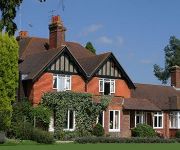
Goddards is a large house in Abinger Common, Surrey, England The house was built by Edwin Lutyens in 1898-1900 and later enlarged. It was built 'as a Home of Rest to which ladies of small means might repair for holiday' for Frederick Mirrielees. It has an integrated skittle alley. In 1991 Mr Bill Hall bequeathed Goddards to the Lutyens Trust in memory of his architect son, Lee Hall, who died in 1988. The property is now leased by the Landmark Trust and is available for holiday lets.
Abinger Castle
Abinger Castle was sited at Abinger Common, between Guildford and Dorking in Surrey. It was built as a motte and bailey castle around 1100 and founded by William fitz Ansculf. It was built of wood and remodelled in 1140. It had a longer life than most castles of this type, surviving until 1153. It was excavated by Dr Brian Hope-Taylor in 1949 when the sites of many of the postholes were found. The mound remains.
Hackhurst and White Downs
Hackhurst and White Downs is a Site of Special Scientific Interest in Surrey, England and can be found along the North Downs Way. It is located on a chalk escarpment
Oxmoor Copse
Oxmoor Copse is just south of the village of Abinger Hammer and to the west of the village of Abinger Common, in Surrey. It is 1.23 hectares and is in an AONB lying within the Surrey Hills. The previous owners gave the copse to the Woodland Trust as a gift. The copse lies on Greensand and the soil is acidic. The main trees are mature oaks and hazel; there are also bluebells. A considerable number of trees were blown down in the 1987 storm. Replanting took place in 1991.
Holmbury Hill
Holmbury Hill is the site of an Iron Age hillfort close to the village of Holmbury St. Mary in Surrey, England. Excavation of the site in 1929 by S.E. Winbolt indicated that it dated to the 1st Century AD and may have been constructed by Belgic tribes of Celts who were settling this part of Britain in the period prior to the Roman invasion of Britain. The hillfort was defended by double ramparts to the west and north with escarpments on the eastern and southern slopes.
Wotton House, Surrey
Wotton House is an hotel, training centre and former country house in Wotton near Dorking, Surrey, England. Originally the centre of the Wotton Estate and the seat of the Evelyn family, it was the birthplace in 1620 of diarist and garden landscaper John Evelyn, who built the first Italian Garden in England there.


