Safety Score: 3,0 of 5.0 based on data from 9 authorites. Meaning we advice caution when travelling to United Kingdom.
Travel warnings are updated daily. Source: Travel Warning United Kingdom. Last Update: 2024-08-13 08:21:03
Delve into Stutton
Stutton in Suffolk (England) with it's 599 habitants is a town located in United Kingdom about 63 mi (or 101 km) north-east of London, the country's capital town.
Time in Stutton is now 12:48 PM (Friday). The local timezone is named Europe / London with an UTC offset of zero hours. We know of 10 airports closer to Stutton, of which 4 are larger airports. The closest airport in United Kingdom is Wethersfield Airport in a distance of 26 mi (or 43 km), West. Besides the airports, there are other travel options available (check left side).
There are several Unesco world heritage sites nearby. The closest heritage site in United Kingdom is Canterbury Cathedral, St Augustine's Abbey, and St Martin's Church in a distance of 48 mi (or 77 km), South. Also, if you like the game of golf, there are some options within driving distance. We saw 1 points of interest near this location. In need of a room? We compiled a list of available hotels close to the map centre further down the page.
Since you are here already, you might want to pay a visit to some of the following locations: Ipswich, Tiptree, Snetterton, Shropham and Southend-on-Sea. To further explore this place, just scroll down and browse the available info.
Local weather forecast
Todays Local Weather Conditions & Forecast: 9°C / 49 °F
| Morning Temperature | 7°C / 44 °F |
| Evening Temperature | 7°C / 45 °F |
| Night Temperature | 5°C / 42 °F |
| Chance of rainfall | 0% |
| Air Humidity | 74% |
| Air Pressure | 1028 hPa |
| Wind Speed | Light breeze with 5 km/h (3 mph) from North-East |
| Cloud Conditions | Overcast clouds, covering 100% of sky |
| General Conditions | Overcast clouds |
Saturday, 16th of November 2024
9°C (48 °F)
8°C (47 °F)
Light rain, gentle breeze, scattered clouds.
Sunday, 17th of November 2024
7°C (44 °F)
4°C (39 °F)
Light rain, moderate breeze, overcast clouds.
Monday, 18th of November 2024
6°C (43 °F)
3°C (37 °F)
Moderate rain, moderate breeze, broken clouds.
Hotels and Places to Stay
Holiday Inn IPSWICH - ORWELL
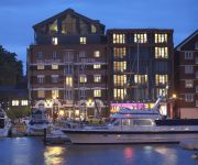
Salthouse Harbour
Novotel Ipswich Centre
pentahotel Ipswich
Innocence Rooms East
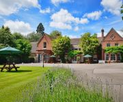
Belstead Brook Muthu Hotel
The Station Hotel
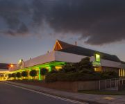
Holiday Inn IPSWICH
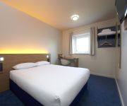
TRAVELODGE IPSWICH
TRAVELODGE IPSWICH CAPEL ST MARY
Videos from this area
These are videos related to the place based on their proximity to this place.
Fly-Over caught from under the Orwell Bridge, River Orwell, Ipswich, UK
Casual filming at the Orwell Bridge, River Orwell, Ipswich when there are a number of boats coming and going, including the local 'Orwell Lady' (persons can be seen to be waiting for something...
B1456 Web Video
This video was shot in 2006/7 and submitted as evidence to the public inquiry into plans to build 325 homes at the former HMS Ganges site on the Shotley peninsula in Suffolk. The Secretary...
First ride of 2015 on the Aprilia Caponord
After what seems like a long 6 weeks since the last ride, I finally got out on the Caponord in 2015. The roads were mostly dry, making the salt all over them less of an issue. But at 3 deg...
Mountain Biking - Track in the Woods
Me and a friend riding the course we built in the woods one day. It took about 5 hours with the two of us working on it. Main parts being the featured burm a...
Vintage Electric at Mistley ~ a film by Fred Ivey
Fred was at Mistley Station on the Harwich branch just as a class 312 EMU passed a class 306 EMU that had strayed well away from its usual haunt. June 15th 1996. Fred Ivey's YouTube videos...
E.V.P. Oh God
This was recorded on 15th September 2011. We were walking the dogs and our Shar Pei stopped and wouldn't move. To be honest this part of the woods always makes me feel uncomfortable anyway,.
Videos provided by Youtube are under the copyright of their owners.
Attractions and noteworthy things
Distances are based on the centre of the city/town and sightseeing location. This list contains brief abstracts about monuments, holiday activities, national parcs, museums, organisations and more from the area as well as interesting facts about the region itself. Where available, you'll find the corresponding homepage. Otherwise the related wikipedia article.
River Stour, Suffolk
The River Stour is a river in East Anglia, England. It is 76 km (47 mi) long and forms most of the county boundary between Suffolk to the north, and Essex to the south. It rises in eastern Cambridgeshire, passes to the east of Haverhill, through Cavendish, Bures, Sudbury, Nayland, Stratford St Mary, Dedham and flows through the Dedham Vale Area of Outstanding Natural Beauty. it becomes tidal just before Manningtree in Essex and joins the North Sea at Harwich.
Alton Water
Alton Water (or Alton Reservoir) is a manmade reservoir. It is the largest in Suffolk, with a perimeter of over 8 miles (13 km).
Tattingstone Wonder
The Tattingstone Wonder is a folly at Tattingstone in Suffolk, England. Located some six miles south of Ipswich the Tattingstone Wonder was originally two cottages. In 1790 Edward White, the local squire, did not like his view of the cottages from Tattingstone Place. He decided to add a third cottage and finished them to look like a church by adding a fake tower and flint façade. It has become a famous Suffolk landmark.
Bradfield railway station
Bradfield railway station served the village of Bradfield in Essex. It was on the Manningtree to Harwich branch line, which is today known as The Mayflower Line. It closed in 1956. Consisting of just two through platforms it had no sidings for working local goods traffic, which was the normal scenario in rural East Anglia.
Samford Hundred
Samford was a hundred of Suffolk, consisting of 44,940 acres . It was situated to the south and south west of Ipswich. The hundred was bounded by the River Orwell to the east, Essex to the south, the River Brett (and Shelley parish) to the west, and the parish boundaries of Burstall, Hintlesham and Sproughton to the north.
Blackbourn Hundred
Blackbourn was a hundred of Suffolk, consisting of 66,272 acres . Blackbourn hundred was situated in the north-west of Suffolk. Its northern boundary is the Little Ouse forming the border with Norfolk, and the River Lark forms part of its western boundary. The hundred appears in the Domesday Book as Blachruna and Blackebrune meaning "black bourn", where a bourn is a stream.
Tattingstone White Horse
Tattingstone White Horse is a hamlet on East Side of Alton Water, in the Babergh District, in the English county of Suffolk. For transport there is the A137 road nearby. Nearby settlements include the town of Ipswich and the village of Tattingstone. Tattingstone White Horse has 1 pub.
Shotley peninsula
The Shotley peninsula is a rural area east of the A137 Ipswich-Colchester road located between the rivers Stour and Orwell in Suffolk, England. The peninsula is named after the settlements of Shotley and Shotley Gate which are situated near its south-eastern tip. Other villages on the peninsula include Chelmondiston, Erwarton (Arwarton), Freston, Harkstead, Holbrook, Stutton, Tattingstone, Wherstead and Woolverstone.


