Safety Score: 3,0 of 5.0 based on data from 9 authorites. Meaning we advice caution when travelling to United Kingdom.
Travel warnings are updated daily. Source: Travel Warning United Kingdom. Last Update: 2024-08-13 08:21:03
Touring Glemsford
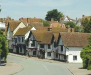
Glemsford in Suffolk (England) with it's 3,382 residents is a town located in United Kingdom about 53 mi (or 86 km) north-east of London, the country's capital place.
Time in Glemsford is now 02:49 PM (Friday). The local timezone is named Europe / London with an UTC offset of zero hours. We know of 10 airports nearby Glemsford, of which 5 are larger airports. The closest airport in United Kingdom is Wethersfield Airport in a distance of 11 mi (or 18 km), South-West. Besides the airports, there are other travel options available (check left side).
There are several Unesco world heritage sites nearby. The closest heritage site in United Kingdom is Royal Botanic Gardens, Kew in a distance of 46 mi (or 74 km), South. Also, if you like the game of golf, there are several options within driving distance. We collected 2 points of interest near this location. Need some hints on where to stay? We compiled a list of available hotels close to the map centre further down the page.
Being here already, you might want to pay a visit to some of the following locations: Tiptree, Linton, Chelmsford, Snetterton and Fulbourn. To further explore this place, just scroll down and browse the available info.
Local weather forecast
Todays Local Weather Conditions & Forecast: 9°C / 48 °F
| Morning Temperature | 6°C / 43 °F |
| Evening Temperature | 7°C / 44 °F |
| Night Temperature | 6°C / 42 °F |
| Chance of rainfall | 0% |
| Air Humidity | 76% |
| Air Pressure | 1028 hPa |
| Wind Speed | Light breeze with 5 km/h (3 mph) from North-East |
| Cloud Conditions | Overcast clouds, covering 92% of sky |
| General Conditions | Overcast clouds |
Saturday, 16th of November 2024
9°C (48 °F)
8°C (46 °F)
Light rain, gentle breeze, broken clouds.
Sunday, 17th of November 2024
6°C (44 °F)
4°C (39 °F)
Light rain, moderate breeze, overcast clouds.
Monday, 18th of November 2024
6°C (43 °F)
2°C (35 °F)
Moderate rain, moderate breeze, broken clouds.
Hotels and Places to Stay
The Swan Hotel
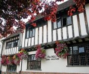
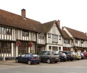
The Bull Hotel Long Melford
The Bull Hotel Long Melford
The Bull
The Mill
Black Lion Hotel
The Bridge Street Historic Guest House
Videos from this area
These are videos related to the place based on their proximity to this place.
Sudbury To The Sea - Documentary (Part 1 of 6)
Part one of the 2009 documentary following the Sudbury to the sea event. It sees over 300 craft take to the water at the Granary in Sudbury and go down a 24 and a half mile stretch of the river...
Sudbury Scooter Extravaganza 2010 - The Stop offs
The meeitng points and stop offs on the Sudbury Scooter Extravaganza 2010 ride-out www.sudburyscooterclub.co.uk.
Sudbury Hapkido Moo Moo Kwan Juniors demo 17 12 2014
Some Hosin Sool from our juniors after their geup promotions.
ALT Training Services, Sudbury, Suffolk UK
http://www.alttraining.co.uk Tel: 01787 313 562 Based in Suffolk, ALT Training train fork lift truck drivers to the highest standard. We offer a wide range of courses covering many aspects...
Suffolk Fire And Rescue Service - Bury St Edmunds - Leaving Sudbury Suffolk 2 of 2
Bury St Edmunds Truck Leaving Sudbury after doing Water Rescue Training at a Local River ..
2013-02-02 - rekovered at the prince of wales, sudbury - pimps of rock montage
few years back when we were doing our pimps of rock tour. Here with the mighty Nik Woodham from before he joined Jupiter Ray we brought the sexy slinky silliness that made for a great night and ...
Videos provided by Youtube are under the copyright of their owners.
Attractions and noteworthy things
Distances are based on the centre of the city/town and sightseeing location. This list contains brief abstracts about monuments, holiday activities, national parcs, museums, organisations and more from the area as well as interesting facts about the region itself. Where available, you'll find the corresponding homepage. Otherwise the related wikipedia article.
Edmund Rice (1638)
Edmund Rice (c. 1594 – 3 May 1663), was an early immigrant to Massachusetts Bay Colony who was born in Suffolk, England, and lived in Stanstead, Suffolk and Berkhamsted, Hertfordshire before sailing with his kin to America. He landed in the Massachusetts Bay Colony in summer or fall of 1638, thought to be first living in the town of Watertown, Massachusetts.
Long Melford railway station
Long Melford railway station is a disused railway station in Long Melford, Suffolk, England. It opened in 1865, as "Melford", and was renamed Long Melford in 1884. The station was part of the Stour Valley Line, operated by the Eastern Counties Railway, and served trains between Sudbury and Cambridge, as well as the branch line between Sudbury and Bury St. Edmunds. The line was closed in 1967, following the Beeching Axe and the station building is now a private residence.
Glemsford railway station
Glemsford railway station was a station in Glemsford, Suffolk. Preceding station Disused railways Following station Cavendish Stour Valley Railway Long Melford
Cavendish railway station
Cavendish railway station was a station in Cavendish, Suffolk. Preceding station Disused railways Following station Clare Stour Valley Railway Glemsford
Rodbridge Corner
Rodbridge Corner is a hamlet on the B1064 road, in the Babergh district, in the county of Suffolk, England. It is located in between Sudbury and Long Melford.
Pentlow
Pentlow is a village and civil parish in the Braintree district, in the county of Essex, England. Nearby settlements include the villages of Foxearth and Cavendish and the hamlet of Pentlow Street. Pentlow has a church dedicated to St Gregory and St George. Pentlow was recorded in the Domesday Book as Pentelawa.


