Safety Score: 3,0 of 5.0 based on data from 9 authorites. Meaning we advice caution when travelling to United Kingdom.
Travel warnings are updated daily. Source: Travel Warning United Kingdom. Last Update: 2024-08-13 08:21:03
Discover Fornham St. Genevieve
Fornham St. Genevieve in Suffolk (England) with it's 324 citizens is a town in United Kingdom about 64 mi (or 103 km) north-east of London, the country's capital city.
Current time in Fornham St. Genevieve is now 01:25 PM (Friday). The local timezone is named Europe / London with an UTC offset of zero hours. We know of 8 airports near Fornham St. Genevieve, of which 5 are larger airports. The closest airport in United Kingdom is RAF Honington in a distance of 5 mi (or 9 km), North-East. Besides the airports, there are other travel options available (check left side).
There are several Unesco world heritage sites nearby. The closest heritage site in United Kingdom is Royal Botanic Gardens, Kew in a distance of 58 mi (or 93 km), South. Also, if you like playing golf, there is an option about 2 mi (or 4 km). away. We discovered 1 points of interest in the vicinity of this place. Looking for a place to stay? we compiled a list of available hotels close to the map centre further down the page.
When in this area, you might want to pay a visit to some of the following locations: Snetterton, Shropham, Tiptree, Linton and Fulbourn. To further explore this place, just scroll down and browse the available info.
Local weather forecast
Todays Local Weather Conditions & Forecast: 9°C / 48 °F
| Morning Temperature | 6°C / 42 °F |
| Evening Temperature | 7°C / 44 °F |
| Night Temperature | 5°C / 42 °F |
| Chance of rainfall | 0% |
| Air Humidity | 76% |
| Air Pressure | 1028 hPa |
| Wind Speed | Gentle Breeze with 6 km/h (4 mph) from North-East |
| Cloud Conditions | Overcast clouds, covering 97% of sky |
| General Conditions | Overcast clouds |
Saturday, 16th of November 2024
8°C (47 °F)
7°C (45 °F)
Light rain, gentle breeze, broken clouds.
Sunday, 17th of November 2024
7°C (44 °F)
3°C (38 °F)
Light rain, moderate breeze, overcast clouds.
Monday, 18th of November 2024
5°C (42 °F)
0°C (33 °F)
Snow, moderate breeze, broken clouds.
Hotels and Places to Stay
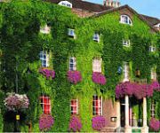
Angel
Dragonfly Hotel Bury
Best Western Priory Priory
Bury St Edmunds Town Centre
Videos from this area
These are videos related to the place based on their proximity to this place.
Bury St Edmunds Suffolk. UK.
Bury St Edmonds is a typical old Emglish market town. Heaped in history, and with amazing buildings, the old town is like stepping back into the past. This contrasts with the new town with...
Bury St. Edmunds June 1991
Bury St Edmunds is a historic market town in the county of Suffolk. Footage of the 2nd of June 1991.
Bury St Edmunds 11-02-2012
This is a quick video i did at Bury St Edmunds station when i was stopping here for a few days. shots are taken on 11th February 2012. Thanks to Paul thomas for leaning my his tripod and millytasti...
Bury St Edmunds Abbey Gardens
Brandi and I went to Bury St Edmunds to meet with some friends and have dinner. A few hours prior to that, we strolled through the Abbey gardens, and visited the market place.
Bury St Edmunds Abbey Gardens
Brandi and I went to Bury St Edmunds to meet with some friends and have dinner. A few hours prior to that, we strolled through the Abbey gardens, and visited the market place.
Mandarin Cycles Bmx Team - Bury St Edmunds and Norwich
A selection of clips from team riders Louis, Gary, Ben and Sheldon, With guest clips from Drew. Filmed at Bury St Edmunds and Eaton Skateparks on a windy Monday.
Suspected gas leak at The Arc, Bury St Edmunds
Inspector Mark Whitehead explains what happened at The Arc on Saturday November 22.
Apache Helicopter landing on Angel Hill Bury St Edmunds.
The Prince of Wales presented medals to troops. 22/07/2010.
Squirrels rage in Bury St Edmunds
"Szalejące" wiewiórki sfilmowane w Bury St Edmunds w technice slow motion ;) PS. Korzystając z okazji chciałbym zaprosić was na stronę http://polskieinfo.org.uk/forum-dyskusyjne/atrakcje-tur...
Bury St Edmunds 22 May 2010 Part Two
The Bury Fringe Festival with Tom Milsom, Alex Day and Eddplant.
Videos provided by Youtube are under the copyright of their owners.
Attractions and noteworthy things
Distances are based on the centre of the city/town and sightseeing location. This list contains brief abstracts about monuments, holiday activities, national parcs, museums, organisations and more from the area as well as interesting facts about the region itself. Where available, you'll find the corresponding homepage. Otherwise the related wikipedia article.
St Edmundsbury
St Edmundsbury is a local government district and borough in Suffolk, England. It is named after its main town, Bury St Edmunds. The second town in the district is Haverhill. The district was formed on 1 April 1974 under the Local Government Act 1972 (with the abolition of West Suffolk) by the merger of the Borough of Bury St Edmunds, Haverhill Urban District, Clare Rural District and Thingoe Rural District. Until March 2009 its main offices were in Bury St Edmunds (Angel Hill and Western Way).
Bury Town F.C
Bury Town Football Club is an English semi-professional football club, based in Bury St Edmunds, Suffolk. The club are currently members of the Isthmian League Premier Division and play at Ram Meadow. Their reserve team goes under the name of Team Bury.
Culford Park
Culford Park in Culford, Suffolk, England, is a country house that is the former seat of the Bacon, Cornwallis and Cadogan families, and now it is the home of Culford School.
Bury St Edmunds railway station
Bury St Edmunds railway station serves the town of Bury St Edmunds in Suffolk, England. The station, and all trains calling there, are operated by Greater Anglia.
Sound Techniques
Sound Techniques was a popular London recording studio at 46a Old Church Street, Chelsea, London, SW3 founded in December 1964. The premises were originally built as a dairy. It quickly became one of the top independently-owned studios in England. In 1976 the original location in Old Church Street closed. Many famous artists recorded there during the studio's heyday. Among the most famous clients were: ‹ The template below is being considered for merging.
Team Bury F.C
Team Bury F.C. are an English football club based in Bury St Edmunds, Suffolk. Consisting of players largely drawn from the West Suffolk College Football Academy, they are a feeder club and reserve team for Bury Town, whose Ram Meadow Ground they play at. They are currently members of Division One of the Eastern Counties League. The club is affiliated to the Suffolk County FA.
Cemetry Road
Cemetry Road was a cricket ground in Bury St Edmunds, Suffolk. The ground was known as Field Lane from 1826 to 1854 and was later known as the West Suffolk Cricket Ground. Today, the location of the ground would be along King's Road in Bury St Edmunds, with the stretch of the A1302 named Parkway bisecting the site.
Fornham Hall
Fornham Hall was a large country house near Bury St Edmunds.


