Safety Score: 3,0 of 5.0 based on data from 9 authorites. Meaning we advice caution when travelling to United Kingdom.
Travel warnings are updated daily. Source: Travel Warning United Kingdom. Last Update: 2024-08-13 08:21:03
Discover Baylham
Baylham in Suffolk (England) is a town in United Kingdom about 66 mi (or 107 km) north-east of London, the country's capital city.
Current time in Baylham is now 01:09 PM (Friday). The local timezone is named Europe / London with an UTC offset of zero hours. We know of 11 airports near Baylham, of which 5 are larger airports. The closest airport in United Kingdom is RAF Honington in a distance of 20 mi (or 32 km), North-West. Besides the airports, there are other travel options available (check left side).
There are several Unesco world heritage sites nearby. The closest heritage site in United Kingdom is Royal Botanic Gardens, Kew in a distance of 55 mi (or 89 km), South-West. Also, if you like playing golf, there are a few options in driving distance. We discovered 1 points of interest in the vicinity of this place. Looking for a place to stay? we compiled a list of available hotels close to the map centre further down the page.
When in this area, you might want to pay a visit to some of the following locations: Ipswich, Snetterton, Shropham, Tiptree and Norwich. To further explore this place, just scroll down and browse the available info.
Local weather forecast
Todays Local Weather Conditions & Forecast: 9°C / 48 °F
| Morning Temperature | 6°C / 43 °F |
| Evening Temperature | 7°C / 45 °F |
| Night Temperature | 5°C / 42 °F |
| Chance of rainfall | 0% |
| Air Humidity | 76% |
| Air Pressure | 1028 hPa |
| Wind Speed | Gentle Breeze with 6 km/h (4 mph) from North-East |
| Cloud Conditions | Overcast clouds, covering 100% of sky |
| General Conditions | Overcast clouds |
Saturday, 16th of November 2024
8°C (47 °F)
8°C (46 °F)
Light rain, gentle breeze, broken clouds.
Sunday, 17th of November 2024
7°C (44 °F)
4°C (38 °F)
Light rain, moderate breeze, overcast clouds.
Monday, 18th of November 2024
5°C (42 °F)
1°C (33 °F)
Snow, moderate breeze, broken clouds.
Hotels and Places to Stay
pentahotel Ipswich
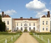
Hintlesham Hall
Novotel Ipswich Centre
TRAVELODGE IPSWICH BEACON HILL
Best Western Claydon Country House
Best Western Cedars Hotel
Holiday Inn IPSWICH
BELSTEAD BROOK MUTHU HOTEL
The Station Hotel
Innocence Rooms West
Videos from this area
These are videos related to the place based on their proximity to this place.
Ipswich cyclist another blind bend bellend in Sproughton
I didn't hear him until it was to late to take primary, this didn't seem as close at the time as it is, the other driver must have been parping it! On reflection he was coming so fast he would...
Fostering advice and information- fostering teenagers
Jenny, a foster carer, explains the challenges and rewards of fostering teenagers. If you are interested in fostering and are based in Suffolk, England, you can find more information either...
Dodgy Ref - AFC Bergholt Vs Ipswich Lions
AFC Bergholt's Highlights From 07-05-12 Includes; Foul On Tee.
Friday Night Football Project (Ipswich)
A showcase video for the successful Friday Night Football Project in Ipswich, a partnership between Suffolk FA, Suffolk Sport, Sportivate, Suffolk Police and Ipswich Borough Council.
East Suffolk & Hageneth Morris Men: The Rampant Horse Needham Market 29th April 2013
Two dances on a club night, one from East Suffolk, and one where both East Suffolk and Hageneth are dancing. A couple of 'whoops' moments are entirely forgivable in context. (At least that's...
War Thunder- Flakpanzer IV Wirbelwind in Arcade Mode (HD)
War Thunder game Footage featuring the Flakpanzer IV "Wirbelwind" and the Pz.kpfw III ausf M, shooting down planes in a attempt to further upgrade the wirblewind enjoy. Thanks for watching...
War Thunder-Yak3-P in The Air Hockey Event (HD)
War Thunder game footage featuring the Yak3-P in this Air Hockey event along with several other russian planes hope you like the action:) Thanks for watching guys, if you like the video please...
Videos provided by Youtube are under the copyright of their owners.
Attractions and noteworthy things
Distances are based on the centre of the city/town and sightseeing location. This list contains brief abstracts about monuments, holiday activities, national parcs, museums, organisations and more from the area as well as interesting facts about the region itself. Where available, you'll find the corresponding homepage. Otherwise the related wikipedia article.
Mid Suffolk
Mid Suffolk is a local government district in Suffolk, England. Its council is based in Needham Market, and the largest town is Stowmarket. The district was formed on 1 April 1974 by the merger of the Borough of Eye, Stowmarket urban district, Gipping Rural District, Hartismere Rural District and Thedwastre Rural District.
Needham Market railway station
Needham Market is a railway station serving the town of Needham Market in Suffolk, England. The station is located on the Great Eastern Main Line from London Liverpool Street to Norwich. The station is served by Greater Anglia.
SnOasis
SnOasis is a controversial proposed indoor winter sports resort in Great Blakenham near Ipswich, Suffolk currently scheduled to open in 'late 2014'. It is planned be the largest real snow indoor ski slope in the world with a 415 metre long slope, 70 metre wide run, and a 100 metre drop; accommodating 1000 skiers per hour.
Shrubland Hall
Shrubland Hall is a historic country house with planned gardens in Suffolk, England built in the 1770s. The Hall was used as a health clinic in the second half of the 20th century. As of 2012 it is residential accommodation for the private higher education establishment, the British Institute of Technology & E-commerce (BITE)
Claydon (Suffolk) railway station
Claydon railway station was a station in Claydon, Suffolk. It closed in 1963.
Bosmere-and-Claydon Hundred
Bosmere and Claydon was a hundred of Suffolk, consisting of 31,850 acres . The hundred is a fertile and picturesque district varying from 8 to about 12 miles in length and breadth. It is bounded on the south by the Borough of Ipswich and Samford Hundred, on the west by Cosford and Stow Hundreds on the north by Hartismere and Thredling Hundreds and on the east by Carlford Hundred. It falls in the Deaneries of Bosmere and Claydon in the Archdeaconry of Suffolk and Diocese of Norwich.


