Safety Score: 3,0 of 5.0 based on data from 9 authorites. Meaning we advice caution when travelling to United Kingdom.
Travel warnings are updated daily. Source: Travel Warning United Kingdom. Last Update: 2024-08-13 08:21:03
Explore Barningham
Barningham in Suffolk (England) with it's 956 inhabitants is located in United Kingdom about 73 mi (or 117 km) north-east of London, the country's capital.
Local time in Barningham is now 11:58 AM (Friday). The local timezone is named Europe / London with an UTC offset of zero hours. We know of 9 airports in the wider vicinity of Barningham, of which 5 are larger airports. The closest airport in United Kingdom is RAF Honington in a distance of 5 mi (or 8 km), West. Besides the airports, there are other travel options available (check left side).
There are several Unesco world heritage sites nearby. The closest heritage site in United Kingdom is Royal Botanic Gardens, Kew in a distance of 65 mi (or 105 km), South. Also, if you like golfing, there are multiple options in driving distance. We found 1 points of interest in the vicinity of this place. If you need a place to sleep, we compiled a list of available hotels close to the map centre further down the page.
Depending on your travel schedule, you might want to pay a visit to some of the following locations: Snetterton, Shropham, Ipswich, Norwich and Tiptree. To further explore this place, just scroll down and browse the available info.
Local weather forecast
Todays Local Weather Conditions & Forecast: 9°C / 48 °F
| Morning Temperature | 6°C / 42 °F |
| Evening Temperature | 7°C / 44 °F |
| Night Temperature | 5°C / 41 °F |
| Chance of rainfall | 0% |
| Air Humidity | 77% |
| Air Pressure | 1027 hPa |
| Wind Speed | Gentle Breeze with 6 km/h (4 mph) from North-East |
| Cloud Conditions | Overcast clouds, covering 98% of sky |
| General Conditions | Overcast clouds |
Saturday, 16th of November 2024
8°C (46 °F)
6°C (43 °F)
Overcast clouds, gentle breeze.
Sunday, 17th of November 2024
7°C (45 °F)
3°C (38 °F)
Light rain, moderate breeze, overcast clouds.
Monday, 18th of November 2024
5°C (41 °F)
0°C (32 °F)
Snow, moderate breeze, broken clouds.
Hotels and Places to Stay
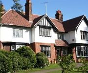
Ixworth House
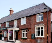
Six Bells
The Pykkerell Inn
Videos from this area
These are videos related to the place based on their proximity to this place.
Greater Anglia 170204 Harling Road 16/06/2012
I wouldn't normally upload a video of a DMU, however after slowing for the temporary speed limit Greater Anglia ex-One liveried 170204 opens up in fine style through Harling road with a tone...
47826 & 47580 - 5Z56 Carnforth-Norwich ECS - 03/05/2013
47826 & 47580 "County of Essex" are seen at Harling Road on 5Z56 Carnforth-Norwich NENTA ECS for the "Anglo-Scotsman" rail-tour. http://www.flickr.com/photos/chriseve1979/8705260084/ ...
Smith Family Day Out At Little Orchard Railway
Smith Family Day Out At Little Orchard Railway 16/05/2009.
Tom & Jerry in LIVE ACTION! Funny Kitten!
Following the success of crap live action hollywood remakes of cartoons such as The Flintstones, Scooby Doo and Sex And The City, I decided to have a crack at Tom and Jerry in full cinemascope...
Combat Paintball. Thetford Norfolk.
http://www.combatpaintball.org/ Combat Paintball LTD. Located between Thetford and Attleborough, Norfolk. 7 fantastic game zones set in the Norfolk counrtyside within Theford Forest. The best...
Brandon Lads U11 Laser Day - 13th July 2008
For our end of season event most of the squad went into Thetford Forest to play Laser at Viking Laser. The following is a roundup of our very enjoyable day.
Snetterton Race Circuit 14th Aug 2012
Video & Pictures on a Tommy Hill track day at MSV Snetterton Circuit. http://www.snetterton.co.uk/ SNETTERTON 300 - SESSIONED TRACKDAY WITH TOMMY HILL.
Videos provided by Youtube are under the copyright of their owners.
Attractions and noteworthy things
Distances are based on the centre of the city/town and sightseeing location. This list contains brief abstracts about monuments, holiday activities, national parcs, museums, organisations and more from the area as well as interesting facts about the region itself. Where available, you'll find the corresponding homepage. Otherwise the related wikipedia article.
Knettishall Heath
Knettishall Heath is an area of common land in Suffolk, England about 7 km east of Thetford near the Norfolk-Suffolk border. Popular with dog walkers and ramblers, it is the site where four long-distance footpaths meet: Angles Way, Icknield Way Path, Iceni Way and Peddars Way (part of the Peddars Way and Norfolk Coast Path National Trail). The Hereward Way ends at nearby Harling Road railway station/East Harling, linked to Knettishall Heath by path. The River Little Ouse flows through the heath.
RAF Knettishall
RAF Knettishall is a former World War II airfield in England. The field is located 6 miles SE of Thetford in Suffolk between the villages of Knettishall and Coney Weston, which lies to the south. This location is on the southern side of the Little Ouse Valley and bordering the area of heath and forest known as the Breckland.
Iceni Way
The Iceni Way is a collective name for several long distance footpaths running from Knettishall Heath to Hunstanton via the Little Ouse and Great Ouse valleys in the English county of Norfolk. The name comes from the Iceni tribe that once lived in the area.
Upthorpe Mill, Stanton
Upthorpe Mill is a Grade II* listed post mill and Scheduled Ancient Monument at Stanton, Suffolk, England which has been restored to working order.
Bardwell Windmill
Bardwell Mill is a Grade II* listed tower mill at Bardwell, Suffolk, England which is under restoration.
Hepworth, Suffolk
Hepworth is a village in the St Edmundsbury District, in the English county of Suffolk. Nearby settlements include the villages of Stanton and Barningham. For transport there is the A143 road nearby. Hepworth has a pub and a place of worship.
St John the Baptist's Church, Stanton
St John the Baptist's Church, Stanton, is a redundant Anglican church in the village of Stanton, Suffolk, England. It has been designated by English Heritage as a Grade II* listed building, and is under the care of the Churches Conservation Trust. Only the tower is intact, the body of the church being roofless. The remains of the church stand to the west of the village.
Market Weston Fen
Market Weston Fen is a reserve near Hopton in the county of Suffolk, England. Suffolk Wildlife Trust owns and manages this reserve. It is a Site of Special Scientific Interest (SSSI) and a Natura 2000 site. It is 91 acres (36 hectares).


