Safety Score: 3,0 of 5.0 based on data from 9 authorites. Meaning we advice caution when travelling to United Kingdom.
Travel warnings are updated daily. Source: Travel Warning United Kingdom. Last Update: 2024-08-13 08:21:03
Explore Cheadle
Cheadle in Stockport (England) is a city in United Kingdom about 158 mi (or 254 km) north-west of London, the country's capital.
Local time in Cheadle is now 02:43 PM (Thursday). The local timezone is named Europe / London with an UTC offset of zero hours. We know of 8 airports in the vicinity of Cheadle, of which 5 are larger airports. The closest airport in United Kingdom is Manchester Airport in a distance of 4 mi (or 6 km), South-West. Besides the airports, there are other travel options available (check left side).
There are several Unesco world heritage sites nearby. The closest heritage site in United Kingdom is Pontcysyllte Aqueduct and Canal in a distance of 41 mi (or 67 km), South-West. Also, if you like golfing, there are multiple options in driving distance. If you need a place to sleep, we compiled a list of available hotels close to the map centre further down the page.
Depending on your travel schedule, you might want to pay a visit to some of the following locations: Stockport, Ringway, Manchester, Mottram St. Andrew and Stretford. To further explore this place, just scroll down and browse the available info.
Local weather forecast
Todays Local Weather Conditions & Forecast: 2°C / 36 °F
| Morning Temperature | 0°C / 32 °F |
| Evening Temperature | 1°C / 34 °F |
| Night Temperature | 4°C / 39 °F |
| Chance of rainfall | 1% |
| Air Humidity | 68% |
| Air Pressure | 1000 hPa |
| Wind Speed | Gentle Breeze with 8 km/h (5 mph) from South-East |
| Cloud Conditions | Broken clouds, covering 84% of sky |
| General Conditions | Rain and snow |
Friday, 22nd of November 2024
3°C (38 °F)
1°C (35 °F)
Rain and snow, moderate breeze, scattered clouds.
Saturday, 23rd of November 2024
4°C (39 °F)
13°C (56 °F)
Rain and snow, strong breeze, overcast clouds.
Sunday, 24th of November 2024
14°C (56 °F)
11°C (52 °F)
Moderate rain, moderate breeze, overcast clouds.
Hotels and Places to Stay
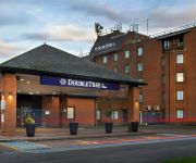
Hilton Manchester Airport
PLUS MANCHESTER AIRPORT WILMSL
Hallmark Manchester Airport
DIDSBURY HOUSE HOTEL
Clayton Manchester Airport
ELEVEN DIDSBURY PARK HOTEL
Stockport Central
Cheadle House
Britannia Country House
Crowne Plaza MANCHESTER AIRPORT
Videos from this area
These are videos related to the place based on their proximity to this place.
The Old Parsonage, Didsbury, Heritage and Renovation Project By Select Interiors
The Old Parsonage Renovation by Select Interiors For more information call 0161 445 4040 or visit www.select-interiors.com.
Exhale Therapy Spa Didsbury Manchester
Exhale Therapy Spa Didsbury Manchester UK Promotional Video detailing services available at this Didsbury spa. www.exhale-therapy.com. Services include Massage, Colonic Hydrotherapy, Turkish...
The Great Hole of Didsbury
On April 29th, 2009, a large and mysterious hole appeared on a busy main road in Didsbury South Manchester.
VILLAGE Hotel Manchester Cheadle
Welcome to the VILLAGE Hotel Manchester Cheadle. Learn more about our 117 modern guest rooms, 4 conference rooms, Verve Grill, Victory Pub & Kitchen and our extensive Leisure Facilities....
20150315 Kill up the hills: Man Tri Sunday Club Ride up Cat & Fiddle and the Long Hill
Didsbury, Brickworks, Mac, Cat & Fiddle, Buxton, Long Hill, Disley, Stockport, Didsbury.
McCarthy & Stone - Dutton Court, Cheadle Hulme
Dutton Court is a development of 68 one and two bedroom Assisted Living apartments for the over 70s situated on Station Approach, off Station Road in Cheadle Hulme. The location couldn't...
Manchester airport walkway from T1 to T2
this is the walkway from Terminal 1 to Terminal 2 on Manchester's international airport. Essentially a suspended airconditioned tube with carousels. Journey time from T1 to T2 approximately 15 minutes.
Waterside Spin Class with Alice
Spin is a great cardio workout that guarantees to leave you on a high! Classes available throughout the week.
AiryFairy - Brownie Making
This is how we make our gorgeous brownie's, mmmm.... www.airyfairycupcakes.co.uk AiryFairy Cake Boutique 24 School Lane Didsbury Manchester.
Videos provided by Youtube are under the copyright of their owners.
Attractions and noteworthy things
Distances are based on the centre of the city/town and sightseeing location. This list contains brief abstracts about monuments, holiday activities, national parcs, museums, organisations and more from the area as well as interesting facts about the region itself. Where available, you'll find the corresponding homepage. Otherwise the related wikipedia article.
Parrs Wood
Parrs Wood is an area of East Didsbury, in the southern part of the city of Manchester, England. It incorporates part of Wilmslow Road and is home to Parrs Wood High School and Sixth Form Centre, a Tesco supermarket, and Parrs Wood Entertainment Centre. Whilst there are some distinct features to Parrs Wood, it has no definite area and incorporates part of East Didsbury.
Cheadle (UK Parliament constituency)
Cheadle is a borough constituency represented in the House of Commons of the Parliament of the United Kingdom. It elects one Member of Parliament (MP) by the first-past-the-post voting system. It is a marginal seat between the Conservatives and the Liberal Democrats. From 1970 until 2001 it was held by the Conservatives, but is now held by the Liberal Democrats.
East Didsbury railway station
East Didsbury is a suburban railway station in the south of the city of Manchester, England. It stands on the Styal Line, between Longsight (Slade Lane Junction) and Wilmslow. It is served by Manchester-Crewe trains operated by Northern Rail, and by Manchester Airport services operated by First TransPennine Express.
Parrs Wood High School
Parrs Wood High School is a specialist technology state comprehensive secondary school and higher education college situated in East Didsbury, Manchester, England, specifically, behind Parrs Wood Entertainment Complex off of Wilmslow Road. It educates young people through the ages of 11 to 18 years; A-Levels are taught at the Parrs Wood Sixth Form Centre, although this is directly integrated with the main school. It was awarded specialist status in technology by the Specialist Schools Trust.
The Barlow RC High School
The Barlow RC High School & Specialist Science College is a comprehensive school in Didsbury in south Manchester, England. Dedicated to Saint Ambrose Barlow, the local, Catholic martyr and saint, the school was established in 1985 by the merger of Hollies RC High School for Girls and St Mark's RC High School for Boys. The Barlow is an inclusive Roman Catholic Secondary School in the Roman Catholic Diocese of Salford maintained by the Manchester Education Authority.
Ladybrook Valley
The Ladybrook Valley begins in the English Peak District and runs through Stockport. In its 15 km course the brook falls 275 m. At various points it is called Bollinhurst Brook, Norbury Brook, the River Ladybrook and the Mickerbrook. The valley has some notable features along its course including Bramall Park and the seven arches railway viaduct in Cheadle Hulme. South of Hazel Grove it is used to delineate the boundary between Greater Manchester and Cheshire.
Parrs Wood Sixth Form Centre
Parrs Wood Sixth Form Centre (also referred to as 6th Form) is a sixth-form college which is part of the Parrs Wood Technology College school campus and is located in (East) Didsbury, Manchester. Parrs Wood Sixth Form opened in 2000 after the rebuilding of the main school.
St Mary's Church, Cheadle
St Mary's Church, Cheadle, is located in High Street, Cheadle, Greater Manchester, England. It is designated by English Heritage as a Grade I listed building. It is an active Anglican parish church in the diocese of Chester, the archdeaconry of Macclesfield and the deanery of Cheadle. Its benefice is united with that of St Cuthbert, Cheadle.
The Towers (Manchester)
The Towers (later known as the Shirley Institute, and then the BTTG) is a research establishment for new technologies in cotton production. The Shirley Institute was established in 1920 at a cost of £10,000 to accommodate the newly formed British Cotton Industry Research Association. It is a Grade II* listed building in the suburb of Didsbury, located 6 miles miles south of Manchester, England.
Shirley Institute
The Shirley Institute was established in 1920 as the British Cotton Industry Research Association at The Towers in Didsbury, Manchester as a research centre dedicated to cotton production technologies. It was at the Institute that Ventile was invented. It was funded by the Cotton Board through a statutory levy. The BCRA merged with the British Rayon Research Association to form the Cotton, Silk, and Man-Made Fibres Research Association in 1961.
Cheadle LNW railway station
Cheadle LNW railway station was a railway station that served Cheadle, Cheshire between 1866 and its closure in 1917.
Parrs Wood House
Parrs Wood House in Wilmslow Road, Didsbury, Manchester, England, is an 18th-century Georgian villa described by Pevsner as "a poorer man's Heaton Hall. " It was designated a Grade II* listed building on 25 February 1952. The "white stucco mansion" consists of a "square main block with (two) unequal service wings on (the) north side. It is of two storeys and [three three] bays [with with] a three-window service range to the left.


