Safety Score: 3,0 of 5.0 based on data from 9 authorites. Meaning we advice caution when travelling to United Kingdom.
Travel warnings are updated daily. Source: Travel Warning United Kingdom. Last Update: 2024-08-13 08:21:03
Explore Wetton
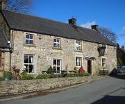
Wetton in Staffordshire (England) is located in United Kingdom about 131 mi (or 211 km) north-west of London, the country's capital.
Local time in Wetton is now 12:10 AM (Wednesday). The local timezone is named Europe / London with an UTC offset of zero hours. We know of 8 airports in the wider vicinity of Wetton, of which 5 are larger airports. The closest airport in United Kingdom is Manchester Woodford Airport in a distance of 21 mi (or 34 km), North-West. Besides the airports, there are other travel options available (check left side).
There are several Unesco world heritage sites nearby. The closest heritage site in United Kingdom is Liverpool – Maritime Mercantile City in a distance of 41 mi (or 65 km), North-East. Also, if you like golfing, there are multiple options in driving distance. We found 1 points of interest in the vicinity of this place. If you need a place to sleep, we compiled a list of available hotels close to the map centre further down the page.
Depending on your travel schedule, you might want to pay a visit to some of the following locations: Bradley, Rodsley, Shirley, Yeldersley and Matlock. To further explore this place, just scroll down and browse the available info.
Local weather forecast
Todays Local Weather Conditions & Forecast: 13°C / 55 °F
| Morning Temperature | 8°C / 46 °F |
| Evening Temperature | 10°C / 49 °F |
| Night Temperature | 9°C / 48 °F |
| Chance of rainfall | 0% |
| Air Humidity | 83% |
| Air Pressure | 1030 hPa |
| Wind Speed | Light breeze with 3 km/h (2 mph) from North-West |
| Cloud Conditions | Scattered clouds, covering 47% of sky |
| General Conditions | Scattered clouds |
Thursday, 7th of November 2024
12°C (53 °F)
7°C (45 °F)
Sky is clear, light breeze, clear sky.
Friday, 8th of November 2024
9°C (48 °F)
6°C (44 °F)
Sky is clear, light breeze, clear sky.
Saturday, 9th of November 2024
12°C (53 °F)
8°C (47 °F)
Overcast clouds, light breeze.
Hotels and Places to Stay
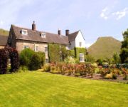
The Izaak Walton Hotel
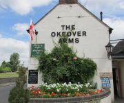
The Okeover Arms
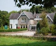
Newton House
The Dog and Partridge Country Inn
Ye Olde Cheshire Cheese Inn
Charles Cotton Hotel
Videos from this area
These are videos related to the place based on their proximity to this place.
Assembling an oak table using draw dowelling
A demonstration by Peter Fox of Fox Country Furniture showing an assembly technique called draw dowelling.
Body Attack
Lesley Emma and Ruth teaching Body Attack and The Dolphin Centre Darlington. Body Attack is a Les Mills Programme (www.lesmills.com) it is an athletic based workout which will improve your...
Apes Tor & Ecton Hill Field Meeting April 21.
Oxford Geology Group Field Meeting, April 21, 2012 facilitated by Ecton Hill Field Studies Association (EHFSA).
dovedale
A slide presentation of the Dovedale walk showing the route map and various photographs of this beautiful stepping stones walk in Derbyshire.
Hartington - Staden Lane (ORPA, N-S)
Subscribe for the love of motorcycles and the great outdoors: http://www.youtube.com/subscription_center?add_user=wiltshirebyways Please click 'S H O W M O R E' for route info: ↓↓↓↓↓↓...
Videos provided by Youtube are under the copyright of their owners.
Attractions and noteworthy things
Distances are based on the centre of the city/town and sightseeing location. This list contains brief abstracts about monuments, holiday activities, national parcs, museums, organisations and more from the area as well as interesting facts about the region itself. Where available, you'll find the corresponding homepage. Otherwise the related wikipedia article.
Long Low, Wetton
Long Low is a Neolithic and Bronze Age site in the English county of Staffordshire. It is about 2 km SE of Wetton. It consists of two round cairns linked by a connecting bank- an unusual layout and one that is unique in England. The northern cairn measures 23 m in diameter and survives to a height of 2.4 m. It appears to be related to other chamber tombs of the Peak District group and was excavated by Samuel Carrington in 1849.
Thor's Cave
Thor's Cave (also known as Thor's House Cavern and Thyrsis's Cave) is a natural cavern located at SK09865496 in the Manifold Valley of the White Peak in Staffordshire, England. It is classified as a Karst cave. Located in a steep limestone crag, the cave entrance, a symmetrical arch 7.5 metres wide and 10 metres high, is prominently visible from the valley bottom, around 80 metres (260 feet) below.
Beeston Tor
Beeston Tor is a limestone cliff in Staffordshire. It overlooks the confluence of the River Hamps with the River Manifold, and is popular with climbers. There was a small station here, of the same name, opened by the narrow gauge (2' 6") Leek and Manifold Valley Light Railway on 27 June 1904, whilst being entirely operated by the North Staffordshire Railway. The station had no siding – unlike most of the stations on the line – but there was a refreshment room.
Manifold Way
The Manifold Way is a footpath and cycle way in Staffordshire, England. Some 8 miles in length, it runs from Hulme End in the north to Waterhouses in the south, mostly through the Manifold Valley and the valley of its only tributary, the River Hamps, following the route of the former Leek and Manifold Valley Light Railway, a 30 gauge line which closed in 1934 after a short life.
Ilam Park
Ilam Park is a 158-acre country park situated in Ilam, on both banks of the River Manifold five miles (8 km) north west of Ashbourne, England, and in the ownership of the National Trust. The property is managed as part of the Trust's South Peak Estate. (Ashbourne, the 'post town', is in Derbyshire and thus so is Ilam's postal address, but the Park, and Ilam, are in Staffordshire; the county boundary being the River Dove).
Sparrowlee railway station
Sparrowlee was the name of a railway station on the Leek and Manifold Valley Light Railway, a 30 narrow gauge line which ran for 8 miles between Hulme End and Waterhouses, in Staffordshire, and was initially operated by the North Staffordshire Railway before being taken over by the LMS.
Hulme End
Castern Hall
Castern Hall is a privately owned 18th century country house, the home of the Hurt family, situated in the Manifold Valley, near Ilam, Staffordshire. It is a Grade II* listed building. It is also spelled 'Casterne'. The grange at Castern was owned by Burton Abbey until the Dissolution of the Monasteries. It was acquired by Roger Hurt, youngest son of Nicholas Hurt of Ashbourne who settled there in the mid 16th century.


