Safety Score: 3,0 of 5.0 based on data from 9 authorites. Meaning we advice caution when travelling to United Kingdom.
Travel warnings are updated daily. Source: Travel Warning United Kingdom. Last Update: 2024-08-13 08:21:03
Discover Salt
Salt in Staffordshire (England) is a town in United Kingdom about 124 mi (or 199 km) north-west of London, the country's capital city.
Current time in Salt is now 05:41 PM (Friday). The local timezone is named Europe / London with an UTC offset of zero hours. We know of 9 airports near Salt, of which 5 are larger airports. The closest airport in United Kingdom is Birmingham International Airport in a distance of 30 mi (or 49 km), South-East. Besides the airports, there are other travel options available (check left side).
There are several Unesco world heritage sites nearby. The closest heritage site in United Kingdom is Pontcysyllte Aqueduct and Canal in a distance of 36 mi (or 58 km), West. Also, if you like playing golf, there are a few options in driving distance. We discovered 2 points of interest in the vicinity of this place. Looking for a place to stay? we compiled a list of available hotels close to the map centre further down the page.
When in this area, you might want to pay a visit to some of the following locations: Stafford, Stoke-on-Trent, Wolverhampton, Walsall and Tong. To further explore this place, just scroll down and browse the available info.
Local weather forecast
Todays Local Weather Conditions & Forecast: 9°C / 47 °F
| Morning Temperature | 5°C / 42 °F |
| Evening Temperature | 7°C / 45 °F |
| Night Temperature | 6°C / 43 °F |
| Chance of rainfall | 0% |
| Air Humidity | 92% |
| Air Pressure | 1027 hPa |
| Wind Speed | Light breeze with 5 km/h (3 mph) from North-East |
| Cloud Conditions | Overcast clouds, covering 100% of sky |
| General Conditions | Overcast clouds |
Saturday, 16th of November 2024
10°C (51 °F)
6°C (43 °F)
Overcast clouds, gentle breeze.
Sunday, 17th of November 2024
7°C (45 °F)
4°C (39 °F)
Light rain, moderate breeze, broken clouds.
Monday, 18th of November 2024
2°C (35 °F)
1°C (34 °F)
Rain and snow, moderate breeze, overcast clouds.
Hotels and Places to Stay
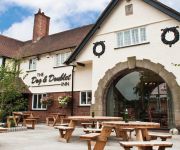
Dog and Doublet Inn
Wyndale Guesthouse
The Swan
Best Western Tillington Hall
Stone House "A Bespoke Hotel"
TRAVELODGE STAFFORD CENTRAL
JCT.13 Holiday Inn Express STAFFORD M6
Stafford North (Spitfire)
Videos from this area
These are videos related to the place based on their proximity to this place.
Model Railway Show - Stafford 2015
My annual pilgrimage to the Stafford Railway Circle Exhibition Another great day out in the cow sheds - well done folks.
[HD] Highlights from 3 Hammers Golf Complex [17th September 2012]
Highlights from an older game. Shot with a Kodak Zx5 mounted on my golf bag.
Cosh Defence 1 - Kaeshi Ryu Jujitsu
www.staffordshirejujitsu.co.uk Defence Against Cosh Attack Uke - Sensei Chris Paines Tori - Junior Sensei Daniel Costa.
Tomoe Nage - Kaeshi Ryu Jujitsu
www.staffordshirejujitsu.co.uk Tomoe Nage Uke - Sensei Barry Daniels Tori - Sensei Richard Tunstall.
Parker's Croft | Stafford | Self-Catering Accommodation
Parker's Croft is a self-catering accommodation, located in Stafford with great travel links to London and Birmingham. It boasts fresh linen, a personal intercom system and a daily maid service,...
Mini Fair 2015 Classic Mini Raffle
At Mini Fair 2015 the British Mini Club raffled a super classic Mini City, one owner with on 30000 miles. Watch the drama unfold as a very lucky family won this superb Mini.
G Scale Society 25th Anniversary Stafford Show
The G Scale Society 25th Anniversary Exhibition at the County Showground, Stafford on 22nd April 2012.
Mini Fair 2013 Part 2
The 2nd part of our quick walk around of the our Mini Fair Show, the UK's leading indoor Classic Mini and new MINI event. Held at Bingley Hall near Stafford in January 2013. Watch for the wonderful...
Videos provided by Youtube are under the copyright of their owners.
Attractions and noteworthy things
Distances are based on the centre of the city/town and sightseeing location. This list contains brief abstracts about monuments, holiday activities, national parcs, museums, organisations and more from the area as well as interesting facts about the region itself. Where available, you'll find the corresponding homepage. Otherwise the related wikipedia article.
Battle of Hopton Heath
The Battle of Hopton Heath, in Staffordshire, was a battle of the First English Civil War, fought on Sunday 19 March 1643 between Parliamentarian forces led by Sir John Gell, 1st Baronet and Sir William Brereton and a Royalist force under Spencer Compton, 2nd Earl of Northampton.
Salt, Staffordshire
Salt is a compact village three miles northeast of Stafford, England situated half a mile southwest of the A51 trunk road and lying on elevated ground above the western side of the Trent valley. The village has an ancient public house with a thatched roof, The Hollybush Inn, dating from the 17th century, reputedly much older, and a village hall. The village church is dedicated to St James the Great and was built on land donated by the Earl of Shrewsbury and largely paid for by him.
Sandon Hall
Sandon Hall is a 19th century country mansion, the seat of the Earl of Harrowby, at Sandon, Staffordshire, 5 miles northeast of Stafford. It is a Grade II* listed building set in 400 acres of parkland. The Manor of Sandon came to Thomas Erdeswicke by marriage in about 1339 and was held by that family until the death of Sampson Erdeswicke in 1603. Thereafter it passed by marriage until it came to William Hamilton, 2nd Duke of Hamilton in the 17th century.
Ingestre railway station
Ingestre and Weston railway station was a former British railway station to serve the village of Ingestre in Staffordshire. It was opened by the Stafford and Uttoxeter Railway in 1867. Originally called Ingestre it was actually much closer to Weston and was renamed (also Ingestre for Weston) in 1870 to avoid confusion with Weston and Ingestre on the North Staffordshire Railway.
Weston and Ingestre railway station
Weston and Ingestre railway station was a former British railway station opened by the North Staffordshire Railway to serve the village of Ingestre in Staffordshire in 1849. Nearby was the Ingestre and Weston station opened by the Stafford and Uttoxeter Railway in 1867 It closed in 1947.
Salt and Sandon railway station
Salt and Sandon railway station was a former British railway station by the Stafford and Uttoxeter Railway to serve the village of Salt in Staffordshire in 1867 Until 1904 it was known simply as "Salt" the name being changed to avoid confusion with Sandon and Salt station on the North Staffordshire Railway. Sandon was actually about two miles away, the station being nearer to Sandon Bank.
Sandon railway station
Sandon railway station was a railway station opened by the North Staffordshire Railway to serve the village of Sandon, Staffordshire, England. For some time it was called Sandon and Salt to avoid confusion with Salt and Sandon railway station opened by the Stafford and Uttoxeter Railway in 1867.
Weston, Staffordshire
Weston is a village situated five miles east of the county town of Stafford en route to the market town of Uttoxeter. The village of Gayton is approximately one mile to the east. Weston was formerly a small farming community. It has now grown to a population of some 1500 people (including Gayton), many of whom commute to work in the local towns.


!['[HD] Highlights from 3 Hammers Golf Complex [17th September 2012]' preview picture of video '[HD] Highlights from 3 Hammers Golf Complex [17th September 2012]'](https://img.youtube.com/vi/x2SsceUj958/mqdefault.jpg)


