Safety Score: 3,0 of 5.0 based on data from 9 authorites. Meaning we advice caution when travelling to United Kingdom.
Travel warnings are updated daily. Source: Travel Warning United Kingdom. Last Update: 2024-08-13 08:21:03
Discover Norbury
Norbury in Staffordshire (England) is a place in United Kingdom about 129 mi (or 207 km) north-west of London, the country's capital city.
Current time in Norbury is now 09:57 PM (Friday). The local timezone is named Europe / London with an UTC offset of zero hours. We know of 9 airports near Norbury, of which 5 are larger airports. The closest airport in United Kingdom is Birmingham International Airport in a distance of 34 mi (or 54 km), South-East. Besides the airports, there are other travel options available (check left side).
There are several Unesco world heritage sites nearby. The closest heritage site in United Kingdom is Pontcysyllte Aqueduct and Canal in a distance of 27 mi (or 44 km), North-West. Also, if you like playing golf, there are a few options in driving distance. We encountered 1 points of interest in the vicinity of this place. If you need a hotel, we compiled a list of available hotels close to the map centre further down the page.
While being here, you might want to pay a visit to some of the following locations: Newport, Chetwynd, Tong, Albrighton and Telford. To further explore this place, just scroll down and browse the available info.
Local weather forecast
Todays Local Weather Conditions & Forecast: 8°C / 47 °F
| Morning Temperature | 5°C / 41 °F |
| Evening Temperature | 9°C / 48 °F |
| Night Temperature | 6°C / 43 °F |
| Chance of rainfall | 0% |
| Air Humidity | 82% |
| Air Pressure | 1027 hPa |
| Wind Speed | Light breeze with 5 km/h (3 mph) from North-East |
| Cloud Conditions | Overcast clouds, covering 89% of sky |
| General Conditions | Overcast clouds |
Saturday, 16th of November 2024
10°C (51 °F)
6°C (43 °F)
Light rain, gentle breeze, overcast clouds.
Sunday, 17th of November 2024
7°C (45 °F)
5°C (40 °F)
Light rain, moderate breeze, scattered clouds.
Monday, 18th of November 2024
2°C (35 °F)
1°C (33 °F)
Rain and snow, moderate breeze, overcast clouds.
Hotels and Places to Stay
Lilleshall National Sports & Conferencing Centre
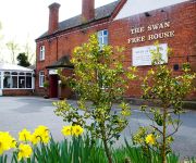
Swan at Forton
Newport/Telford
Videos from this area
These are videos related to the place based on their proximity to this place.
2014 Newport Nocturne
Stone Wheelers represented in the 2014 Newport Nocturne by Wayne Lacey and Matt Cartlidge.
Driving Along The A41 From Tern Hill To Newport, Telford and Wrekin, England 19th February 2011
Driving along the A41, Tern Hill, Rosehill, Sutton Heath, Crickmerry, Mill Green, High Heath, Hinstock, Chetwynd & Newport, Telford and Wrekin , England Videoed on Saturday, 19th February...
Newport Lorry Fire
some drunk idiot set fire to a lorry carring crushed paper... this is some of the video...
NYE 2011 Central square Newport Telford
NYE 2011 Central square Newport Telford CAUTION STROBE IN USE.
Olympic Torch visits Newport, Shropshire 30th May 2012
This video is all about the atmosphere of the occasion.
Tern Valley Steam Fair 2012
Previously known as the Vintage Machinery Show, it is now being held at Chetwynd Deer Park at Newport Shropshire on Sat-Sun 18-19th August 2012. These are some of the shots I took - Starting...
Aikido, passage grade Nidan Aikikai
Passage de grade Nidan Aikikai pendant le stage Summer School 2012 organisé par UKA à Harper Adams Agricultural college, Edgemond, Nr Newport, Shropshire, en Angleterre. Tori: Julien PARNY.
traxxas summit + slash 4x4 snow bashing jumps bmx track 2010
traxxas summit and slash 4x4 huge jumps and frontflips at newport rc bmx track stafford 11.1 lipo in the slash w/ 4x4 beetle body 2x 7.2 nimh in the summit lost the front rpm bumper on...
BMX-Transfer
Me landing my first transfer "Ever" at newport skate park bwaaaap bwwwaaap bwaaaaaap bwaaaap ;)
Videos provided by Youtube are under the copyright of their owners.
Attractions and noteworthy things
Distances are based on the centre of the city/town and sightseeing location. This list contains brief abstracts about monuments, holiday activities, national parcs, museums, organisations and more from the area as well as interesting facts about the region itself. Where available, you'll find the corresponding homepage. Otherwise the related wikipedia article.
Norbury, Staffordshire
Norbury is a village in the Borough of Stafford, in south-west Staffordshire, England. It is situated approximately 4 miles north-east of Newport, just south of the A519 Newport to Newcastle-under-Lyme road, and two miles south-east of Woodseaves. The village gave its name to Norbury Junction, about one mile to the south-east.
Loynton
Loynton is a hamlet on the A519 near the villages of Norbury, and Woodseaves in Staffordshire, England. It lies in the civil parish of Norbury. Loynton Hall is believed to have been built around 1671 by the Higgin Burne family. Whilst there are very few houses and farms, the main feature of the hamlet is a nature reserve, Loynton Moss, which attracts ramblers regularly. Through the nature reserve runs the Shropshire Union Canal.
Norbury Junction
Norbury Junction (Grid Ref SJ 793228) is a canal junction which lies about 1 mile to the south east of Norbury, in Staffordshire, England. It opened in 1835, and closed in 1944, although the main line of the Shropshire Union Canal still runs through it.
Loynton Moss
Loynton Moss is a nature reserve situated at Loynton, near the village of Woodseaves, in Staffordshire, England. Through the reserve runs the Shropshire Union Canal, as it runs from nearby Norbury to High Offley.
Gnosall Rural District
Gnosall was a rural district in Staffordshire, England from 1894 to 1934. It was formed under the Local Government Act 1894 from that part of the Newport rural sanitary district which was in Staffordshire. It consisted of the parishes of Adbaston, Church Eaton, Forton, Gnosall, High Offley, Norbury and Weston Jones. The district was abolished in 1934 under a County Review Order. Most of it became part of the Stafford Rural District, with part going to Cannock Rural District.
Aqualate Mere
Aqualate Mere is the largest natural lake in the English Midlands and is managed as a National Nature Reserve (NNR) by Natural England. It is a remnant of the prehistoric Lake Lapworth. The Mere lies within the borough of Stafford in Staffordshire, England, some 2 km east of the market town of Newport, Shropshire. It is within the grounds of Aqualate Hall, a country house, with a landscaped deer park.
Aqualate Hall
Aqualate Hall a 20th century country house, is located in Staffordshire, England, some 3.5 km east of the market town of Newport, Shropshire and 17 km west of the County town of Stafford. It is a Grade II* listed building The first manor house on the site, built above the mere in the 16th century by Thomas Skrymsher was rebuilt for Edwin Skrymsher (Member of Parliament for Stafford) in the 17th century just after he had completed nearby Forton Hall.
Back Brook, English Midlands
The Back Brook is a minor watercourse in the English counties of Shropshire and Staffordshire, in places forming the boundary between the two, and located generally to the east/southeast of the town of Newport. It flows into Aqualate Mere.


