Safety Score: 3,0 of 5.0 based on data from 9 authorites. Meaning we advice caution when travelling to United Kingdom.
Travel warnings are updated daily. Source: Travel Warning United Kingdom. Last Update: 2024-08-13 08:21:03
Discover Little Bridgeford
Little Bridgeford in Staffordshire (England) is a town in United Kingdom about 127 mi (or 204 km) north-west of London, the country's capital city.
Current time in Little Bridgeford is now 07:41 PM (Friday). The local timezone is named Europe / London with an UTC offset of zero hours. We know of 9 airports near Little Bridgeford, of which 5 are larger airports. The closest airport in United Kingdom is Birmingham International Airport in a distance of 33 mi (or 52 km), South-East. Besides the airports, there are other travel options available (check left side).
There are several Unesco world heritage sites nearby. The closest heritage site in United Kingdom is Pontcysyllte Aqueduct and Canal in a distance of 32 mi (or 51 km), West. Also, if you like playing golf, there are a few options in driving distance. We discovered 2 points of interest in the vicinity of this place. Looking for a place to stay? we compiled a list of available hotels close to the map centre further down the page.
When in this area, you might want to pay a visit to some of the following locations: Stafford, Stoke-on-Trent, Newport, Tong and Chetwynd. To further explore this place, just scroll down and browse the available info.
Local weather forecast
Todays Local Weather Conditions & Forecast: 8°C / 47 °F
| Morning Temperature | 5°C / 41 °F |
| Evening Temperature | 9°C / 48 °F |
| Night Temperature | 6°C / 42 °F |
| Chance of rainfall | 0% |
| Air Humidity | 89% |
| Air Pressure | 1026 hPa |
| Wind Speed | Light breeze with 5 km/h (3 mph) from East |
| Cloud Conditions | Overcast clouds, covering 96% of sky |
| General Conditions | Overcast clouds |
Saturday, 16th of November 2024
10°C (50 °F)
6°C (43 °F)
Overcast clouds, gentle breeze.
Sunday, 17th of November 2024
7°C (45 °F)
3°C (37 °F)
Light rain, moderate breeze, scattered clouds.
Monday, 18th of November 2024
1°C (34 °F)
1°C (33 °F)
Rain and snow, fresh breeze, overcast clouds.
Hotels and Places to Stay
Days Inn Stafford Roadchef
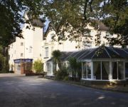
Best Western Tillington Hall
Stone House "A Bespoke Hotel"
The Swan
Wyndale Guesthouse
TRAVELODGE STAFFORD M6
TRAVELODGE STAFFORD CENTRAL
JCT.13 Holiday Inn Express STAFFORD M6
Stafford North (Spitfire)
Videos from this area
These are videos related to the place based on their proximity to this place.
Episode 16: 64 days on MiniMed 640G: Plain Jane vs Cindy Crawford
DiabetesMM640G vs VEO: Volvo vs Porche: Plain Jane vs Cindy Crawford! A brief summary of the difference between having the MiniMed 640G vs VEO during the first week. I have upgrades to a super ...
Staffordshire Air Cadets: Easter Swynnerton 2011
Every year, air cadets from across Staffordshire descend on Swynnerton for an Adventure Training camp with activities such as Kayaking, Canoeing, Raft Building, Rock Climbing, Caving, Shooting,...
Breakfast Arrives 06:00 Swynnerton Base
Mmmm full English at Swynnerton Royal Ordnance Factory. We were housed here for the Black Knots Tercentenary (64th Regiment of Foot)
Swynnerton Stage 2
Pat Naylor & Andy Lawrence on ABMTS Rally 2009, Car 6, Cosworth Escort RWD shakedown event, good venue and enjoyable event although limited by turbo boost problems and ultimately diff failure.
Op Soter
Intro to the exercise and video from the Op Soter. South and East Midlands Camp 2014 - DTE Swynnerton. 12 flights of cadets took part in the exercise, over 200 cadets in 4 days.
John Deere 6430 cambridge rolling Oil seed rape
Preparing minimum till seed bed for oil seed rape with John Deere 6430 and cambridge rollers.
'Dinah' played by Billy Edwards, Ray Owen and Peter Robinson
Recorded by Chris Latham on 14 June 2011. Billy Edwards - Trumpet Peter Robinson - Banjo Ray Owen - Bass and Vocal.
Pre-Virgin class 47s, Norton Bridge 25 July 1997
West Coast Mainline and Cross Country trains before the Virgin livery influence, featuring 47817 (now 57311) in Porterbrook livery, 47825, 47831 (now 57310), 47849 and 47853.
Class 92 drag, Norton Bridge 25 July 1997
Back in the days of the dragging of class 92s from Willesden to Crewe for servicing. 90021 drags 92023, 92006, 92004 and 92026 north.
Various Trains at The Mill Public House near Norton Bridge 15th April 2012 (HD)
After a great day of Spotting in stafford Railway Station and a ice cream! :P We went to the Mill Public House for some Tea. The Mill Public House is the best beer garden in staffordshire but...
Videos provided by Youtube are under the copyright of their owners.
Attractions and noteworthy things
Distances are based on the centre of the city/town and sightseeing location. This list contains brief abstracts about monuments, holiday activities, national parcs, museums, organisations and more from the area as well as interesting facts about the region itself. Where available, you'll find the corresponding homepage. Otherwise the related wikipedia article.
Great Bridgeford
Great Bridgeford is a village in Staffordshire, England. It lies on the A5013 and is the point where the B5405 meets the A5013. The village lies on the West Coast Main Line railway and contains a village hall, and two tennis courts. The railway line at Great Bridgeford was the scene of a major accident and derailment on the evening of 6 June 1932. Four people died and many others were injured in this accident.
Norton Bridge
For the Emperor Norton Bridge, see San Francisco – Oakland Bay Bridge Norton Bridge is a village in Staffordshire, England. Until 2004 it was served by Norton Bridge railway station. Arguably Norton Bridge is a hamlet as it is in the Parish of Chebsey and does not have its own church. Local amenities At present, Norton Bridge is lacking amenities for residents. There is a children's park which consists of four swings and a small (mostly vandalised) climbing frame.
Creswell, Staffordshire
Creswell is a small village on the north-western edge of Stafford, the county town of Staffordshire, England situated on elevated ground above the wide floodplain and extensive marshes of the River Sow. The village, just to the west of the M6 motorway (junction 14), has a population of just a few hundred, although the parish boundary also incorporates the Primepoint business park on the other side of the motorway. The village also lies close to Doxey Marshes.
Norton Bridge railway station
Norton Bridge railway station is four miles north-west of Stafford on the West Coast Main Line near the village of Norton Bridge in Staffordshire, England. The main line platforms were removed before electrification in the 1960s. The island platform serving the Manchester via Stoke-on-Trent branch of the WCML has been out of use since 2004 when the footbridge was removed in order to improve clearances.
Seighford
Seighford is a small village about 3 miles west of Stafford in Staffordshire, England. The ford across a small stream is the origin of the village's name. The village has a red sandstone church, St. Chad's and a Tudor mansion. William White's History, Gazetteer and Directory of Staffordshire(1851) described Seighford is a scattered village above a small brook which flows east from Latford pool to the River Sow.
Cooper Perry Primary School
Cooper Perry Primary School in Seighford, Stafford, England was founded in 1874 and provides an education based on traditional village school values within a stimulating yet safe environment. The school was re-furbished and extended in 2001 as part of Staffordshire's first Private Finance Initiative (PFI). The Victorian frontage hides a modern high tech facility to the rear housing a recording studio and coffee shop.
Ranton, Staffordshire
Ranton is a small village in Staffordshire, England, situated 3.5 miles west of Stafford, 2.5 miles east of Woodseaves and 2 miles northeast of Gnosall.
Tillington, Staffordshire
Tillington is an ancient geographic district about 1½ miles north of Stafford town centre, in the county of Staffordshire, England. Essentially, the district lies within a triangle formed by Eccleshall Road, Stone Road and Crab Lane that narrows southward to a point where the two roads join at Foregate Street. Since records were first kept, the area has been recorded as Tillington.


