Safety Score: 3,0 of 5.0 based on data from 9 authorites. Meaning we advice caution when travelling to United Kingdom.
Travel warnings are updated daily. Source: Travel Warning United Kingdom. Last Update: 2024-08-13 08:21:03
Delve into Kings Bromley
Kings Bromley in Staffordshire (England) is located in United Kingdom about 112 mi (or 180 km) north-west of London, the country's capital town.
Current time in Kings Bromley is now 01:07 PM (Friday). The local timezone is named Europe / London with an UTC offset of zero hours. We know of 9 airports close to Kings Bromley, of which 5 are larger airports. The closest airport in United Kingdom is Birmingham International Airport in a distance of 21 mi (or 33 km), South. Besides the airports, there are other travel options available (check left side).
There are several Unesco world heritage sites nearby. The closest heritage site in United Kingdom is Pontcysyllte Aqueduct and Canal in a distance of 48 mi (or 77 km), West. Also, if you like playing golf, there are some options within driving distance. We encountered 2 points of interest near this location. If you need a hotel, we compiled a list of available hotels close to the map centre further down the page.
While being here, you might want to pay a visit to some of the following locations: Walsall, Rodsley, Netherseal, Shirley and Birmingham. To further explore this place, just scroll down and browse the available info.
Local weather forecast
Todays Local Weather Conditions & Forecast: 8°C / 47 °F
| Morning Temperature | 6°C / 42 °F |
| Evening Temperature | 8°C / 46 °F |
| Night Temperature | 6°C / 43 °F |
| Chance of rainfall | 0% |
| Air Humidity | 74% |
| Air Pressure | 1027 hPa |
| Wind Speed | Gentle Breeze with 6 km/h (3 mph) from North-East |
| Cloud Conditions | Overcast clouds, covering 100% of sky |
| General Conditions | Overcast clouds |
Saturday, 16th of November 2024
10°C (50 °F)
7°C (44 °F)
Light rain, gentle breeze, overcast clouds.
Sunday, 17th of November 2024
8°C (46 °F)
4°C (40 °F)
Light rain, moderate breeze, overcast clouds.
Monday, 18th of November 2024
6°C (42 °F)
0°C (32 °F)
Snow, moderate breeze, overcast clouds.
Hotels and Places to Stay
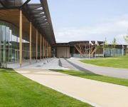
Hilton at St George's Park
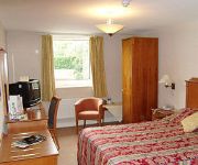
Wychnor Park Country Club by Diamond Resorts
Cathedral Lodge
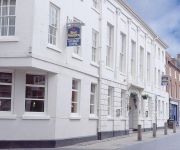
Best Western George
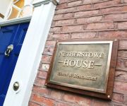
NETHERSTOWE HOUSE
Lichfield North East (A38)
Lichfield City Centre
Videos from this area
These are videos related to the place based on their proximity to this place.
The Nuts come out for New Year at Yoxall
The Nuts are a five piece band from Staffordshire. The dance floor fills when they play cover versions spanning several decades. Here they are at Yoxall for New Years eve celebrations.
Flying Scotsman Vintage Reliability Trial 2014
Fradley Junction, Staffordshire. Friday 4th April 2014 http://www.endurorally.com/pages/flying-scotsman-rally-2014.
Day 1
Day 1 of our week long cruise from Kings Bromley Marina to Nottingham and return. Timelapse video, camera (Ricoh R8 set to take 1 photo every 5 seconds) using Photolapse 3.0 (freeware) to put...
Songkran Festival,2015,Kings Bromley,England
Songkran Festival at Wat Mahathat,Kings Bromley,April 19th,2015,near Burton on Trent,England.Market stalls,Thai New Year festivities,stills from performers.VIP guests.This event well attended...
timelapse T&M kings bromley to rugeley
Timelapse sequence of a cruise from south east of Bridge 54, King's Bromley Wharf to Bridge 64, Rugeley.
Curborough Sprint Course Lap Record - Caterham R500 19th June 2014
Lap record (current at 19th June 2014) of Curborough Sprint Course. Set me - Daniel French, in my Caterham R500 Duratec which I built myself. Follow my story at http://www.caterhamr500.co.uk...
Caterham R500 F1 Drifting @ Curborough
Some more fun sideways moments at Curbs today, with Rich as a passenger.
BARC Curborough 2 Lap Sprint Radical PR6 55.00secs
Fastest run of the day at the BARC Curborough Sprint on the 10th of August 2014. This was a PB of 55.00 secs, enough for FTD on the day but a couple of secs behind the class record. (Speedo...
Curborough sprint course - Filmed by Rotorshot
Thanks to www.trackdaydrivers.com for the on-board shots.
Videos provided by Youtube are under the copyright of their owners.
Attractions and noteworthy things
Distances are based on the centre of the city/town and sightseeing location. This list contains brief abstracts about monuments, holiday activities, national parcs, museums, organisations and more from the area as well as interesting facts about the region itself. Where available, you'll find the corresponding homepage. Otherwise the related wikipedia article.
Fradley Junction
Fradley Junction is a canal junction between Fradley and Alrewas near Lichfield, Staffordshire, England and the point at which the Coventry Canal joins the Trent and Mersey Canal. It opened in 1790, and several of the buildings around it, including The Swan public house, are grade II listed structures.
Elmhurst, Staffordshire
Elmhurst is a small village and civil parish within Lichfield District, in Staffordshire, England. It is located approximately 1.5 miles north of Lichfield. The village is rural in nature consisting of a few farms and a small amount of private houses. It was once the site of Elmhurst Hall a large country residence which once hosted King Edward VII when he visited Lichfield for the centenary of the Staffordshire Yeomanry in 1894.
RAF Lichfield
Royal Air Force Station Lichfield also known as Fradley Aerodrome, was an operational training station from 1940 until 1958. It was situated in Fradley, 2 miles north east of Lichfield, Staffordshire, England. The airfield was the busiest airfield in Staffordshire during World War II. The airfield supported its own units as well as providing safe haven for many more.
Elmhurst Hall
Elmhurst Hall was a country house in the village of Elmhurst, Staffordshire. The house was located approximately 1.5 miles north of the city of Lichfield.
Church of St Michael and All Angels, Hamstall Ridware
The Church of St Michael and All Angels is a parish church and Grade I listed building in the village of Hamstall Ridware, Staffordshire. The church is situated in a remote position to the north of the village accessed by a 250 m pathway through pasture land. The church is situated on a gentle slope 160 m west of the River Blithe. The church was founded in 1130—1150 but the majority of the present church was built of ashlar sandstone in the 14th and 15th centuries.


