Safety Score: 3,0 of 5.0 based on data from 9 authorites. Meaning we advice caution when travelling to United Kingdom.
Travel warnings are updated daily. Source: Travel Warning United Kingdom. Last Update: 2024-08-13 08:21:03
Delve into Great Chatwell
Great Chatwell in Staffordshire (England) is a city located in United Kingdom about 125 mi (or 201 km) north-west of London, the country's capital town.
Current time in Great Chatwell is now 12:26 AM (Monday). The local timezone is named Europe / London with an UTC offset of zero hours. We know of 9 airports closer to Great Chatwell, of which 5 are larger airports. The closest airport in United Kingdom is Birmingham International Airport in a distance of 30 mi (or 48 km), South-East. Besides the airports, there are other travel options available (check left side).
There are several Unesco world heritage sites nearby. The closest heritage site in United Kingdom is Pontcysyllte Aqueduct and Canal in a distance of 30 mi (or 49 km), North-West. Also, if you like playing golf, there are some options within driving distance. We saw 1 points of interest near this location. In need of a room? We compiled a list of available hotels close to the map centre further down the page.
Since you are here already, you might want to pay a visit to some of the following locations: Tong, Newport, Albrighton, Chetwynd and Ryton. To further explore this place, just scroll down and browse the available info.
Local weather forecast
Todays Local Weather Conditions & Forecast: 6°C / 43 °F
| Morning Temperature | 4°C / 40 °F |
| Evening Temperature | 5°C / 41 °F |
| Night Temperature | 4°C / 39 °F |
| Chance of rainfall | 8% |
| Air Humidity | 85% |
| Air Pressure | 1012 hPa |
| Wind Speed | Moderate breeze with 11 km/h (7 mph) from West |
| Cloud Conditions | Overcast clouds, covering 100% of sky |
| General Conditions | Moderate rain |
Tuesday, 19th of November 2024
2°C (35 °F)
-1°C (31 °F)
Rain and snow, moderate breeze, overcast clouds.
Wednesday, 20th of November 2024
3°C (37 °F)
0°C (33 °F)
Light snow, gentle breeze, clear sky.
Thursday, 21st of November 2024
4°C (40 °F)
-1°C (30 °F)
Light snow, fresh breeze, scattered clouds.
Hotels and Places to Stay
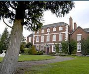
Park House Hotel
Lilleshall National Sports & Conferencing Centre
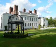
Haughton Hall
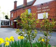
Swan at Forton
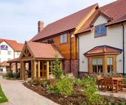
Newport/Telford
Videos from this area
These are videos related to the place based on their proximity to this place.
Hurry on Sundown
A Time Lapse movie shot mostly with a Canon 400D until it broke after around 60000 shutter releases, & then using both a Canon S5is with CHDK interval firmware, & a small Canon Powershot A80...
Aqualate Winter Ramble
A 'Winter Ramble' organised by Natural England around Aqualate Mere on the Shropshire- Staffordshire border. As the guide explains, Aqualate Mere is the largest natural lake in the Midlands,...
Norton 908cc Cafe Racer - Test Drive
The Norton was taken out for it's first run this afternoon, all went well and attached is a short video of the run. http://nochangegiven.com.
Gnosall History: Railway, Gnosall, Staffs, England
Historical information about the railway from photos, documents, and memories.
Gnosall History: Newport Road, Gnosall, Staffs, England
Historical tour of Newport Road from photos, documents, and memories.
Shropshire Union Canal - Shelmore Embankment
The briefest of glimpses of the only kingfisher we saw on this trip on the embankment which caused the good Mr Telford many years of trouble.
At Norbury Junction on the Shropshire Union Canal
It is a lovely sunny August afternoon stroll to Norbury Junction, a chance to relax and watch the boats chug by, and maybe paint a picture, or admire some traditional canal art.
Shropshire Union Canal - Lord Vernon's Wharf
Either side of Bridge No 25 and apparently the site of a former Cadbury's depot.
Videos provided by Youtube are under the copyright of their owners.
Attractions and noteworthy things
Distances are based on the centre of the city/town and sightseeing location. This list contains brief abstracts about monuments, holiday activities, national parcs, museums, organisations and more from the area as well as interesting facts about the region itself. Where available, you'll find the corresponding homepage. Otherwise the related wikipedia article.
Weston-under-Lizard
Weston under Lizard is a village in the South Staffordshire district of Staffordshire, England. It constitutes a civil parish with Blymhill, called Blymhill and Weston-under-Lizard. The village is on the A5 (here following the course of Watling Street), and is very close to the county boundary with Shropshire. Nearby places are Blymhill, and Tong. To the south of the village is Weston Park the ancestral home of the Earls of Bradford.
Blymhill and Weston-under-Lizard
Blymhill and Weston-under-Lizard is a civil parish in the South Staffordshire district of Staffordshire, near the border with Shropshire in England. According to the 2001 census, it had a population of 654. The parish includes Blymhill, Weston-under-Lizard, Brineton and Orslow. In medieval times, the manor was held by the Brereton family, baronets of Handforth, Cheshire.
Moreton, Staffordshire
Moreton is a small rural village in Staffordshire, England. It lies 3.5 miles south-west from Gnosall railway station, and 4 miles south-east from Newport, both on the Stafford and Shrewsbury section of the former London and North Western Railway.
Way for the Millennium
The Way for the Millennium is an east-west route across Staffordshire, deliberately designed for easy walking, using towpaths, old railway lines and footpaths and visiting attractive countryside and green spaces.
Outwoods, Stafford
Outwoods is a hamlet in the English county of Staffordshire. Outwoods is located in the extreme west of the county near to the town of Newport, Shropshire. It forms part of the civil parish of Gnosall and the borough of Stafford.
Woodcote Hall
Woodcote Hall is situated on the edge of Newport, Shropshire on the Staffordshire border and is currently a nursing home. Rebuilt in 1875 by F.P. Cockerell after the 18th century mansion was destroyed by fire. There are remains of the original house at the north-west and south-west sides and there are vestiges of 17th century fabric at the rear (south), one room contains fireplaces with inscription " T. C. 1767" and stopped and chamfered ceiling beams. ' T. C. ' stands for Thomas Cotes.
Elder Well
The Elder Well is a holy well located at Blymhill Marsh, close to the village of Blymhill, Staffordshire. It can be found among Elder trees on the north side of the Holy Well plantation. The well is a spring that emerges into a sandstone structure set into the ground. The structure is approximately 1 m square and 70 cm in depth. The well was said to be blessed with medicinal properties and in particular to be a remedy for afflictions of the eyes.
White Sitch
White Sitch is an ancient lake in the parish of Blymhill, 1 mile to the W of the village. It is situated in a tract of cropped and degraded woodland currently owned by the Bradford Estate. The woods are used for breeding pheasant and the lake for commercial carp fishing.


