Safety Score: 3,0 of 5.0 based on data from 9 authorites. Meaning we advice caution when travelling to United Kingdom.
Travel warnings are updated daily. Source: Travel Warning United Kingdom. Last Update: 2024-08-13 08:21:03
Explore Claymills
The district Claymills of in Staffordshire (England) is located in United Kingdom about 111 mi north-west of London, the country's capital.
If you need a place to sleep, we compiled a list of available hotels close to the map centre further down the page.
Depending on your travel schedule, you might want to pay a visit to some of the following locations: Netherseal, Shirley, Rodsley, Yeldersley and Derby. To further explore this place, just scroll down and browse the available info.
Local weather forecast
Todays Local Weather Conditions & Forecast: 9°C / 47 °F
| Morning Temperature | 5°C / 42 °F |
| Evening Temperature | 7°C / 45 °F |
| Night Temperature | 5°C / 42 °F |
| Chance of rainfall | 0% |
| Air Humidity | 88% |
| Air Pressure | 1027 hPa |
| Wind Speed | Gentle Breeze with 5 km/h (3 mph) from East |
| Cloud Conditions | Overcast clouds, covering 99% of sky |
| General Conditions | Overcast clouds |
Saturday, 16th of November 2024
10°C (51 °F)
7°C (44 °F)
Overcast clouds, gentle breeze.
Sunday, 17th of November 2024
7°C (45 °F)
2°C (36 °F)
Light rain, moderate breeze, scattered clouds.
Monday, 18th of November 2024
2°C (35 °F)
1°C (33 °F)
Rain and snow, moderate breeze, overcast clouds.
Hotels and Places to Stay
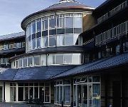
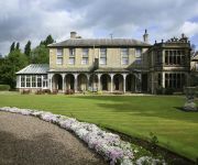
Hallmark Derby Mickleover Mickleover Court
Mercure Burton upon Trent Newton Park Hotel
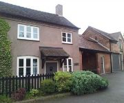
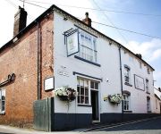
The Unicorn Inn
The Boot
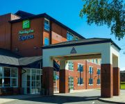
Holiday Inn Express BURTON UPON TRENT
Burton On Trent East
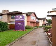
Premier Inn Burton On Trent Central
Videos from this area
These are videos related to the place based on their proximity to this place.
Chilli Eating Contest Burton on Trent Winter Chili Festival December 2013
The First Burton on Trent Chili Festival & Chilli eating contest held on Sunday 1st December in the grounds of National Brewery Centre. With each round the Scoville Heat Units (SHU) goes up...
Chilli Eating Contest Burton on Trent 2014
THE OFFICIAL Burton on Trent Chili Eating Contest video this year held at the National Brewery Centre. As each round gets Hotter and Hotter the contestants start to drop out........ How hot...
Railworks 2013, EWS Class 66 at Burton on Trent
Railworks 2013, EWS Class 66 (V2) at Burton on Trent, jetgriff's Bromsgrove - Derby route.
Paving Slabs - Project Patio Packs, Burton on Trent
A short video/slide showing some of Barton Fields range of patio paving packs. A great way to purchase paving, packed with different sized decorative flags. The packs can be seen on display...
Rat Control Burton on Trent - Call 01332 402882
Rat Control Burton on Trent. If you've got a rat in your house, garden or business then you need Rat Control Burton on Trent. Call us on 01332 402882 and we can usually come and sort your Burton...
Cycle From Clays Lane (branston) to Shobnall using my gopro hero
First Test of My GoPro Hero Camera, Riding a Viking SanMarino Roadbike. Start from Clays Lane in Branston (Burton on trent) and Finish on Grange Street in Shobnall Area of Burton on trent....
Driving Lessons Burton on Trent - Learn to Drive in Burton on Trent
Driving Lessons Burton on Trent - Learn to Drive in Burton on Trent with OMG! I'm Driving. Your first five lessons for just £56. Call Dave now on 07753 547132 or visit http://www.drivinglessonsbu...
Part 1/ Last day at Ind Coope Burton Brewery Curzon street Burton on Trent
Last day of the Ind Coope Canning & Bottling stores in Curzon street Burton upon Trent.1989.
The London 2012 Olympic Torch Arrives in Burton Upon Trent
The 2012 Olympic Torch passing through Burton On Trent on 30/06/2012.
Skoda Fabia 1.9 TDI 315bhp dyno run. Good power but more to come!
My car does a 315bhp power run at CC Tuning (in Burton on Trent) - It's first official 300+ dyno, This was backed up the next day at a different dyno where it did 312. That's me flicking...
Videos provided by Youtube are under the copyright of their owners.
Attractions and noteworthy things
Distances are based on the centre of the city/town and sightseeing location. This list contains brief abstracts about monuments, holiday activities, national parcs, museums, organisations and more from the area as well as interesting facts about the region itself. Where available, you'll find the corresponding homepage. Otherwise the related wikipedia article.
Claymills Pumping Station
Claymills Pumping Station is a restored Victorian sewage pumping station on the north side of Burton upon Trent, Staffordshire, England. It was designed by James Mansergh and used to pump sewage to the sewage farm at Etwall. The main pumping plant consists of four Woolf compound, rotative, beam pumping engines. These are arranged in mirror image pairs, in two separate engine houses, with a central boiler house and chimney. The engines were built in 1885 by Gimson and Company of Leicester.
Pirelli Stadium
The Pirelli Stadium is an association football stadium on Princess Way in Burton upon Trent, East Staffordshire, England. It was built in 2005 and is the current home of Burton Albion F.C. , replacing the club's old Eton Park home, also on Princess Way, which was demolished and developed into housing.
Derby Airfield
Derby Airfield is located 6 NM southwest of Derby, East Midlands, England. Derby Aerodrome has a CAA Ordinary Licence (Number P785) that allows flights for flying instruction as authorised by the licensee (Derby Aero Club & Flying School). The aerodrome is not licensed for night use. It is the home of Airspeed Aviation Ltd and operates Derby Aero Club. Airspeed Aviation Ltd is a CAA and EASA Approved Aircraft Maintenance Organisation holding approvals EASA Part M Subpart F (Approval Number UK.
A516 road
The A516 road is a road in Derbyshire that is used mostly for traffic flowing from the A50 to the A38. It finishes in Derby.
Burton Abbey
Burton Abbey at Burton upon Trent in Staffordshire, England, was originally founded in the 7th or 9th century by St Modwen or Modwenna; and later refounded in 1003 as a Benedictine abbey by Wulfric Spott, a thegn possibly descended from King Alfred. He was known to have been buried in the abbey cloister in 1010, alongside the grave of his wife.
Jinnie Trail
The Jinnie Nature Trail is a conservation area stretching along a narrow man-made valley between the villages of Rolleston on Dove and Stretton. It was originally built as a railway line stretching from Tutbury and into Burton on Trent. However, today it remains as a rural walk kept as a nature conservation area stretching approximately 2 kilometres.
Bass Worthington Ground
The Bass Worthington Ground (also known as the Town Ground) was a cricket ground located along Derby Road in Burton upon Trent, Staffordshire. The ground was bordered to the east and north by the Pirelli tyre factory.
Ind Coope Ground
The Ind Coope Ground is a cricket ground in Burton, England where Derbyshire CCC played between 1938 and 1980. In most years, the ground would host at least one County Championship match. Staffordshire CCC used the ground between 1987 and 1991 for NatWest Trophy and Minor Counties Championship matches. The ground hosted 38 first-class matches and 7 List A matches. The ground is named after the former brewing firm Ind Coope.
Burton-on-Trent CC Ground
Burton-on-Trent Cricket Club Ground is a cricket ground in Burton, England used by Derbyshire CCC for 13 first-class matches between 1914 and 1937. The ground also hosted two ICC Trophy matches - Canada v Hong Kong in 1982 and East Africa v Malaysia in 1986. Game Information: Game Statistics: first-class:
St. Chad's Church, Burton-on-Trent
St Chad's Church is an Anglican church on Hunter Street in Burton upon Trent, Staffordshire England. It is in the diocese of Lichfield and the advowson is vested in the bishop. In 1979 the church was registered as a Grade I listed building.
National Brewery Centre
The National Brewery Centre (formerly the Bass Museum and later the Coors Visitor Center) is a museum and tourist attraction in Burton upon Trent, Staffordshire, England. The centre celebrates the brewing heritage of Burton and features exhibits showcasing the history of brewing techniques. The centre also houses a bar and cafe, a history of the town, a collection of historic vehicles, a micro brewery and a shire horse collection.
Stretton and Claymills railway station
Stretton and Claymills railway station is a former railway station in Stretton, near Burton upon Trent, Staffordshire.
Rolleston-on-Dove railway station
Rolleston-on-Dove railway station is a former railway station built to serve Rolleston in Staffordshire.
Egginton railway station
Egginton railway station was a former railway station in Egginton, Derbyshire. It was opened by the North Staffordshire Railway. However it closed in 1878 when the Great Northern Railway (Great Britain) opened its Derbyshire Extension and a joint station was built at Egginton Junction. The buildings next to the Etwall Road level crossing, however, have survived and are still occupied.
Egginton Junction railway station
Egginton Junction railway station is a former railway station in Egginton, Derbyshire.
Horninglow railway station
Horninglow railway station is a former railway station in Horninglow, near Burton upon Trent, Staffordshire.
St Mark's, Winshill
St Mark's is the Church of England parish church for the Burton upon Trent suburb of Winshill, east of the town. It is part of the Diocese of Derby. Built to the west of Winshill and commanding a prominent spot high above Burton upon Trent, St Mark's is a landmark that can be seen for miles along the valley of the River Trent. St Mark's church was (... ) paid for by the brewer John Gretton of Bladon House (d. 1867), was opened in 1869.
St Mary's, Stretton
St Mary's is the Church of England parish church for the village of Stretton, north of Burton upon Trent. It is part of the Diocese of Lichfield. St Mary's church was (... ) wholly paid for by John Gretton (d. 1899) of Bladon House in Winshill, a native of Stretton and a director of the Burton brewers Bass, Ratcliff, and Gretton. (... ) dedicated to St. Mary, it was designed by J. T. Micklethwaite of Westminster on an aisled, cruciform plan with a massive crossing tower.
St Modwen's, Burton upon Trent
St Modwen's is the Church of England town centre parish church for Burton upon Trent. It is part of the Diocese of Lichfield.
Eton Park
Eton Park was an association football stadium located in Burton upon Trent, England. It was the home ground of Burton Albion F.C. from 1958 to 2005 when they moved to the £7.2 million Pirelli Stadium. The Brewers moved to the ground on 20 September 1958, coinciding with their promotion to the Southern League, and by the time of their departure 47 years later, they were members of the Conference.
76 Club
76 Club was a nightclub in Burton upon Trent, Staffordshire, England. During the 1970s-1980s, the club featured shows by well-known rock bands. In 1976, the Sex Pistols recorded their live album Anarchy in the UK: Live at the 76 Club. Other bands that performed at the club include AC/DC, Dire Straits, Judas Priest, Motörhead, Skid Row, Suzi Quatro, Thin Lizzy, and Ultravox.
Battle of Burton Bridge (1643)
The Battle of Burton Bridge was fought between Royalist and Parliamentarian forces at Burton upon Trent on 4 July 1643 during the First English Civil War. By the time of the battle the town, which had at various times been held by both sides, was garrisoned by a Parliamentarian unit under the command of Captain Thomas Sanders and the town's military governor, Colonel Richard Houghton.
Battle of Burton Bridge (1322)
The 1322 Battle of Burton Bridge was fought between Thomas, 2nd Earl of Lancaster and his cousin Edward II of England during the Despenser War. Edward's army was proceeding northwards to engage Lancaster, having defeated his Marcher Lord allies in Wales. Lancaster fortified the bridge at Burton upon Trent, an important crossing of the River Trent, in an attempt to prevent the king from proceeding.
Bladon Castle
Bladon Castle is a folly, partly converted into a country house, located some 600 yards southwest of the village of Newton Solney in South Derbyshire, 1 mile northeast of Burton-on-Trent and close to the point at which the River Trent forms the boundary with Staffordshire. The building lies within the grounds of Bladon House School.
Cooper's Square
Coopers Square is an indoor shopping centre located in Burton upon Trent, Staffordshire, England. It is owned by the Grosvenor Group. Formerly called Burton Shopping Centre; the site was opened in 1970 by HRH Princess Alexandra. The total retail area for the shopping centre is 35,766 m (385,000 sq ft). The shopping centre has 800 car parking spaces, with a ground car park as well as a rooftop car park.


