Safety Score: 3,0 of 5.0 based on data from 9 authorites. Meaning we advice caution when travelling to United Kingdom.
Travel warnings are updated daily. Source: Travel Warning United Kingdom. Last Update: 2024-08-13 08:21:03
Delve into Calton
Calton in Staffordshire (England) is a town located in United Kingdom about 128 mi (or 206 km) north-west of London, the country's capital town.
Time in Calton is now 08:13 PM (Sunday). The local timezone is named Europe / London with an UTC offset of zero hours. We know of 8 airports closer to Calton, of which 5 are larger airports. The closest airport in United Kingdom is Manchester Woodford Airport in a distance of 24 mi (or 39 km), North-West. Besides the airports, there are other travel options available (check left side).
There are several Unesco world heritage sites nearby. The closest heritage site in United Kingdom is Liverpool – Maritime Mercantile City in a distance of 43 mi (or 70 km), North-East. Also, if you like the game of golf, there are some options within driving distance. We saw 1 points of interest near this location. In need of a room? We compiled a list of available hotels close to the map centre further down the page.
Since you are here already, you might want to pay a visit to some of the following locations: Rodsley, Bradley, Shirley, Yeldersley and Matlock. To further explore this place, just scroll down and browse the available info.
Local weather forecast
Todays Local Weather Conditions & Forecast: 12°C / 53 °F
| Morning Temperature | 14°C / 57 °F |
| Evening Temperature | 9°C / 48 °F |
| Night Temperature | 8°C / 46 °F |
| Chance of rainfall | 21% |
| Air Humidity | 88% |
| Air Pressure | 988 hPa |
| Wind Speed | Strong breeze with 21 km/h (13 mph) from North |
| Cloud Conditions | Overcast clouds, covering 100% of sky |
| General Conditions | Heavy intensity rain |
Monday, 25th of November 2024
7°C (44 °F)
4°C (39 °F)
Light rain, fresh breeze, scattered clouds.
Tuesday, 26th of November 2024
5°C (40 °F)
2°C (36 °F)
Sky is clear, moderate breeze, clear sky.
Wednesday, 27th of November 2024
4°C (39 °F)
2°C (36 °F)
Light rain, moderate breeze, scattered clouds.
Hotels and Places to Stay
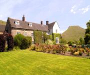
The Izaak Walton Hotel
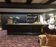
The Dog and Partridge Country Inn
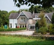
Newton House
Videos from this area
These are videos related to the place based on their proximity to this place.
PES 2015 Cardiff City vs Zenit (PEN F30)
PEN Season 6 PS4 Premiership Fixture 30: Bluebird Vs Goat261 ProEvoNetwork.com.
PES 2015 Zenit vs Stoke City (PEN F7)
PEN Season 6 PS4 Premiership Fixture 7: Goat261 Vs Venom ProEvoNetwork.com.
PES 2015 Zenit vs Cardiff City (PEN F9)
PEN Season 6 PS4 Premiership Fixture 3: Goat261 Vs Bluebird ProEvoNetwork.com.
PES 2014 Zenit vs Stoke City (PEN F5)
PEN PS3 Premiership Season 5. Fixture 5: Goat261 Vs Venom ProEvoNetwork.com.
PES 2013 Fiorentina vs Stoke City (PEN F7)
Season 3, PEN PS3 Premiership Fixture 1: Goat261 Vs Bridgey proevonetwork.com.
PES 2013 Benfica vs Porto (PEN F13)
PEN Xbox Division 1 Season 3 Fixture 13: Nirvana vs Goat2611 proevonetwork.com.
PES 2013 Porto vs Sochaux (PEN F14)
PEN Xbox Division 1 Season 3 Fixture 1: Goat2611 Vs Mancan proevonetwork.com.
PES 2014 Zenit vs Cardiff (PEN F8)
PEN PS3 Premiership Season 5. Fixture 8: Bluebird vs Goat proevonetwork.com.
Videos provided by Youtube are under the copyright of their owners.
Attractions and noteworthy things
Distances are based on the centre of the city/town and sightseeing location. This list contains brief abstracts about monuments, holiday activities, national parcs, museums, organisations and more from the area as well as interesting facts about the region itself. Where available, you'll find the corresponding homepage. Otherwise the related wikipedia article.
Leek and Manifold Valley Light Railway
The Leek and Manifold Valley Light Railway (L&MVLR) was a narrow gauge railway in Staffordshire, Great Britain that operated between 1904 and 1934. When in operation, the line mainly carried milk from dairies in the region, acting as a feeder to the standard gauge system. It also provided passenger services to the small villages and beauty spots along its route.
Waterhouses, Staffordshire
Waterhouses is a village in the south of the Staffordshire Peak District. It is around 8 miles from Leek and Ashbourne, being nearly the halfway point between the two towns on the A523 road, which roughly follows the southern boundary of the Peak District National Park. Waterhouses is also a civil parish, created in 1934 when the parishes of Calton, Cauldon, Ilam and Waterfall were merged; previously the village of Waterhouses was on the boundary of Waterfall and Cauldon parishes.
Ilam Park
Ilam Park is a 158-acre country park situated in Ilam, on both banks of the River Manifold five miles (8 km) north west of Ashbourne, England, and in the ownership of the National Trust. The property is managed as part of the Trust's South Peak Estate. (Ashbourne, the 'post town', is in Derbyshire and thus so is Ilam's postal address, but the Park, and Ilam, are in Staffordshire; the county boundary being the River Dove).
Blore
Blore is a small village and parish in the Staffordshire Moorlands District of England. It is on an acclivity above Dovedale, three and a half miles north west of Ashbourne, including the hamlet of Swinscoe, one mile (1.6 km) to the south and a part of the parochial chapelry of Calton. The ecclesiastical parish is Blore Ray with Okeover and the civil parish is Blore-with-Swinscoe, both with slightly different boundaries.
Sparrowlee railway station
Sparrowlee was the name of a railway station on the Leek and Manifold Valley Light Railway, a 30 narrow gauge line which ran for 8 miles between Hulme End and Waterhouses, in Staffordshire, and was initially operated by the North Staffordshire Railway before being taken over by the LMS.
Wootton Lodge
Wootton Lodge is a privately owned 17th-century country house situated at Wootton near Ellastone, Staffordshire, England. It is a Grade I listed building. The nearby Calwich Abbey estate, owned prior to the Dissolution of the Monasteries by the Priory of Kenilworth, was in 1543 granted by Henry VIII to John Fleetwood (High Sheriff of Staffordshire in 1548 and 1568). Wootton Lodge was built about 1611 for Sir Richard Fleetwood Bt (High Sheriff in 1614) possibly by architect Robert Smythson.
Castern Hall
Castern Hall is a privately owned 18th century country house, the home of the Hurt family, situated in the Manifold Valley, near Ilam, Staffordshire. It is a Grade II* listed building. It is also spelled 'Casterne'. The grange at Castern was owned by Burton Abbey until the Dissolution of the Monasteries. It was acquired by Roger Hurt, youngest son of Nicholas Hurt of Ashbourne who settled there in the mid 16th century.
Waterhouses (Staffordshire) railway station
Waterhouses railway station was a railway station that served the village of Waterhouses, Staffordshire. It was opened jointly by the North Staffordshire Railway (NSR) and the Leek and Manifold Valley Light Railway (L&MVLR) in 1905 and closed in 1943.


