Safety Score: 3,0 of 5.0 based on data from 9 authorites. Meaning we advice caution when travelling to United Kingdom.
Travel warnings are updated daily. Source: Travel Warning United Kingdom. Last Update: 2024-08-13 08:21:03
Discover Burnhill Green
Burnhill Green in Staffordshire (England) is a city in United Kingdom about 120 mi (or 193 km) north-west of London, the country's capital city.
Local time in Burnhill Green is now 12:48 AM (Monday). The local timezone is named Europe / London with an UTC offset of zero hours. We know of 9 airports in the vicinity of Burnhill Green, of which 5 are larger airports. The closest airport in United Kingdom is Birmingham International Airport in a distance of 26 mi (or 42 km), South-East. Besides the airports, there are other travel options available (check left side).
There are several Unesco world heritage sites nearby. The closest heritage site in United Kingdom is Pontcysyllte Aqueduct and Canal in a distance of 36 mi (or 57 km), North-West. Also, if you like golfing, there are a few options in driving distance. We discovered 1 points of interest in the vicinity of this place. Looking for a place to stay? we compiled a list of available hotels close to the map centre further down the page.
When in this area, you might want to pay a visit to some of the following locations: Ryton, Albrighton, Tong, Madeley and Romsley. To further explore this place, just scroll down and browse the available info.
Local weather forecast
Todays Local Weather Conditions & Forecast: 7°C / 45 °F
| Morning Temperature | 5°C / 41 °F |
| Evening Temperature | 6°C / 42 °F |
| Night Temperature | 5°C / 41 °F |
| Chance of rainfall | 8% |
| Air Humidity | 83% |
| Air Pressure | 1012 hPa |
| Wind Speed | Moderate breeze with 10 km/h (6 mph) from West |
| Cloud Conditions | Overcast clouds, covering 100% of sky |
| General Conditions | Moderate rain |
Tuesday, 19th of November 2024
2°C (36 °F)
-0°C (32 °F)
Rain and snow, moderate breeze, overcast clouds.
Wednesday, 20th of November 2024
4°C (39 °F)
1°C (33 °F)
Light snow, gentle breeze, clear sky.
Thursday, 21st of November 2024
5°C (41 °F)
-1°C (30 °F)
Rain and snow, fresh breeze, scattered clouds.
Hotels and Places to Stay
Featherstone Farm Hotel
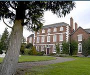
Park House Hotel
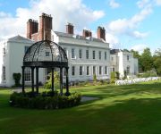
Haughton Hall
Videos from this area
These are videos related to the place based on their proximity to this place.
Wayside Guest House B&B Wolverhampton Telford
http://www.waysidebandb.co.uk/ A warm welcome awaits you at Wayside B and B, situated in a convenient location for many tourist attractions throughout Shropshire and yet offering the business...
Dene River Jazzmen play Jambalaya.
This version of "Jambalaya" was recorded at The Harp Hotel, Albrighton, Shropshire, England on Sunday, January 15th 2012 by Dene River Jazzmen. Led by Peter Roberts on banjo, the line-up...
Autumn/Winter 2014 Telford shopping center style show
This video was uploaded from an Android phone.
ROBLOX Tutorial August 2009 - how to drive a car - roblox
ROBLOX Tutorial August 2009 jackdd NOTE:this is for the old cars on roblox becuase some places still use them.
Gary Bell and Janice Williamson play Our Love is Here to Stay
This version of "Our Love is Here to Stay" was recorded at The Harp Hotel, Albrighton, Shropshire, England on Sunday, January 22nd 2012 by the Gary Bell Quartet with Janice Williamson...this...
P3D - Hawker Hurricane D-Day MkIIC Tankbuster - RAF Cosford - By JMCV 2013
Prepar3D (P3D) is a simulation platform developed by Lockheed Martin. * The Hawker Hurricane is a British single-seat fighter aircraft that was designed and predominantly built by Hawker...
Douglas C47 Dakota 'Kwicherbichen' - Battle of Britain Memorial Flight - Cosford Airshow 2014
The RAF Battle of Britain Memorial Flight's Douglas C47 Dakota, 'Kwicherbichen', performing at the RAF Cosford Airshow 2014.
Videos provided by Youtube are under the copyright of their owners.
Attractions and noteworthy things
Distances are based on the centre of the city/town and sightseeing location. This list contains brief abstracts about monuments, holiday activities, national parcs, museums, organisations and more from the area as well as interesting facts about the region itself. Where available, you'll find the corresponding homepage. Otherwise the related wikipedia article.
Ackleton
Ackleton is a village in the English county of Shropshire. Situated some seven miles (11 kilometers) from the market town of Bridgnorth, this village is the home of the two pub and restaurants The Red Cow and The Folley. Convenient for both Wolverhampton and Telford, this rural retreat is surrounded by open fields and views. It also shares its territory with Badger Dingle, which is a forest area often visited by walkers and hikers.
Badger, Shropshire
Badger is a village and civil parish in Shropshire, England, about six miles north-east of Bridgnorth. The parish had a population of 134 according to the 2001 census. Badger Parish is at grid map reference SJ 76834 99840. The boundaries of the parish contain the village of Badger, one side of Badger Dingle, and Badger Heath Farm. It is approximately 2.7 km at its widest point. The village and its surroundings, particularly the Dingle, are considered a visitor attraction.
Beckbury
Beckbury is a village and civil parish in Shropshire, England. Beckbury has a population of 327 according to the 2001 census. The village is about eight miles south-east of Telford and is close to the Staffordshire border. The small rural parish of Beckbury lies on the Shropshire–Staffordshire border 6 km. south of Shifnal. It has a pub - the Seven Stars, a Church of England school, and a parish church.
Boningale
Boningale is a village and civil parish in Shropshire, England. According to the 2001 census, the parish had a population of 266. Its name was formerly spelt as Boningall or Bonninghall. The red sandstone church of St. Chad was originally built in the 12th century, and now has a 19th century interior. There are the remains of a medieval cross in the churchyard. Boningale's most famous resident is perhaps the notorious eighteenth-century criminal Jonathan Wild, who was born there in 1682.
Burnhill Green
Burnhill Green is a small hamlet near Pattingham, situated in Staffordshire, England. The area consists of a pub, The Dartmouth Arms, surrounded by a few pre-1950 houses.
RAF Cosford
Royal Air Force Station Cosford or RAF Cosford (formerly DCAE Cosford) is a Royal Air Force station in Cosford, Shropshire, just to the northwest of Wolverhampton and next to Albrighton.
Royal Air Force Museum Cosford
The Royal Air Force Museum Cosford is a museum dedicated to the history of aviation, and the Royal Air Force in particular. The museum is a non-departmental public body sponsored by the Department for Culture, Media and Sport and a registered charity. The museum is spread over two sites in England, the other site is at the Royal Air Force Museum London at Colindale in north London.
St Mary's Church, Patshull
St Mary's Church, Patshull, is a redundant Anglican church near the village of Pattingham, Staffordshire, England, and is situated near Patshull Hall. It is designated by English Heritage as a Grade II* listed building, and is under the care of the Churches Conservation Trust. The church stands in parkland beside a lake.


