Safety Score: 3,0 of 5.0 based on data from 9 authorites. Meaning we advice caution when travelling to United Kingdom.
Travel warnings are updated daily. Source: Travel Warning United Kingdom. Last Update: 2024-08-13 08:21:03
Delve into Bar Hill
Bar Hill in Staffordshire (England) is a city located in United Kingdom about 139 mi (or 224 km) north-west of London, the country's capital town.
Current time in Bar Hill is now 10:24 PM (Sunday). The local timezone is named Europe / London with an UTC offset of zero hours. We know of 9 airports closer to Bar Hill, of which 5 are larger airports. The closest airport in United Kingdom is Manchester Airport in a distance of 25 mi (or 41 km), North. Besides the airports, there are other travel options available (check left side).
There are several Unesco world heritage sites nearby. The closest heritage site in United Kingdom is Pontcysyllte Aqueduct and Canal in a distance of 23 mi (or 37 km), West. Also, if you like playing golf, there are some options within driving distance. In need of a room? We compiled a list of available hotels close to the map centre further down the page.
Since you are here already, you might want to pay a visit to some of the following locations: Chorlton, Weston, Willaston, Market Drayton and Stoke-on-Trent. To further explore this place, just scroll down and browse the available info.
Local weather forecast
Todays Local Weather Conditions & Forecast: 8°C / 46 °F
| Morning Temperature | 6°C / 42 °F |
| Evening Temperature | 7°C / 44 °F |
| Night Temperature | 7°C / 44 °F |
| Chance of rainfall | 4% |
| Air Humidity | 75% |
| Air Pressure | 1015 hPa |
| Wind Speed | Moderate breeze with 10 km/h (6 mph) from East |
| Cloud Conditions | Broken clouds, covering 65% of sky |
| General Conditions | Moderate rain |
Monday, 18th of November 2024
5°C (41 °F)
2°C (35 °F)
Moderate rain, fresh breeze, overcast clouds.
Tuesday, 19th of November 2024
2°C (35 °F)
-2°C (29 °F)
Rain and snow, moderate breeze, broken clouds.
Wednesday, 20th of November 2024
2°C (36 °F)
0°C (32 °F)
Rain and snow, gentle breeze, broken clouds.
Hotels and Places to Stay
Wychwood Park
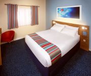
TRAVELODGE CREWE BARTHOMLEY
Videos from this area
These are videos related to the place based on their proximity to this place.
Driving On The M6 Motorway From J15 Stoke-on-Trent To Keele Services, Newcastle Under Lyme, England
Driving on the M6 motorway from junction 15 (A500 Stoke-on-Trent Newcastle-under-Lyme) to Keele Services, Newcastle Under Lyme, Staffordshire, England Videoed on Tuesday, 3rd April 2012 ...
#KeeleGraduation 2014: Honorary graduate Nigel Johnson Part 1
Nigel Johnson, sports broadcaster, Keele honorary graduate and the BBC's 'voice of Stoke City' speaks about his early career behind the microphone... Parts 2 & 3 released soon!
#KeeleGraduation 2014: Honorary graduate Nigel Johnson Part 2
Nigel Johnson, sports broadcaster, Keele honorary graduate and the BBC's 'voice of Stoke City' speaks about his early career behind the microphone...
#KeeleGraduation 2014: Honorary graduate Nigel Johnson Part 3
Nigel Johnson, sports broadcaster, honorary graduate and the BBC's 'voice of Stoke City' speaks about his career behind the microphone and the influence of Keele University.
Planets in Keele,UK
This is the Ligi Ndogo Planet team that represented the soccer school at the Keele Tournament in the UK,2011. The Manchester Keele International Cup is Britain's biggest youth football tournament....
English Literature at Keele University - Undergraduate study
Students and academic staff talk about the range of English Literature undergraduate options at Keele University's School of English Apply now: http://www.keele.ac.uk/english/studywithus/
Driving On The M6 Motorway From J15 Stoke-on-Trent To J16 Crewe, Cheshire East, England
Driving at night on the M6 motorway from junction 15 (A500 Stoke-on-Trent Newcastle-under-Lyme) to junction 16 (A500 Nantwich Crewe), Cheshire East, England Videoed on Friday,10th February...
Reasons to choose Keele: “It’s a good feeling to be supported...
Shagufta, second year Economics and Mathematics, made friends through student societies, including our Student Union-run Bangladesh Society. She loves the support available for International...
Videos provided by Youtube are under the copyright of their owners.
Attractions and noteworthy things
Distances are based on the centre of the city/town and sightseeing location. This list contains brief abstracts about monuments, holiday activities, national parcs, museums, organisations and more from the area as well as interesting facts about the region itself. Where available, you'll find the corresponding homepage. Otherwise the related wikipedia article.
Woore
Woore is a village and civil parish in the north of the English county of Shropshire. It had a population of 1,411 in the 2001 census. The name means "boundary" in ancient Celtic and this fits nicely with the fact that it is on the boundary with both the counties of Cheshire and Staffordshire. The parish is the most northerly in Shropshire. The civil parish includes several other hamlets and villages including Gravenhunger, Dorrington, Pipe Gate and Ireland's Cross.
Madeley Old Hall
Madeley Old Hall is a historical 16th century house now a small hotel in the village of Madeley in Staffordshire, England. It is a Grade II* listed building.
Newcastle-under-Lyme Rural District
Newcastle-under-Lyme Rural District was a rural district in the county of Staffordshire. It was formed in 1894 with the civil parishes of Ashley, Audley Rural, Balterley, Betley, Chapel and Hill Chorlton, Clayton, Keele, Madeley, Maer, Mucklestone, Tyrley and Whitmore. It was abolished in 1974, by virtue of the Local Government Act 1972, when it was absorbed into the Borough of Newcastle-under-Lyme.
Checkley cum Wrinehill
Checkley cum Wrinehill is a civil parish in the unitary authority of Cheshire East and the ceremonial county of Cheshire, England, which lies adjacent to the boundaries with Shropshire and Staffordshire. The hamlet of Checkley lies to the south east of Crewe and to the west of Newcastle-under-Lyme. The parish is largely rural but also includes the small settlements of Bunkers Hill and Randilow. Wrinehill was formerly included in the parish, becoming part of Staffordshire in 1965.
Heighley Castle
Heighley Castle (or Heleigh Castle) is a ruined medieval castle situated at Madeley, Staffordshire near the present village of Madeley, Staffs. The castle was completed by the Audley family in 1233 and for over 300 years was one of their ancestral homes. It was held for Charles I during the English Civil War and was destroyed by Parliamentary forces in the 1640s. The ruinous remains comprise masonry fragments, mostly overgrown by vegetation.
Ireland's Cross
Ireland's Cross is a small hamlet in the civil parish of Woore in Shropshire, England.
Madeley High School
Madeley High School, established 1957, is a comprehensive secondary school in the village of Madeley, Staffordshire, England. The school was founded as a secondary modern school. It is now a Specialist Technology College with joint second specialisms in Arts and Cognition and Learning. Madeley High School is co-educational and caters to children in the 11-16 age group. It is administered by Staffordshire County Council.
Pipe Gate railway station
Pipe Gate was a railway station on the North Staffordshire Railway's Stoke on Trent to Market Drayton line.


