Safety Score: 3,0 of 5.0 based on data from 9 authorites. Meaning we advice caution when travelling to United Kingdom.
Travel warnings are updated daily. Source: Travel Warning United Kingdom. Last Update: 2024-08-13 08:21:03
Discover Audley
Audley in Staffordshire (England) with it's 5,638 citizens is a city in United Kingdom about 141 mi (or 226 km) north-west of London, the country's capital city.
Local time in Audley is now 11:34 PM (Sunday). The local timezone is named Europe / London with an UTC offset of zero hours. We know of 8 airports in the vicinity of Audley, of which 5 are larger airports. The closest airport in United Kingdom is Manchester Airport in a distance of 21 mi (or 34 km), North. Besides the airports, there are other travel options available (check left side).
There are several Unesco world heritage sites nearby. The closest heritage site in United Kingdom is Pontcysyllte Aqueduct and Canal in a distance of 26 mi (or 42 km), West. Also, if you like golfing, there are a few options in driving distance. Looking for a place to stay? we compiled a list of available hotels close to the map centre further down the page.
When in this area, you might want to pay a visit to some of the following locations: Weston, Chorlton, Stoke-on-Trent, Eaton and Willaston. To further explore this place, just scroll down and browse the available info.
Local weather forecast
Todays Local Weather Conditions & Forecast: 8°C / 46 °F
| Morning Temperature | 6°C / 42 °F |
| Evening Temperature | 7°C / 44 °F |
| Night Temperature | 7°C / 44 °F |
| Chance of rainfall | 4% |
| Air Humidity | 75% |
| Air Pressure | 1015 hPa |
| Wind Speed | Moderate breeze with 10 km/h (6 mph) from East |
| Cloud Conditions | Broken clouds, covering 65% of sky |
| General Conditions | Moderate rain |
Monday, 18th of November 2024
5°C (41 °F)
2°C (35 °F)
Moderate rain, fresh breeze, overcast clouds.
Tuesday, 19th of November 2024
2°C (35 °F)
-2°C (29 °F)
Rain and snow, moderate breeze, broken clouds.
Wednesday, 20th of November 2024
2°C (36 °F)
0°C (32 °F)
Rain and snow, gentle breeze, broken clouds.
Hotels and Places to Stay
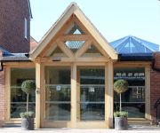
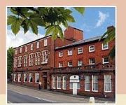
Best Western Manor House
Borough Arms Hotel
Clayton Lodge Hotel
JCT.15 Holiday Inn STOKE ON TRENT M6
TRAVELODGE CREWE BARTHOMLEY
TRAVELODGE STOKE TALKE
TRAVELODGE NEWCASTLE-UNDER-LYME CENTRAL
Newcastle Under Lyme
Videos from this area
These are videos related to the place based on their proximity to this place.
Audley builders by Headway Construction, Audley, Staffordshire
http://www.headwayconstruction.co.uk/audley-builders/ Need a builder in Audley, Alsager or Sandbach? Headway Construction are based in Audley serving the Staffordshire and Cheshire borders....
A5011 - Talke to Church Lawton - Rear View
The A5011 is a short link road connecting the A34 at Talke in Staffordshire to the A50 at Church Lawton in Cheshire, skirting the east side of Alsager. In the pre-motorway age, this formed...
Barratt & David Wilson homes - Heritage park, Silverdale, Newcastle-u-Lyme. POV openspace 2012
New homes historian takes a look at the amazing country park that has been created by Barratt and David wilson homes on the site of the former Silverdale colliery. We take a look over the...
A5011 - Talke to Church Lawton - Front View
The A5011 is a short link road connecting the A34 at Talke in Staffordshire to the A50 at Church Lawton in Cheshire, skirting the east side of Alsager. In the pre-motorway age, this formed...
Apedale - Remembrance Sunday (9/11/08)
Footage showing "Protected Simplex" MR1369/LR3090) running into Apedale Station just prior to official handover to the Moseley Railway Trust by Leeds City Museums. Please see www.mrt.org.uk...
Holly Trees Hotel, Alsager, Cheshire, Review by a regular guest
http://www.hollytreeshotel.co.uk/ Holly Trees Hotel, Alsager, Cheshire, ST7 2JL. Telephone: 01270 876847. Review by a regular guest. This is a quick review, and a testimonial, for The Holly...
A34 Congleton Road, Butt Lane - Southbound Front View with Rearview Mirror
The A34 is one of the longest A-roads in Britain, running for 200 miles (320km) from Winchester on the south coast to Salford near Manchester, although it is now split into two halves which...
Videos provided by Youtube are under the copyright of their owners.
Attractions and noteworthy things
Distances are based on the centre of the city/town and sightseeing location. This list contains brief abstracts about monuments, holiday activities, national parcs, museums, organisations and more from the area as well as interesting facts about the region itself. Where available, you'll find the corresponding homepage. Otherwise the related wikipedia article.
Newcastle-under-Lyme (UK Parliament constituency)
Newcastle-under-Lyme is a constituency in the Potteries represented in the House of Commons of the UK Parliament since 2001 by Paul Farrelly of the Labour Party.
Bignall Hill
Bignall Hill, Staffordshire is a prominent local landmark, and forms part of an escarpment ridge four miles north-west of Newcastle-under-Lyme. It is classed as a sub HuMP. There is a large stone monument on the summit which is dedicated to John Wedgwood (1760–1839), a former local employer and coal mine owner. Wedgwood's monument was initially an immense obelisk erected in 1850.
Audley and Bignall End (ward)
Audley and Bignall End ward is a ward in the Borough of Newcastle-under-Lyme. It covers the villages of Audley and Bignall End.
Halmerend (ward)
Halmerend ward is a ward in the Borough of Newcastle-under-Lyme. It covers the villages of Alsagers Bank, Balterley, Betley, Halmer End and Wrinehill.
Audley Urban District
Audley Urban District is a former administrative unit in Staffordshire created by the Local Government Act 1894. It contained the civil parish of Audley. In 1932 it was abolished, being absorbed into the Newcastle-under-Lyme Municipal Borough, Newcastle-under-Lyme Rural District and Kidsgrove Urban Districta.
Apedale Hall
Apedale Hall is a manor house near Newcastle-under-Lyme in Staffordshire, it was rebuilt in 1826 by the Heathcote family in the Elizabethan style by British Industrialist Richard Edensor Heathcote,, but was demolished in 1934, due to subsidence from the coal mines underneath. Oswald Mosley, a.k.a.
Minnie Pit Disaster
The Minnie Pit disaster was a coal mining accident in Halmer End, Staffordshire, UK in which 155 men died. The disaster took place on 12 January 1918, at the height of the Great War. The disaster, which was caused by an explosion due to firedamp, is the worst ever recorded in the North Staffordshire Coalfield.
Audley and Bignall End railway station
Audley and Bignall End railway station was a station on the North Staffordshire Railway, which operated in the West Midlands county of Staffordshire, in England.


