Safety Score: 3,0 of 5.0 based on data from 9 authorites. Meaning we advice caution when travelling to United Kingdom.
Travel warnings are updated daily. Source: Travel Warning United Kingdom. Last Update: 2024-08-13 08:21:03
Explore Spring Gardens
The district Spring Gardens of in Somerset (England) is located in United Kingdom about 97 mi west of London, the country's capital.
If you need a place to sleep, we compiled a list of available hotels close to the map centre further down the page.
Depending on your travel schedule, you might want to pay a visit to some of the following locations: Hinton Charterhouse, Chapmanslade, Corsley, Wellow and Wingfield. To further explore this place, just scroll down and browse the available info.
Local weather forecast
Todays Local Weather Conditions & Forecast: 6°C / 43 °F
| Morning Temperature | 6°C / 43 °F |
| Evening Temperature | 4°C / 39 °F |
| Night Temperature | 3°C / 37 °F |
| Chance of rainfall | 0% |
| Air Humidity | 89% |
| Air Pressure | 1023 hPa |
| Wind Speed | Light breeze with 4 km/h (3 mph) from North-West |
| Cloud Conditions | Overcast clouds, covering 90% of sky |
| General Conditions | Light rain |
Wednesday, 4th of December 2024
6°C (43 °F)
11°C (51 °F)
Light rain, fresh breeze, overcast clouds.
Thursday, 5th of December 2024
12°C (53 °F)
8°C (47 °F)
Light rain, strong breeze, overcast clouds.
Friday, 6th of December 2024
8°C (46 °F)
13°C (55 °F)
Light rain, strong breeze, overcast clouds.
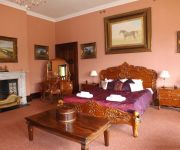
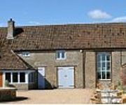
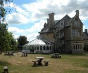
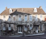
Hotels and Places to Stay
Orchardleigh House
The Lighthouse
The House Near Bath previously House at Woolverton
The George Inn
Stay at Penny's Mill
The Bath Arms
The Somerset Arms
The Cornerhouse
Wheelbrook Mill
Plaine Guest House
Videos from this area
These are videos related to the place based on their proximity to this place.
Frome, Somerset
Time-lapse video of Frome Town Centre. Frome is in Somerset and is located near the Mendip Hills and the City of Bath. Frome is also where Taking Pictures is based.
Frome flood 13th dec 2008 part 2
After the rain on the morning of the 13th Dec 2008 parts of Frome flood. This was taken late in the afternoon round 4pm so water has gone down alot at this point.
Remembrance Day 2014
Frome Film & Video Makers was formed in 1974 and continues frome strength to strength. Remembrance day 11th November 2013 was held at the Memorial Theatre in Frome and was filmed and ...
THE RUTLES
LIVE AT THE CHEESE AND GRAIN , FROME ON SATURDAY 10th MAY 2014 PLAYING THE MIGHTY "JOE PUBLIC."
Take a closer look at Frome (This Video Contains Graphic Scenes)
Some years ago I was asked todo a short video for schools showing the impact plastic bags and rubbish had on the local environment, we showed it to middle schools in Frome. it was the silence...
Frome, Somerset - A great place for independent shops
Catherine Hill, Cheap Street, Frome, Frome Independent Market, Shopping.
CSF Professional Wrestling. Results from Frome, Somerset. 4th October 2014
Brief highlights / results from Saturday Night Slam! Held in Frome, Somerset on 4th October 2014.
Frome Christmas Extravaganza 2014
Frome Town Centre became an Edwardian fairground on Friday 28 November 2014 for the town's Christmas light switch on. Produced by Frome Town Council with performances by The Renegade ...
Carlton lift at Frome leisure Center (Retake)
This time, it did not fail, so you can actually watch it.
Videos provided by Youtube are under the copyright of their owners.
Attractions and noteworthy things
Distances are based on the centre of the city/town and sightseeing location. This list contains brief abstracts about monuments, holiday activities, national parcs, museums, organisations and more from the area as well as interesting facts about the region itself. Where available, you'll find the corresponding homepage. Otherwise the related wikipedia article.
Longleat
Longleat is an English stately home, currently the seat of the Marquesses of Bath, adjacent to the village of Horningsham and near the towns of Warminster in Wiltshire and Frome in Somerset. It is noted for its Elizabethan country house, maze, landscaped parkland and safari park. The house is set in over 900 acres of parkland, landscaped by Capability Brown, with 100,000 acres of woods and farmland.
Orchardleigh Lake
Orchardleigh Lake (also spelt Orchardlea) is an 11.23-hectare artificial lake in the grounds of the Orchardleigh Estate, just north of Frome, Somerset, England. It was formed by damming a tributary of the River Frome. Today, the lake is used for angling, and also birdwatching. There is a small island towards the western side of lake where St Mary's Church can be found. It was built in the 13th century, and underwent extensive renovation by Sir George Gilbert Scott, for the Rev. W. A.
Whatley, Mendip
Whatley is a small rural village and civil parish near Frome in the English county of Somerset.
Frome Town F.C
Frome Town Football Club is an English football club based Frome, a town in the county of Somerset. They play in the Southern Football League Premier Division. The clubs nickname is the Robins and they play in a predominantly red kit. Their first team manager is Darren Perrin and his assistant is Derek Graham.
Witham (Somerset) railway station
This station in Somerset is closed. For the open station in East Anglia, see Witham railway station. Witham (Somerset) railway station was a station serving the Somerset village of Witham Friary and was located on the Frome to Yeovil section of the Wilts, Somerset and Weymouth Railway that opened in 1856.
Trowbridge Village Pump Festival
The Village Pump Festival has its roots 43 years ago in a barn at the Lamb Inn Trowbridge, it then moved to Stowford Manor Farm, Farleigh Hungerford, England. The music covers a variety of genres from folk and roots to blues, celtic and Ceilidh with a variety of other entertainment including a family field, with puppetry and story telling.
Stoney Littleton Long Barrow
The Stoney Littleton Long Barrow (also known as Bath Tumulus and the Wellow Tumulus) is a Neolithic chambered tomb with multiple burial chambers, located near the village of Wellow, Somerset. It is an example of the Severn-Cotswold tomb. The barrow is about 30 metres in length and 15 metres wide at the south-east end, it stands nearly 3 metres high. Internally it consists of a 12.8 metres long gallery with three pairs of side chambers and an end chamber.
Bradley Woods
Bradley Woods is an area of woodland in Wiltshire, south of Longleat Woods and north of Gare Hill. A 48.7 hectare area within the site has been notified as a biological Site of Special Scientific Interest, notification originally taking place in 1986.
The Abbey, Beckington
The Abbey, Beckington in Somerset, UK was built as a monastic grange and also used as a college for priests; the building was begun in 1502, but after the Dissolution of the Monasteries it became a private house. It was altered in the early 17th century with a new front and a sumptuous barrel-vaulted plaster ceiling, and also altered in 19th century.
Rook Lane Chapel, Frome
Rook Lane Chapel was a place of worship, and is now an arts centre, in Frome, Somerset, England. Built in 1707, the chapel was the place of worship for nonconformists, however congregations dwindled and it closed in the 1960s. It was sold to developers but they were unable to get planning permission for proposed future uses. Lead and tiles were stolen from the roof, vandals broke in, smashed all the memorials and brought down the gallery.
Corsley
Corsley is a village and civil parish 3 miles west of Warminster in Wiltshire, England, at grid reference ST828467. The parish includes seven hamlets: Corsley Heath (generally regarded as the centre of the parish), Lane End, Longhedge, Lyes Green and three Whitbournes. The 2001 census recorded a parish population of 716. Much of the parish was originally part of the Longleat Estate and part of the Longleat Safari Park lies within the parish boundary. Corsley Mill is now in Chapmanslade parish.
Farleigh House
Farleigh House (or Farleigh Castle) is a large country house in the English county of Somerset that was formerly the centre of the Farleigh Hungerford estate, and much of the stone came from Farleigh Hungerford Castle. The house is a Grade II listed building. The house was built and extended during the 18th and 19th centuries serving as a country estate for various families until 1970 when it was purchased for use as a Special Needs school.
Whatley Quarry
Whatley Quarry, grid reference ST731479 is a limestone quarry owned by Hanson plc, near the village of Whatley on the Mendip Hills, Somerset, England. The quarry exhibits pale to dark grey Carboniferous Limestone with small area of overlying horizontally bedded buff-coloured Jurassic oolitic limestone forming an angular unconformity, with extensive dolomitisation of top of the Black Rock Limestone.
Colemans Quarry
Colemans Quarry, grid reference ST726452 is a limestone quarry at Holwell, near Nunney on the Mendip Hills, Somerset, England. The Colemans Quarry complex comprises four pits separated by three roads (including the A361) The quarry exhibits pale to dark grey Black Rock, Vallis and Clifton Down Groups of Carboniferous Limestone with overlying buff-coloured Jurassic oolitic limestone forming an angular unconformity.
Shoscombe and Single Hill Halt railway station
Shoscombe & Single Hill Halt was a small railway station on the Somerset and Dorset Joint Railway serving small villages between Wellow and Radstock, about seven miles south of Bath. The station was the last to open on the Somerset and Dorset main line, with services beginning on 23 September 1929. It closed with the rest of the line on 7 March 1966 under the Beeching Axe.
Wellow (Somerset) railway station
Wellow railway station was a station on the Somerset and Dorset Joint Railway at Wellow in the county of Somerset in England. Opened on 20 July 1874, the station consisted of two platforms, a goods yard and sidings, controlled from an 18 lever signal box. The station closed to goods in 1963: passenger services were withdrawn when the SDJR closed on 7 March 1966.
Hinton Priory
Hinton Priory was one of the ten medieval Carthusian houses (charterhouses) in England. It was first established at Hatherop in 1222 by William Longspee, Earl of Salisbury. The monks disliked the location, and on Longspee's death in 1226 they petitioned his countess for a new site to achieve greater solitude. She gave them her manors of Hinton and Norton St Philip in Somerset and the new house was consecrated at Hinton Charterhouse in May 1232. It was called Locus Dei meaning 'God's Place'.
St Margaret's, Corsley
St Margaret's, Corsley, is the Parish Church of Corsley in Wiltshire. Designed by John Leachman and built in the 1830s, St Margaret's is one of two Anglican churches in the parish, the other being St Mary's, Corsley, which was once a private chapel. The design and layout was very similar to those of another of Leachman's churches in Wiltshire, Christ Church, Warminster.
Church of St John the Baptist, Frome
The Church of St John the Baptist, Frome is a parish church in the Church of England located in Frome, Somerset.
Church of All Saints, Nunney
The Church of All Saints at Nunney, Somerset, England, is a Grade I listed building dating from the 12th century. It was probably built on the site of an earlier Saxon or Norman church from which a Saxon cross and Norman font can still be seen. A 15th century wagon or Barrel vault used to cover the nave however the timber rotted and it was demolished in 1957. A temporary roof was installed and hidden by a suspended ceiling.
Frome Rural District
Frome was a rural district in Somerset, England, from 1894 to 1974. It was created in 1894 under the Local Government Act 1894. In 1974 it was abolished under the Local Government Act 1972 when it became part of Mendip.
Blatchbridge
Blatchbridge is a hamlet situated on the B3092 road from Frome to Maiden Bradley. It formerly had a Blacksmith's Shop, situated on the Frome side of the river. It has a public House called the Cross Keys. A former Methodist Chapel, now converted to a private dwelling, is situated halfway up the hill towards Frome. http://en. wikipedia. org/wiki/Frome_Rural_District
Frome Hoard
The Frome Hoard is a hoard of 52,503 Roman coins found in April 2010 by metal detectorist Dave Crisp near Frome in Somerset, England. The coins were contained in a ceramic pot 45 cm in diameter, and date from AD 253 to 305. Most of the coins are made from debased silver or bronze.
Agricultural Showgrounds, Frome
Agricultural Showgrounds is a cricket ground in Frome, Somerset. The first recorded match on the ground was in 1882, when Frome played United Eleven. In 1932, Somerset played Northamptonshire in the County Championship, in what was the grounds first first-class match. From 1932 to 1961, the ground played host to 18 first-class matches, with the final first-class match held at the ground between Somerset and Hampshire.
Frome Cobble Wobble
The Frome Cobble Wobble, established in 2009, is an individually timed bicycle hill climb sprint in Frome, Somerset, England. It was first organised by the local community to celebrate the stage 5 of the 2009 Tour of Britain, which started in Frome. It is set to become an annual event for the town. The course begins at the bottom of Stony Street, takes a sharp turn as it joins Catherine Hill, and finishes at the end of the cobbles the top of the hill.


