Safety Score: 3,0 of 5.0 based on data from 9 authorites. Meaning we advice caution when travelling to United Kingdom.
Travel warnings are updated daily. Source: Travel Warning United Kingdom. Last Update: 2024-08-13 08:21:03
Delve into Oakhill
Oakhill in Somerset (England) with it's 739 habitants is located in United Kingdom about 105 mi (or 170 km) west of London, the country's capital town.
Current time in Oakhill is now 05:58 AM (Friday). The local timezone is named Europe / London with an UTC offset of zero hours. We know of 9 airports close to Oakhill, of which 5 are larger airports. The closest airport in United Kingdom is Bristol International Airport in a distance of 14 mi (or 22 km), North-West. Besides the airports, there are other travel options available (check left side).
There are several Unesco world heritage sites nearby. The closest heritage site in United Kingdom is City of Bath in a distance of 40 mi (or 64 km), East. Also, if you like playing golf, there are some options within driving distance. We encountered 1 points of interest near this location. If you need a hotel, we compiled a list of available hotels close to the map centre further down the page.
While being here, you might want to pay a visit to some of the following locations: Paulton, Clutton, Timsbury, Camerton and East Harptree. To further explore this place, just scroll down and browse the available info.
Local weather forecast
Todays Local Weather Conditions & Forecast: 7°C / 44 °F
| Morning Temperature | 2°C / 36 °F |
| Evening Temperature | 4°C / 40 °F |
| Night Temperature | 3°C / 38 °F |
| Chance of rainfall | 0% |
| Air Humidity | 79% |
| Air Pressure | 1028 hPa |
| Wind Speed | Light breeze with 3 km/h (2 mph) from North-East |
| Cloud Conditions | Few clouds, covering 11% of sky |
| General Conditions | Few clouds |
Saturday, 16th of November 2024
8°C (46 °F)
7°C (45 °F)
Light rain, gentle breeze, few clouds.
Sunday, 17th of November 2024
8°C (46 °F)
3°C (38 °F)
Light rain, moderate breeze, broken clouds.
Monday, 18th of November 2024
5°C (41 °F)
10°C (50 °F)
Light rain, fresh breeze, overcast clouds.
Hotels and Places to Stay
Longbridge House
Charlton House Spa Hotel
CHARLTON HOUSE
Bowlish House - Restaurant with rooms
Ston Easton Park
Best Western Plus Centurion Midsomer Norton
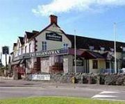
Highwayman Inn Relaxinnz
Prestleigh Inn
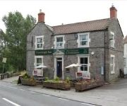
The Oakhill Inn
Videos from this area
These are videos related to the place based on their proximity to this place.
Bellringing on The Waterloo Tower, Shepton Mallet
The first ringing on The Waterloo Tower, a miniature ring of 8 church Bells hung in the 1st floorf flat of Aaron Moulder and Matthew Hull, Shepton Mallet. (Sorry about the bad quality, filmed...
Cary Comedians, 'Oompahpah' Shepton Mallet Carnival 2014
'Oompahpah' Cary Comedians, Shepton Mallet carnival 2014 winning first place in the comedy class.
Bikejor with Sula and Toby round Shepton Mallet and Bodden
Bikejoring with Sula (Staffie X Lab) and Toby (Collie X Lurcher) on the road round Shepton Mallet through Bodden.
Dreamscape 27 - New Years Eve 1997
Dreamscape 27 - Countdown to 98 - Happy Hardcore and Drum and Bass Rave Video filmed on 31st December 1997 at The Royal Bath & West Showground, Shepton Mallet, Somerset. The sound ...
Shepton Mallet - The Fosse Way (ORPA, S-N)
Subscribe for the love of motorcycles and the great outdoors: http://www.youtube.com/subscription_center?add_user=wiltshirebyways Please click 'S H O W M O R E' for route info: ↓↓↓↓↓↓...
Shepton Mallet - Old Bristol Road (ORPA, S-N)
Subscribe for the love of motorcycles and the great outdoors: http://www.youtube.com/subscription_center?add_user=wiltshirebyways Please click 'S H O W M O R E' for route info: ↓↓↓↓↓↓...
Wycieczka na pchli targ.
West Bath Showground - pchli targ nieopodal Shepton Mallet, miasteczka, w którym znajduje się nasz sklep z winylami Cloud7.
Dreamscape 27 - New Years Eve 1997 - Part 4
Dreamscape 27 - Countdown to 98 - Happy Hardcore and Drum and Bass Rave Video filmed on 31st December 1997 at The Royal Bath and West Showground, Shepton Mallet, Somerset. The sound ...
Dreamscape 27 - New Years Eve 1997 - Part 3
Dreamscape 27 - Countdown to 98 - Happy Hardcore and Drum and Bass Rave video filmed on 31st December 1997 at The Royal Bath & West Showground, Shepton Mallet, Somerset. The sound ...
Videos provided by Youtube are under the copyright of their owners.
Attractions and noteworthy things
Distances are based on the centre of the city/town and sightseeing location. This list contains brief abstracts about monuments, holiday activities, national parcs, museums, organisations and more from the area as well as interesting facts about the region itself. Where available, you'll find the corresponding homepage. Otherwise the related wikipedia article.
Binegar railway station
Binegar railway station was a station on the Somerset and Dorset Joint Railway in the county of Somerset in England. Opened on 20 July 1874, the station consisted of two platforms, with a building on the down platform. There was a substantial goods yard with two sheds and sidings, controlled from a 24 lever signal box. The station closed to goods in 1963: passenger services were withdrawn when the SDJR closed on 7 March 1966.
Shatter Cave
Shatter Cave is a cave in Fairy Cave Quarry, near Stoke St Michael in the limestone of the Mendip Hills, in Somerset, England. It falls within the St. Dunstan's Well Catchment Site of Special Scientific Interest. The name commemorates the damage, done by blasting in the quarry, to some of the decoration within the cave.
Fairy Cave Quarry
Fairy Cave Quarry is between Stoke St Michael and Oakhill in the limestone of the Mendip Hills, in Somerset, England. Quarrying was first started on the site in the early 1920s. In 1963 the quarry was acquired by Hobbs (Quarries) Ltd. , and production on a much larger scale began. Excavations cut back into the hillside above St Dunstan's Well Rising, a Bristol Water abstraction point (long since abandoned), various caves were intercepted. The quarry ceased production in 1977.
Gurney Slade quarry
Gurney Slade quarry, grid reference ST626497 is a limestone quarry near Gurney Slade between Binegar and Holcombe, on the Mendip Hills, Somerset, England. Gurney Slade quarry exhibits pale to very dark grey Carboniferous Limestone overlain by red and purple-coloured Triassic breccias and marls with a small faulted block of overlying Lower Jurassic breccias forming an angular unconformity with the Carboniferous Limestone. There is abundant vertical sediment infilled fissures and joints.
Balch Cave
Balch Cave is a cave in Fairy Cave Quarry, near Stoke St Michael in the limestone of the Mendip Hills, in Somerset, England. The cave is part of the complex of passages feeding to St. Dunstan's Well Catchment Site of Special Scientific Interest and an abandoned Bristol Water abstraction point. It is named in honour of Herbert E. Balch who was famous for his exploration of the Caves of the Mendip Hills. The cave was broken into by quarry blasting in November 1961.
Hillier's Cave
Hillier's Cave is a cave in Fairy Cave Quarry, near Stoke St Michael in the limestone of the Mendip Hills, in Somerset, England. It falls within the St. Dunstan's Well Catchment Site of Special Scientific Interest. The cave was discovered on 13 February 1954, when blasting at one of the working faces opened up a cave passage, and is now choked with sludge waste from the quarry.
W/L Cave
W/L Cave is part of the Fairy Cave Quarry group of caves between Stoke St Michael and Oakhill in the limestone of the Mendip Hills, in Somerset, England. It is named after the initials of its discoverers, Bob Whitaker and Jerry Lavis, was first entered in the summer of 1967. It was the first significant cave to be discovered after the destruction of Balch Cave in the same (Fairy Cave) quarry.
Shepton Mallet Rural District
Shepton Mallet was a rural district in Somerset, England, from 1894 to 1974. It was created in 1894, under the Local Government Act 1894. In 1974 it was abolished under the Local Government Act 1972 when it became part of the Mendip district.


