Safety Score: 3,0 of 5.0 based on data from 9 authorites. Meaning we advice caution when travelling to United Kingdom.
Travel warnings are updated daily. Source: Travel Warning United Kingdom. Last Update: 2024-08-13 08:21:03
Delve into East Woodlands
East Woodlands in Somerset (England) is a city located in United Kingdom about 96 mi (or 155 km) west of London, the country's capital town.
Current time in East Woodlands is now 06:19 AM (Sunday). The local timezone is named Europe / London with an UTC offset of zero hours. We know of 9 airports closer to East Woodlands, of which 5 are larger airports. The closest airport in United Kingdom is RNAS Yeovilton in a distance of 19 mi (or 31 km), South-West. Besides the airports, there are other travel options available (check left side).
There are several Unesco world heritage sites nearby. The closest heritage site in United Kingdom is City of Bath in a distance of 31 mi (or 50 km), North-East. Also, if you like playing golf, there are some options within driving distance. We saw 1 points of interest near this location. In need of a room? We compiled a list of available hotels close to the map centre further down the page.
Since you are here already, you might want to pay a visit to some of the following locations: Corsley, Chapmanslade, Kilmington, Mere and Upton Scudamore. To further explore this place, just scroll down and browse the available info.
Local weather forecast
Todays Local Weather Conditions & Forecast: 14°C / 58 °F
| Morning Temperature | 15°C / 59 °F |
| Evening Temperature | 11°C / 51 °F |
| Night Temperature | 9°C / 49 °F |
| Chance of rainfall | 27% |
| Air Humidity | 91% |
| Air Pressure | 994 hPa |
| Wind Speed | High wind, near gale with 27 km/h (17 mph) from North |
| Cloud Conditions | Overcast clouds, covering 100% of sky |
| General Conditions | Moderate rain |
Monday, 25th of November 2024
9°C (49 °F)
5°C (40 °F)
Light rain, fresh breeze, overcast clouds.
Tuesday, 26th of November 2024
7°C (45 °F)
6°C (43 °F)
Light rain, moderate breeze, clear sky.
Wednesday, 27th of November 2024
6°C (43 °F)
4°C (38 °F)
Moderate rain, gentle breeze, broken clouds.
Hotels and Places to Stay
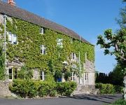
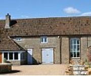
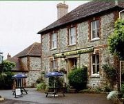
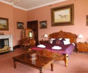
The Bath Arms
The Lighthouse
The Somerset Arms
Orchardleigh House
Stay at Penny's Mill
The Cornerhouse
TRAVELODGE BECKINGTON
Frome
Videos from this area
These are videos related to the place based on their proximity to this place.
DAY 5 PART 1 - Road Trip to Longleat Safari Park - Bath City - Bristol City UK
SUBSCRIBE FOR LATEST VLOG'S. PLEASE HIT LIKE IF YOU LIKE :) MANY THANKS FOR WATCHING...
DAY 5 PART 2 - Road Trip to Longleat Safari Park - Bath City - Bristol City UK
SUBSCRIBE FOR LATEST VLOG'S. PLEASE HIT LIKE IF YOU LIKE :) MANY THANKS FOR WATCHING...
DAY 5 PART 4 - Road Trip to Longleat Safari Park - Bath City - Bristol City UK
SUBSCRIBE FOR LATEST VLOG'S. PLEASE HIT LIKE IF YOU LIKE :) MANY THANKS FOR WATCHING...
Penguin Island at Longleat - New attraction guide
A visit to the brand new penguin enclosure at Longleat Safari Park to see the Humboldt penguins. They swim up close and splash in this amazing subterranean cave on penguin island!
DAY 5 PART 3 - Road Trip to Longleat Safari Park - Bath City - Bristol City UK
SUBSCRIBE FOR LATEST VLOG'S. PLEASE HIT LIKE IF YOU LIKE :) MANY THANKS FOR WATCHING... london road uk road trip wild life of uk.
DAY 5 PART 6 - Road Trip to Longleat Safari Park - Bath City - Bristol City UK
SUBSCRIBE FOR LATEST VLOG'S. PLEASE HIT LIKE IF YOU LIKE :) MANY THANKS FOR WATCHING...
DAY 5 PART 5 - Road Trip to Longleat Safari Park - Bath City - Bristol City UK
SUBSCRIBE FOR LATEST VLOG'S. PLEASE HIT LIKE IF YOU LIKE :) MANY THANKS FOR WATCHING...
Longleat Behind Closed Doors - Draining the Lake
We've been very busy while you've been gone.. draining half-mile lake, home to two hippos and some sea lions, amongst many other things. The hippos seemed to thoroughly enjoy their complimentary ...
Videos provided by Youtube are under the copyright of their owners.
Attractions and noteworthy things
Distances are based on the centre of the city/town and sightseeing location. This list contains brief abstracts about monuments, holiday activities, national parcs, museums, organisations and more from the area as well as interesting facts about the region itself. Where available, you'll find the corresponding homepage. Otherwise the related wikipedia article.
Longleat
Longleat is an English stately home, currently the seat of the Marquesses of Bath, adjacent to the village of Horningsham and near the towns of Warminster in Wiltshire and Frome in Somerset. It is noted for its Elizabethan country house, maze, landscaped parkland and safari park. The house is set in over 900 acres of parkland, landscaped by Capability Brown, with 100,000 acres of woods and farmland.
Frome Town F.C
Frome Town Football Club is an English football club based Frome, a town in the county of Somerset. They play in the Southern Football League Premier Division. The clubs nickname is the Robins and they play in a predominantly red kit. Their first team manager is Darren Perrin and his assistant is Derek Graham.
Bradley Woods
Bradley Woods is an area of woodland in Wiltshire, south of Longleat Woods and north of Gare Hill. A 48.7 hectare area within the site has been notified as a biological Site of Special Scientific Interest, notification originally taking place in 1986.
Rook Lane Chapel, Frome
Rook Lane Chapel was a place of worship, and is now an arts centre, in Frome, Somerset, England. Built in 1707, the chapel was the place of worship for nonconformists, however congregations dwindled and it closed in the 1960s. It was sold to developers but they were unable to get planning permission for proposed future uses. Lead and tiles were stolen from the roof, vandals broke in, smashed all the memorials and brought down the gallery.
Church of St John the Baptist, Frome
The Church of St John the Baptist, Frome is a parish church in the Church of England located in Frome, Somerset.
Frome Rural District
Frome was a rural district in Somerset, England, from 1894 to 1974. It was created in 1894 under the Local Government Act 1894. In 1974 it was abolished under the Local Government Act 1972 when it became part of Mendip.
Blatchbridge
Blatchbridge is a hamlet situated on the B3092 road from Frome to Maiden Bradley. It formerly had a Blacksmith's Shop, situated on the Frome side of the river. It has a public House called the Cross Keys. A former Methodist Chapel, now converted to a private dwelling, is situated halfway up the hill towards Frome. http://en. wikipedia. org/wiki/Frome_Rural_District
Frome Hoard
The Frome Hoard is a hoard of 52,503 Roman coins found in April 2010 by metal detectorist Dave Crisp near Frome in Somerset, England. The coins were contained in a ceramic pot 45 cm in diameter, and date from AD 253 to 305. Most of the coins are made from debased silver or bronze.


