Safety Score: 3,0 of 5.0 based on data from 9 authorites. Meaning we advice caution when travelling to United Kingdom.
Travel warnings are updated daily. Source: Travel Warning United Kingdom. Last Update: 2024-08-13 08:21:03
Discover Lythwood
The district Lythwood of in Shropshire (England) is a district in United Kingdom about 139 mi north-west of London, the country's capital city.
Looking for a place to stay? we compiled a list of available hotels close to the map centre further down the page.
When in this area, you might want to pay a visit to some of the following locations: Bayston Hill, Great Hanwood, Shrewsbury, Bicton and Longnor. To further explore this place, just scroll down and browse the available info.
Local weather forecast
Todays Local Weather Conditions & Forecast: 8°C / 47 °F
| Morning Temperature | 8°C / 46 °F |
| Evening Temperature | 6°C / 44 °F |
| Night Temperature | 6°C / 43 °F |
| Chance of rainfall | 0% |
| Air Humidity | 71% |
| Air Pressure | 998 hPa |
| Wind Speed | Fresh Breeze with 14 km/h (9 mph) from North-East |
| Cloud Conditions | Clear sky, covering 7% of sky |
| General Conditions | Sky is clear |
Tuesday, 26th of November 2024
6°C (44 °F)
4°C (38 °F)
Sky is clear, moderate breeze, clear sky.
Wednesday, 27th of November 2024
5°C (41 °F)
4°C (40 °F)
Sky is clear, gentle breeze, clear sky.
Thursday, 28th of November 2024
5°C (42 °F)
5°C (42 °F)
Light rain, gentle breeze, overcast clouds.
Hotels and Places to Stay
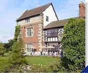
Albright Hussey Manor
Mercure Shrewsbury Albrighton Hall Hotel and Spa
The Lion Hotel Shrewsbury by Compass Hospitality
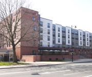
Holiday Inn Express SHREWSBURY
Three Tuns Hotel
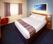
TRAVELODGE SHREWSBURY BAYSTON HILL
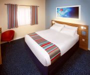
TRAVELODGE SHREWSBURY BATTLEFIELD
ABBOTS MEAD HOTEL
Shrewsbury Town Centre
Shrewsbury North (Harmer Hill)
Videos from this area
These are videos related to the place based on their proximity to this place.
Town 4 Exeter City 0 - Behind The Goal - Town TV
The goals from the 4-0 win over Exeter City from our behind the goals angle.
MASTERCHEF: Skitty vs Vernon challenge
Club physio Chris Skitt and first team performance analyst Michael Vernon pick their teams and go head to head in the MasterChef challenge.
Shrewsbury Town v Blackpool – League Cup Highlights 2014/2015
Shrewsbury Town v Blackpool – League Cup Highlights 2014/2015.
MASTERCHEF: The Shrewsbury College final
Two teams from Shrewsbury College went head to head in the final of a MasterChef competition - held at Shrewsbury Town's Greenhous Meadow.
HIGHLIGHTS: Shrewsbury Town 5-1 Wrexham
Watch the goals from Shrewsbury Town's resounding win over Wrexham in the Final Third Development League - West Division.
Pearl of Africa Choir at Shrewsbury Town v Mansfield Town - 1080HD
Shrewsbury Town Community Sports Trust Pearl of Africa Choir : http://www.pearlofafrica.org.uk/
Shrewsbury Town 0 - 1 Wolves Sako Penalty 21/09/13
Atmosphere around the Wolves stand before Sako slots his penalty at the back of the net. SUBSCRIBE/LIKE/SHARE FOR MORE VIDEOS LIKE THIS.
Sutton Tranings
READ:WATCH IN HIGHQUALITY: Been makin this vid over the past couple of weeks jus filming stuf in sutton the stuf in this vid isent suposed to be majorly epic jus some trainings :). #87 -...
Videos provided by Youtube are under the copyright of their owners.
Attractions and noteworthy things
Distances are based on the centre of the city/town and sightseeing location. This list contains brief abstracts about monuments, holiday activities, national parcs, museums, organisations and more from the area as well as interesting facts about the region itself. Where available, you'll find the corresponding homepage. Otherwise the related wikipedia article.
The Quarry
The Quarry is the main recreational park in Shrewsbury, the county town of Shropshire, England. The park was created in 1719 and encompasses 29 acres. With a location within easy walking distance of Shrewsbury town centre, Shrewsbury Sixth Form College and Shrewsbury School, it is the most heavily used public park within the county.
The Mount, Shrewsbury
The Mount is the site of a house in Shrewsbury, officially known as Mount House that belonged to Robert Darwin and was the birthplace of his son Charles Darwin.
Frankwell
Frankwell is a district of the town of Shrewsbury, in Shropshire, England. It lies adjacent to the River Severn, to the northwest of the town centre, and is one of Shrewsbury's oldest suburbs. Frankwell grew up as a port and trading location by the river and on the road to Wales, but across the river from the walled borough of Shrewsbury and therefore beyond the town's jurisdiction.
Belle Vue, Shrewsbury
Belle Vue is a suburb of the town of Shrewsbury, Shropshire. It is located about a mile south of the town centre. Built up during the 19th and early 20th Centuries, it is now mainly residential. "Belle Vue Road" runs through the middle of the area, which has many public houses such as The Grove, the Belle Vue Tavern, the Masonic Arms and the Boar's Head. It also has a selection of small shops, though many have become houses in recent decades.
Music Hall, Shrewsbury
The Music Hall in Shrewsbury, England, is a large Victorian building owned by Shropshire Council and currently houses the town's theatre and central Visitor Information Centre, as well as a cafe and some council offices. It is located on The Square in Shrewsbury town centre. In front of it is the Old Market Hall, now used as the borough council's cinema which was formerly housed within the Music Hall itself.
Shrewsbury and Atcham (UK Parliament constituency)
Shrewsbury and Atcham is a constituency represented in the House of Commons of the UK Parliament since 2005 by Daniel Kawczynski, a Conservative.
Welsh Bridge
The Welsh Bridge is a masonry arch viaduct in the town of Shrewsbury, England which crosses the River Severn. It connects Frankwell with the town centre. It is a Listed Building, Grade II*. The bridge was designed and built by John Tilley and John Carline (whose father was a mason on the English Bridge), who had built Montford Bridge for Thomas Telford. Four of the arches span 43 feet 4 inches, while the fifth and central arch is 46 feet 2 inches.
Shelton, Shropshire
Shelton is a suburb of Shrewsbury in Shropshire, England, described by the Pevsner Architectural Guides as "Shrewsbury's principal interwar suburb. " It was once a village of its own, but the town of Shrewsbury has grown steadily in the area since the 1950s. It has a cricket team which played in the Shropshire Premier Cricket League until the league was wound up after the 2011 season.
Meole Brace
Meole Brace is a suburb of Shrewsbury, Shropshire, England. The Rea Brook, a tributary of the River Severn, flows through the area. The brook was in the past known as the "Meole Brook". The name Meole Brace comes from the old Saxon manor house, which no longer stands, owned by the Brace family .
New Meadow
The New Meadow, also known as the Greenhous Meadow for sponsorship purposes, is the home ground of English football club Shrewsbury Town, and is a UEFA Category Four stadium. The stadium is situated on the southern outskirts of Shrewsbury, Shropshire, between the districts of Meole Brace and Sutton Farm, and close to the A5. It was completed in the summer of 2007, in time for the 2007–08 English football season, and was built to replace the Gay Meadow stadium, home of Shrewsbury Town since 1910.
Hanwood
Hanwood is a large village in Shropshire, England. It is located 3 miles SW of Shrewsbury town centre, on the A488 road. The A5 is only a mile away. The Cambrian Line runs through the village but there is no longer a station here. It was closed in 1964, as a result of the Beeching Axe. Hanwood has a small shop, a pub (the "Cock Inn"), a post office and a primary school. The Rea Brook flows through the village and the village is laid along the floor of a small valley.
Hook-a-Gate
Hook-a-Gate is a village in Shropshire, England. It is located on the Shrewsbury to Longden road, just over the A5 Shrewsbury by-pass from Shrewsbury itself. Bayston Hill is nearby, though there is no direct vehicular road connecting the two villages, only a track. It was formerly a stop on the now defunct Shropshire and Montgomeryshire Railway. There is no primary school but there is a Tuition Centre for Secondary children. The Rea Brook flows through the village.
Nobold
Nobold is a small village on the south-western edge of Shrewsbury in Shropshire, England. It is located on the Shrewsbury to Longden road. Nobold boasts Shropshire's oldest natural water well. Nearby are Meole Brace and Hook-a-Gate villages.
Pulley, Shropshire
Pulley is a small village on the southern edge of Shrewsbury in Shropshire, England. It is located between Shrewsbury and Bayston Hill. The A5 Shrewsbury by-pass cuts through the area. To the north is the Shrewsbury suburb of Meole Brace.
Kingsland Bridge
Kingsland Bridge is a privately owned toll bridge, spanning the River Severn in Shrewsbury, Shropshire. It is located near Shrewsbury School and the cost for cars to cross is 20p. It is a Listed Building, Grade II.
Radbrook Green
Radbrook Green is the name of a small suburb of Shrewsbury, situated to the south-west of the town, approximately 1.5 miles from the town centre. Construction of the estate started in the late 1970s, with most of the estate completed by the early 1990s. It is a private housing estate, predominantly seen as a middle class area of the town.
Old Market Hall
The Old Market Hall is an Elizabethan building situated in the town centre of Shrewsbury, the county town of Shropshire, England. Built in 1596, the property is now in the ownership of Shropshire Council. In 2004 the building underwent a £1.7 million restoration, having been previously restored in 1904. The OMH is a scheduled monument.
Royal Shrewsbury Hospital
The Royal Shrewsbury Hospital is a teaching hospital in Shrewsbury, Shropshire, England. It forms the Shrewsbury site of the Shrewsbury and Telford Hospital NHS Trust, serving patients from Shropshire and Powys, in conjunction with the Princess Royal Hospital in Telford. The hospital was founded in 1979 following the closure of the Royal Salop Infirmary that occupied a position in the centre of Shrewsbury.
Town Walls Tower
Town Walls Tower is a building in the care of the National Trust in the county town of Shrewsbury, Shropshire, England in the United Kingdom.
St Chad's Church, Shrewsbury
St Chad's Church, Shrewsbury occupies a prominent position in the county town of Shropshire. The current church building was built in 1792, and with its distinctive round shape and high tower it is a well-known landmark in the town. It faces The Quarry area of parkland, which slopes down to the River Severn. The church is a Grade I listed building. The motto of the church is "open doors, open hearts, and open minds".
Condover railway station
Condover railway station was located in the village of Condover, Shropshire. Originally built by the Shrewsbury and Hereford Railway, the station closed a few years before the Beeching Axe, but its line, the Welsh Marches Line, is still operational.
The Quantum Leap
The Quantum Leap is a sculpture situated next to the River Severn in Shrewsbury, Shropshire, England, United Kingdom. It was created to celebrate the bicentenary of the birth of evolutionist Charles Darwin, who was born in the town in 1809. The sculpture was unveiled on 8 October 2009 by Randal Keynes, a great-great-grandson of Darwin.
Mardol (street)
Mardol is a historic street in Shrewsbury, Shropshire with a variety of architectural styles, ranging from Tudor timber-framed buildings to more modern constructs. It runs from the Welsh Bridge up to the town centre. Shuts and passages leading from the street include the King's Head Passage, Phoenix Place, Mardol Gardens, Carnarvon Lane, Hill's Lane and Roushill Bank. At the top of Mardol now stands a new modern monument, Darwin's Gate. The original of the name of the street is not clear.
The Parade Shopping Centre
The Parade Shopping centre, is a specialist shopping centre located in Shrewsbury, the county town of Shropshire. It is a Grade II listed building home to 30 shops on two floors and a terrace cafe overlooking the River Severn. The centre is located at St. Mary's Place, across the road from St. Mary's Church. It is a short walk from the principal shopping area of Pride Hill and Shrewsbury Rail Station.
Christ Church Shelton and Oxon
The parish of Christ Church, Shelton and Oxon lies within the Diocese of Lichfield, in the County of Shropshire, UK. The church was built in 1854 by Edward Haycock Snr in Early English style with many lancet features. It is located on Welshpool Road in what is now suburban Shrewsbury, and is a Grade II listed building. The exterior has rubble walls with ashlar dressings. There is a bellcote and a gabled porch.


