Safety Score: 3,0 of 5.0 based on data from 9 authorites. Meaning we advice caution when travelling to United Kingdom.
Travel warnings are updated daily. Source: Travel Warning United Kingdom. Last Update: 2024-08-13 08:21:03
Discover Crackleybank
Crackleybank in Shropshire (England) is a city in United Kingdom about 125 mi (or 202 km) north-west of London, the country's capital city.
Local time in Crackleybank is now 10:21 PM (Sunday). The local timezone is named Europe / London with an UTC offset of zero hours. We know of 9 airports in the vicinity of Crackleybank, of which 5 are larger airports. The closest airport in United Kingdom is Birmingham International Airport in a distance of 31 mi (or 49 km), South-East. Besides the airports, there are other travel options available (check left side).
There are several Unesco world heritage sites nearby. The closest heritage site in United Kingdom is Pontcysyllte Aqueduct and Canal in a distance of 30 mi (or 48 km), North-West. Also, if you like golfing, there are a few options in driving distance. We discovered 1 points of interest in the vicinity of this place. Looking for a place to stay? we compiled a list of available hotels close to the map centre further down the page.
When in this area, you might want to pay a visit to some of the following locations: Tong, Newport, Ryton, Telford and Chetwynd. To further explore this place, just scroll down and browse the available info.
Local weather forecast
Todays Local Weather Conditions & Forecast: 8°C / 46 °F
| Morning Temperature | 5°C / 42 °F |
| Evening Temperature | 8°C / 46 °F |
| Night Temperature | 5°C / 40 °F |
| Chance of rainfall | 2% |
| Air Humidity | 73% |
| Air Pressure | 1015 hPa |
| Wind Speed | Moderate breeze with 9 km/h (6 mph) from East |
| Cloud Conditions | Overcast clouds, covering 90% of sky |
| General Conditions | Light rain |
Monday, 18th of November 2024
6°C (43 °F)
4°C (39 °F)
Moderate rain, moderate breeze, overcast clouds.
Tuesday, 19th of November 2024
2°C (35 °F)
-1°C (31 °F)
Rain and snow, moderate breeze, overcast clouds.
Wednesday, 20th of November 2024
3°C (37 °F)
0°C (33 °F)
Light snow, gentle breeze, clear sky.
Hotels and Places to Stay
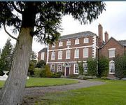
Park House Hotel
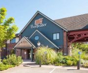
Featherstone Farm Hotel
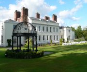
Haughton Hall
Lilleshall National Sports & Conferencing Centre
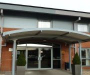
Days Inn Telford Iron Bridge Welcome Break Service Area
Holiday Inn TELFORD - IRONBRIDGE
Telford Central
The International Telford
Newport/Telford
Telford North
Videos from this area
These are videos related to the place based on their proximity to this place.
VOSA-Telford(GB)
Tym razem wpadłem:-)))Będzie kontrola :-( VOSA-Spec.służba do kontroli ciężarówek na terenie (GB).
Driving Along The A518 Newport To Wrockwardine Wood & Trench, Telford & Wrekin 26th August 2013
Driving along the A518 (Newport Bypass, Wellington Road & New Trench Road) from Newport to Wrockwardine Wood & Trench, Telford & Wrekin, England Videoed on Monday, 26th August 2013 ...
Hurry on Sundown
A Time Lapse movie shot mostly with a Canon 400D until it broke after around 60000 shutter releases, & then using both a Canon S5is with CHDK interval firmware, & a small Canon Powershot A80...
P3D - Hawker Hurricane D-Day MkIIC Tankbuster - RAF Cosford - By JMCV 2013
Prepar3D (P3D) is a simulation platform developed by Lockheed Martin. * The Hawker Hurricane is a British single-seat fighter aircraft that was designed and predominantly built by Hawker...
Rope Race Zip Wire for Severn Hospice
On Sunday the 30th of September Rope Race Climbing Center ran a zip wire for Severn Hospice from the roof of the Cold War Museum at RAF Cosford. 140 brave volunteers zipped down the 500ft wire ...
RAF Cosford Motorbike Rideout & Mountain Bike Show
Motorbike ride from Shrewsbury Meole Brace Park & Ride to RAF Cosford. Mountain Bike Show from Savage Skills with a Police man as a Guinea pig and in danger of loosing his...... Also 1 wheel jump.
G8FC Station Tour Amateur Radio
A quick tour of G8FC RAFARS HQ station at RAF Cosford, Wolverhampton, England.
Videos provided by Youtube are under the copyright of their owners.
Attractions and noteworthy things
Distances are based on the centre of the city/town and sightseeing location. This list contains brief abstracts about monuments, holiday activities, national parcs, museums, organisations and more from the area as well as interesting facts about the region itself. Where available, you'll find the corresponding homepage. Otherwise the related wikipedia article.
Sheriffhales
Sheriffhales (or Sheriff Hales) is a scattered village in Shropshire, England, 6 km north-east of Telford, 3 km north of Shifnal and 5 km south of Newport. Despite being a small village of around 100 people, there is a primary school, a church and a local post office, as well as a playing field with football goals and a children's playground. The church parish has a population of about 700 people, however it reached 1019 people in 1850, when the Duke of Sutherland owned most of it.
Shifnal Rural District
Shifnal was a rural district in Shropshire, England from 1894 to 1974. It was created from the Shifnal rural sanitary district by the Local Government Act 1894. Until 1934 it also administered two parishes in Staffordshire, Blymhill and Weston under Lizard, which were transferred to the Cannock Rural District.
Shifnal Town F.C
Shifnal Town F.C. is a football club based in Shifnal, Shropshire, England. They have reached the 4th round of the FA Vase three times in their history. They were West Midlands (Regional) League Premier Division champions in the 2006/07 season.
Shifnal railway station
Shifnal railway station is a station on the former Great Western Railway's London (Paddington) to Birkenhead via Birmingham (Snow Hill) line. Trains are about hourly off-peak. The station is located on a viaduct/causeway high above the town itself. It is on the Shrewsbury to Wolverhampton Line. When Shifnal was controlled by semaphore signalling it boasted a three storey signal box.
Lilleshall Hall
Lilleshall Hall is a large former country house and estate located near Lilleshall in Shropshire, England. It was based around an Augustinian Abbey founded in the 12th century, with its estate running to some 30,000 acres . The ruins of the original Lilleshall Abbey are protected today by English Heritage. Now run by Serco Leisure Operating Ltd on behalf of Sport England, Lilleshall is one of five National Sports Centres.
Lilyhurst
Lilyhurst is a small hamlet near Lilleshall and Sheriffhales in Shropshire. It has a population of roughly 20 people. It is part of the parish of Sheriffhales and contains a small industrial estate and garden centre.
Haughton Hall
For the house with the same name in Cheshire, see Haughton Hall, Cheshire Haughton Hall is an early 18th century country house situated at Haughton Lane, Shifnal, Shropshire now converted for use as an hotel. It is a Grade II* listed building. The de Haughton family owned land at Haughton under the Lord of the Manor of Shifnal as early as 1185. The estate passed to Sir John Charlton early in the 14th century and by the marriage of a Charlton heiress to Richard Moreton in early 16th century.
Shrewsbury Road, Shifnal
Shrewsbury Road is a cricket ground in Shifnal, Shropshire. The first recorded match on the ground was in 1900, when Shifnal played Wolverhampton. Shropshire played their first Minor Counties Championship match at the ground against Cornwall in 1987. From 1987 to present, the ground has hosted 14 Minor Counties Championship matches and 2 MCCA Knockout Trophy matches. The ground has also held 2 List-A matches. The first saw Shropshire play the Surrey Cricket Board in the 2000 NatWest Trophy.


