Safety Score: 3,0 of 5.0 based on data from 9 authorites. Meaning we advice caution when travelling to United Kingdom.
Travel warnings are updated daily. Source: Travel Warning United Kingdom. Last Update: 2024-08-13 08:21:03
Delve into Clee Saint Margaret
Clee Saint Margaret in Shropshire (England) is located in United Kingdom about 126 mi (or 202 km) north-west of London, the country's capital town.
Current time in Clee Saint Margaret is now 07:21 PM (Friday). The local timezone is named Europe / London with an UTC offset of zero hours. We know of 9 airports close to Clee Saint Margaret, of which 5 are larger airports. The closest airport in United Kingdom is Birmingham International Airport in a distance of 38 mi (or 61 km), East. Besides the airports, there are other travel options available (check left side).
There are several Unesco world heritage sites nearby. The closest heritage site in United Kingdom is Pontcysyllte Aqueduct and Canal in a distance of 38 mi (or 60 km), North. Also, if you like playing golf, there are some options within driving distance. If you need a hotel, we compiled a list of available hotels close to the map centre further down the page.
While being here, you might want to pay a visit to some of the following locations: Cardington, Bromfield, Kenley, Harley and Longnor. To further explore this place, just scroll down and browse the available info.
Local weather forecast
Todays Local Weather Conditions & Forecast: 8°C / 47 °F
| Morning Temperature | 5°C / 41 °F |
| Evening Temperature | 7°C / 44 °F |
| Night Temperature | 7°C / 44 °F |
| Chance of rainfall | 0% |
| Air Humidity | 81% |
| Air Pressure | 1027 hPa |
| Wind Speed | Light breeze with 5 km/h (3 mph) from North-East |
| Cloud Conditions | Overcast clouds, covering 96% of sky |
| General Conditions | Overcast clouds |
Saturday, 16th of November 2024
11°C (52 °F)
6°C (44 °F)
Light rain, gentle breeze, overcast clouds.
Sunday, 17th of November 2024
8°C (46 °F)
2°C (35 °F)
Light rain, moderate breeze, broken clouds.
Monday, 18th of November 2024
3°C (38 °F)
2°C (36 °F)
Moderate rain, gentle breeze, overcast clouds.
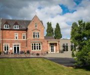
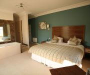
Hotels and Places to Stay
The Cliffe at Dinham
Feathers
FISHMORE HALL
Videos from this area
These are videos related to the place based on their proximity to this place.
Vision Project 2014 - St Laurence's Church, Ludlow, England
Shaun Ward, Clerk of Works at St. Laurence's, describes the recent restoration work on the church fabric and plans for the future.
Ludlow Station, Ludlow, Shropshire
Video taken on Ludlow Station. Arriving and departing southbound ATW Class 175 Coradia. Arriving ATW class 150 which we then travel on as it goes north towards Shrewsbury.
Trees blown down near Ludlow UK. Very early january 1976
We had a very mild and stormy winter in the uk in 2013-2014. However, just to remind you that we have had stormy weather like this before. Hope you enjoy this short video from my archives....
Sam & The Pacemakers - [COVER] Billy Idol - White Wedding
Performing at Stuarts 60th Birthday Party - Ludlow Brewery - 17.01.15 [apologies but my camera does not do justice to the sound quality of the performance]
Sam & The Pacemakers - [COVER] Bad Company; Just What I Needed
Performing at Stuarts 60th Birthday Party - Ludlow Brewery - 17.01.15 [apologies but my camera does not do justice to the sound quality of the performance]
Sam & The Pacemakers - [COVER] The Stranglers; Something Better Change
Performing at Stuarts 60th Birthday Party - Ludlow Brewery - 17.01.15 [apologies but my camera does not do justice to the sound quality of the performance]
Sam & The Pacemakers - [COVER] Rolling Stones; Paint It Black
Performing at Stuarts 60th Birthday Party - Ludlow Brewery - 17.01.15 [apologies but my camera does not do justice to the sound quality of the performance]
Sam & The Pacemakers - [COVER] Rolling Stones; Jumping Jack Flash
Performing at Stuarts 60th Birthday Party - Ludlow Brewery - 17.01.15 [apologies but my camera does not do justice to the sound quality of the performance]
Fallout 3 The Settlers Guide
The first quest for the settlers mod to make your own village. sorry about when i take my time i was very very drunk when i did this.
Videos provided by Youtube are under the copyright of their owners.
Attractions and noteworthy things
Distances are based on the centre of the city/town and sightseeing location. This list contains brief abstracts about monuments, holiday activities, national parcs, museums, organisations and more from the area as well as interesting facts about the region itself. Where available, you'll find the corresponding homepage. Otherwise the related wikipedia article.
Clee Hills
The Clee Hills are a range of hills in Shropshire, England near Ludlow, consisting of Brown Clee Hill 1,772 feet, the highest peak in Shropshire, and Titterstone Clee Hill 1,749 feet . They are both in the Shropshire Hills Area of Outstanding Natural Beauty.
Abdon, Shropshire
Abdon is an upland village and civil parish in the Clee Hills area of English county of Shropshire.
Stoke St. Milborough
Stoke St. Milborough is a parish located in Shropshire, England.
Hopton Cangeford
Hopton Cangeford, also referred to as Hopton-in-the-Hole, is a small village and parish in Shropshire, England. The father of painter Charles Wellington Furse was the perpetual curate of the parish.
Nordy Bank
For the children's novel by Sheena Porter, please see Nordy Bank (novel). Nordy Bank is an Iron Age hill fort on Brown Clee Hill in the Shropshire Hills AONB in South Shropshire, England.
Heath Chapel
Heath Chapel is located in an isolated position in a field in the civil parish of Heath, Shropshire, England. It is an Anglican chapel in the deanery of Ludlow, the archdeaconry of Ludlow, and the diocese of Hereford. The chapel is served by the Ludlow Team Ministry. It is designated by English Heritage as a Grade I listed building. The authors of the Buildings of England series describe it as "the perfect example of a rich little Norman chapel".


!['Sam & The Pacemakers - [COVER] Billy Idol - White Wedding' preview picture of video 'Sam & The Pacemakers - [COVER] Billy Idol - White Wedding'](https://img.youtube.com/vi/afAIi66DB4c/mqdefault.jpg)
!['Sam & The Pacemakers - [COVER] Bad Company; Just What I Needed' preview picture of video 'Sam & The Pacemakers - [COVER] Bad Company; Just What I Needed'](https://img.youtube.com/vi/voucIs4WpuI/mqdefault.jpg)
!['Sam & The Pacemakers - [COVER] The Stranglers; Something Better Change' preview picture of video 'Sam & The Pacemakers - [COVER] The Stranglers; Something Better Change'](https://img.youtube.com/vi/AGa-bTSpjDY/mqdefault.jpg)
!['Sam & The Pacemakers - [COVER] Rolling Stones; Paint It Black' preview picture of video 'Sam & The Pacemakers - [COVER] Rolling Stones; Paint It Black'](https://img.youtube.com/vi/1dbTNcKO1q0/mqdefault.jpg)
!['Sam & The Pacemakers - [COVER] Rolling Stones; Jumping Jack Flash' preview picture of video 'Sam & The Pacemakers - [COVER] Rolling Stones; Jumping Jack Flash'](https://img.youtube.com/vi/JwkHvjHPwyw/mqdefault.jpg)
