Safety Score: 3,0 of 5.0 based on data from 9 authorites. Meaning we advice caution when travelling to United Kingdom.
Travel warnings are updated daily. Source: Travel Warning United Kingdom. Last Update: 2024-08-13 08:21:03
Discover Oughtibridge
Oughtibridge in Sheffield (England) with it's 4,939 citizens is a city in United Kingdom about 146 mi (or 235 km) north-west of London, the country's capital city.
Local time in Oughtibridge is now 11:05 PM (Thursday). The local timezone is named Europe / London with an UTC offset of zero hours. We know of 9 airports in the vicinity of Oughtibridge, of which 5 are larger airports. The closest airport in United Kingdom is Robin Hood Doncaster Sheffield Airport in a distance of 22 mi (or 35 km), East. Besides the airports, there are other travel options available (check left side).
There are several Unesco world heritage sites nearby. The closest heritage site in United Kingdom is Liverpool – Maritime Mercantile City in a distance of 22 mi (or 36 km), East. Also, if you like golfing, there are a few options in driving distance. Looking for a place to stay? we compiled a list of available hotels close to the map centre further down the page.
When in this area, you might want to pay a visit to some of the following locations: Wortley, Bradfield, Sheffield, Stainborough and Barnsley. To further explore this place, just scroll down and browse the available info.
Local weather forecast
Todays Local Weather Conditions & Forecast: 2°C / 36 °F
| Morning Temperature | -0°C / 31 °F |
| Evening Temperature | 2°C / 35 °F |
| Night Temperature | 3°C / 37 °F |
| Chance of rainfall | 0% |
| Air Humidity | 74% |
| Air Pressure | 999 hPa |
| Wind Speed | Moderate breeze with 11 km/h (7 mph) from East |
| Cloud Conditions | Scattered clouds, covering 31% of sky |
| General Conditions | Scattered clouds |
Friday, 22nd of November 2024
4°C (39 °F)
1°C (35 °F)
Light rain, fresh breeze, clear sky.
Saturday, 23rd of November 2024
4°C (39 °F)
13°C (55 °F)
Rain and snow, fresh breeze, overcast clouds.
Sunday, 24th of November 2024
14°C (57 °F)
9°C (49 °F)
Moderate rain, strong breeze, overcast clouds.
Hotels and Places to Stay
CORAL KHARTOUM HOTEL
Holiday Inn SHEFFIELD
Best Western Plus Kenwood Hall Hotels
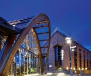
Hilton Sheffield
Novotel Sheffield Centre
Mercure Sheffield St Paul's Hotel and Spa
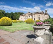
Wortley Hall
Whitley Hall
Leopold Hotel
Rutland
Videos from this area
These are videos related to the place based on their proximity to this place.
Peaty's Steel City Downhill Race 2014 practice run 1440p
One of my practice runs during the Peaty's Steel City DH 2014. 17th May 2014. Filmed with GoPro Hero 3 Black.
Peaty's Steel City Downhill race - 4/2012
Peaty's Steel City Downhill mountain bike race, in Greno Woods near Sheffield, 21/4/2012. Produced for Monkeyspoon.com by Jeff R King, in association with BikeGarage.co.uk.
My Delorean - Sheffield
Little clip done of my DeLorean in Sheffield. Taken at Grenoside. Nothing special.
Wharncliffe Woods DH rock garden and tree drop
Squid doing a real tricky rocky section ending with a drop through a tree!
Wharnecliffe DH Road Trip
Some of the GoPro footage from my latest trip to Wharncliffe Woods DH Trails, with Olly and Will Tyne.
Middlewood Lodge (Sheffield) time lapse
Time lapse at Middlewood Lodge, Wadsley Park Village, Sheffield. Just over 200 individual pictures, making just 8 seconds of footage. It was also raining, so more reason to head inside! (Testing...
Videos provided by Youtube are under the copyright of their owners.
Attractions and noteworthy things
Distances are based on the centre of the city/town and sightseeing location. This list contains brief abstracts about monuments, holiday activities, national parcs, museums, organisations and more from the area as well as interesting facts about the region itself. Where available, you'll find the corresponding homepage. Otherwise the related wikipedia article.
Great Sheffield Flood
Not to be confused with the floods in Sheffield in 2007. The Great Sheffield Flood was a flood that devastated parts of Sheffield, England, on 11 March 1864, when the Dale Dyke Dam broke.
Wortley Rural District
Wortley was a rural district in the West Riding of Yorkshire from 1894 to 1974, situated to the north-west of the county borough of Sheffield. It was abolished in 1974 under the Local Government Act 1972, with the parishes of Bradfield and Ecclesfield going to the metropolitan borough of Sheffield and the parishes of Tankersley and Wortley going to the Metropolitan Borough of Barnsley.
Beeley Wood
Beeley Wood is a woodland in the north of the City of Sheffield, near Middlewood. It is one of 35 ancient woodland areas within the Sheffield City boundary. An ancient woodland is defined as a site that has been continuously occupied by woodland from the year 1600 or before.
Wadsley Parish Church
Wadsley Parish Church is situated within the city of Sheffield, South Yorkshire, England. It is located on Worrall Road, 3 miles north west of the city centre in the suburb of Wadsley, which was formerly a village outside the city boundary. The church is quite unusual in that it is not dedicated to a saint. It is a grade II listed building.
Onesacre Hall
Onesacre Hall is a Grade II* Listed building situated in the rural outskirts of the City of Sheffield in South Yorkshire, England. The hall is located on Green Lane in the small hamlet of Onesacre in the suburb of Oughtibridge, 8.5 km north west of the city centre.
Little Matlock Rolling Mill
Little Matlock Rolling Mill also known as Low Matlock Rolling Mill is a Grade II* Listed building situated on the River Loxley in the village of Loxley on the outskirts of the City of Sheffield, South Yorkshire, England. The building continues to operate as a rolling mill, owned and operated by Pro-Roll Ltd, a specialist hand rolling company. A brick building extension has been added to the original 1882 structure.
Loxley House
Loxley House is a Georgian building situated off Ben Lane in the Wadsley area of Sheffield in South Yorkshire, England. It is a Grade Two Listed building.
Middlewood Hospital
Middlewood Hospital is a former psychiatric hospital situated between the suburbs of Middlewood and Wadsley in the north west of the City of Sheffield, England. It was also known as the South Yorkshire Asylum (1872–1888), the West Riding Asylum, Wadsley (1889–1929) and Wadsley Mental Hospital (1930–1948). It was one of four hospitals that made up The West Riding General Asylums Committee. It closed in 1996 and is now a private housing development called Wadsley Park Village.


