Safety Score: 3,0 of 5.0 based on data from 9 authorites. Meaning we advice caution when travelling to United Kingdom.
Travel warnings are updated daily. Source: Travel Warning United Kingdom. Last Update: 2024-08-13 08:21:03
Discover Deepcar
Deepcar in Sheffield (England) is a town in United Kingdom about 149 mi (or 240 km) north-west of London, the country's capital city.
Current time in Deepcar is now 12:00 AM (Wednesday). The local timezone is named Europe / London with an UTC offset of zero hours. We know of 9 airports near Deepcar, of which 5 are larger airports. The closest airport in United Kingdom is Robin Hood Doncaster Sheffield Airport in a distance of 23 mi (or 37 km), East. Besides the airports, there are other travel options available (check left side).
There are several Unesco world heritage sites nearby. The closest heritage site in United Kingdom is Liverpool – Maritime Mercantile City in a distance of 24 mi (or 38 km), East. Also, if you like playing golf, there are a few options in driving distance. Looking for a place to stay? we compiled a list of available hotels close to the map centre further down the page.
When in this area, you might want to pay a visit to some of the following locations: Wortley, Bradfield, Stainborough, Penistone and Cawthorne. To further explore this place, just scroll down and browse the available info.
Local weather forecast
Todays Local Weather Conditions & Forecast: 14°C / 57 °F
| Morning Temperature | 9°C / 48 °F |
| Evening Temperature | 12°C / 53 °F |
| Night Temperature | 10°C / 50 °F |
| Chance of rainfall | 0% |
| Air Humidity | 75% |
| Air Pressure | 1030 hPa |
| Wind Speed | Light breeze with 3 km/h (2 mph) from North-East |
| Cloud Conditions | Scattered clouds, covering 47% of sky |
| General Conditions | Scattered clouds |
Thursday, 7th of November 2024
13°C (55 °F)
9°C (48 °F)
Sky is clear, light breeze, clear sky.
Friday, 8th of November 2024
10°C (50 °F)
8°C (46 °F)
Sky is clear, light breeze, clear sky.
Saturday, 9th of November 2024
13°C (55 °F)
10°C (49 °F)
Overcast clouds, calm.
Hotels and Places to Stay
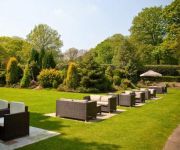
Whitley Hall
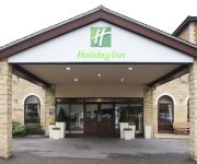
JCT.37 Holiday Inn BARNSLEY M1
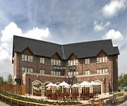
The Fairway
ibis Styles Barnsley
Alara Bed and Breakfast
William's Apartments Hillsborough
Sheffield/Barnsley (M1 Jct36)
Barnsley Central M1 J37
Videos from this area
These are videos related to the place based on their proximity to this place.
Open Some Hours
Anthony Youel at The Monkey Thurgoland with Dusty his trusty wooden sausage dog, or Dachshund. If the doors are open then the gallery pub is open. Dusty is very friendly, he had his bark...
Bleu Nude by Anthony Youel
In an act he describes as, “Un A Shamed Plagiarism,” Anthony Roy Youel staged his Bleu Nude as a tribute to Henri Matisse on 27 July 2014 at 2pm he modelled a new in bleu. A giant frame...
Proverb by Anthony Youel 25 April 2012
Here we see the Poetic Pub Landlord Anthony Youel delivering rhymes and pints at The Monkey in Thurgoland South Yorkshire. This evening was hosted by, "Monke...
Wortley Hall Video
Originally the ancestral Home of the Earls of Wharncliffe, Wortley Hall can be traced back to 1440, were Sir Thomas Wortley lived in the manor, believed to be Wortley Hall. Over the centuries...
WORTLEY HALL WEDDING PHOTOS £50 PHOTOGRAPHY PHOTOGRAPHERS REVIES PRICES
Photographs at Wortley Hall Sheffield venue by http://www.creamphoto.co.uk Cream Wedding Photography as the photographers. Prices £50 per hour and great reviews. Photos numbered 1529.
Opera The Conspirators Part 2 of 3
Schubert's opera The Conspirators, WMA Summer School 2013, Wortley Hall, Sheffield.
Butterflies of a Deepcar Garden
Account of the butterflies observed in a South Yorkshire,UK, garden, with numerous photographs and written commentary. No audio.
Sunday at Wharncliffe with the lads (Mike and Joe)
Short day riding at Wharncliffe Woods Downhill with the lads (Mike and Joe).
Videos provided by Youtube are under the copyright of their owners.
Attractions and noteworthy things
Distances are based on the centre of the city/town and sightseeing location. This list contains brief abstracts about monuments, holiday activities, national parcs, museums, organisations and more from the area as well as interesting facts about the region itself. Where available, you'll find the corresponding homepage. Otherwise the related wikipedia article.
Stocksbridge and Upper Don
Stocksbridge and Upper Don ward is one of the 28 electoral wards of the borough of Sheffield, South Yorkshire, England. The main population centres in the ward are Stocksbridge and Oughtibridge; the ward also includes the villages of Deepcar, Wharncliffe Side, Bolsterstone, Midhopestones, Upper Midhope and Ewden Village.
Little Don River
The Little Don River also known as The Porter, is a tributary of the River Don in South Yorkshire, England. Arising on the Langsett Moors in the northern Peak District, the Little Don River feeds the Langsett and Underbank Reservoirs. It runs through the town of Stocksbridge before joining the River Don. A 1.1 hectare section of the river is designated as a site of special scientific interest since 1977.
Wortley Rural District
Wortley was a rural district in the West Riding of Yorkshire from 1894 to 1974, situated to the north-west of the county borough of Sheffield. It was abolished in 1974 under the Local Government Act 1972, with the parishes of Bradfield and Ecclesfield going to the metropolitan borough of Sheffield and the parishes of Tankersley and Wortley going to the Metropolitan Borough of Barnsley.
Wortley Hall
Wortley Hall is a stately home in the small South Yorkshire village of Wortley, located south of Barnsley. For more than five decades the hall has been chiefly associated with the British Labour movement. It is currently used by several trades unions and other organisations as a venue for residential training courses and other meetings, as well as for purely social gatherings.
Wharncliffe Crags
Wharncliffe Crags is a gritstone escarpment or edge situated approximately 10 km north west of the city of Sheffield in South Yorkshire, England.
Oxspring railway station
Oxspring railway station was a short lived station built by the Sheffield, Ashton-Under-Lyne and Manchester Railway to serve the village of Oxspring, South Yorkshire, England. The station opened on 5 December 1845 but due to cost-cutting measures it was closed, along with Dog Lane, Hazelhead and Thurgoland, on 5 November 1847.
Hunshelf
Hunshelf is a civil parish in the Metropolitan Borough of Barnsley. At the 2001 census it had a population of 324. Most of its population lives in the village of Greenmoor.
St Mary's Church, Bolsterstone
St Mary’s Church, Bolsterstone is situated in the village of Bolsterstone, within the boundary of the City of Sheffield in South Yorkshire, England. The church dates from 1879 although there is evidence that a place of worship has existed on the site since the 12th century. It is located 13 km NW of the city centre and is a grade II listed building.


